
East Epi submarine volcano erupts for the first time since 2004, 10 km danger zone established, Vanuatu
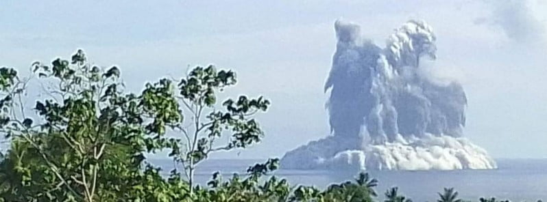
Image credit: VMGD
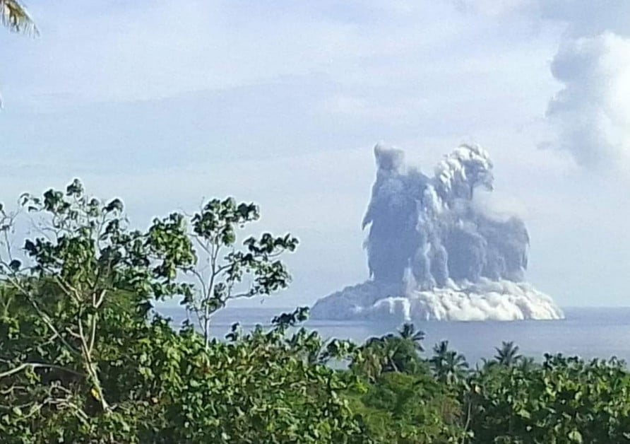
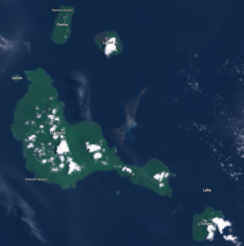
A submarine volcano located near the island of Epi in Vanuatu started erupting at 18:30 UTC on January 31, 2023, prompting authorities to raise the Volcano Alert Level to 1 and establish a 10 km (6.2 miles) danger zone. This marks the first eruption of the volcano since 2004 (VEI 2).
- Submarine volcanoes like East Epi are known for their violent eruptions that occur when lava meets seawater. These eruptions can be extremely dangerous and have the potential to sink ships, poison fish, and trigger tsunamis
- The latest observations confirm that the volcanic cone is building up with the continuous ash emissions
- Authorities have established a 10 km (6.2 miles) danger zone around the volcano and advised locals to stay clear of the coast as phreatic explosions may continue and generate tsunami waves
- People on Epi and surrounding islands are also advised to stay on alert for any large earthquake associated with the ongoing volcanic eruptions that could trigger a possible tsunami
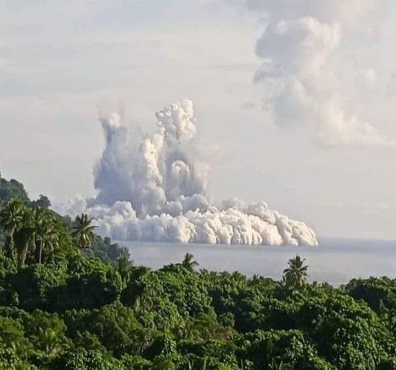
Reports and observations from locals at Epi island indicated an increase in the activity of the East Api submarine volcano at around 20:48 UTC on January 31 (07:48 LT on February 1) with steam over the volcano area and sulfur dioxide emissions followed by phreatic explosions propelling ash some 100 m (330 feet) above the sea surface.
After receiving the reports, the Vanuatu Meteorology and Geohazards Department (VMGD) advised people on Epi, Tongoa, and the surrounding islands to stay clear of the coast as phreatic explosions may continue and could generate small waves.1
Tsunami systems within the Tsunami Warning Center (TWC) have not picked up this activity. However, such eruptions have the potential to create tsunami waves, TWC said and advised people over Epi and the Sheperd groups to exercise observance and stay away from coastal areas.
Soon after, the VMGD increased the Volcano Alert Level for East Api to 1 and established a 10 km (6.2 miles) danger zone.
“Due to ongoing volcanic activity at East Epi submarine volcano with phreatic explosions, light degassing and emissions of ash, the danger zone is at 10 km (6.2 miles) radius around the East Epi submarine volcano,” VMGD said, adding that the latest observations confirmed that the volcanic cone is building up with the continuous ash emissions.
Aviation and Mariners are advised that with the ongoing submarine volcano activity, the danger zone is along the East side of Epi island.
People on Epi and surrounding islands are also advised to stay on alert for any large earthquake associated with the ongoing volcanic eruptions that could trigger a possible tsunami.
The last eruptive episode at this volcano lasted from February 16 to 24, 2004 (VEI 2).
Geological summary
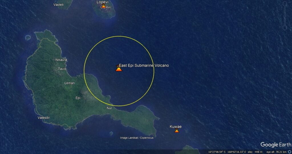
A large caldera, with submarine post-caldera cones active in historical time, lies off the eastern coast of Epi Island.
Epi Island itself, located slightly west of the main New Hebrides volcanic arc, largely consists of two Quaternary volcanoes, Mount Allombei on the west and Pomare (Tavani Kutali) on the east.
Tavani Ruro, which forms an elongated eastern extension of Epi Island across a narrow isthmus, is related to Kuwae caldera to the east.
Pomare volcano is the highest point on the island and has three well-preserved subsidiary cones to the east with youthful summit craters. Pomare volcano is truncated on its eastern side by the largely submarine East Epi caldera, which has been the source of all historical eruptions.
Three small submarine basaltic and dacitic cones, known as Epi A, Epi B, and Epi C, are located along the northern rim of the breached caldera.
Ephemeral islands were formed during eruptions in 1920 and 1953, and the summit of the shallowest cone, Epi B, was 34 m (111 feet) below sea level at the time of a 2001 survey.2
References:
1 East Epi volcano updates – Vanuatu Meteorology and Geohazards Department – February 1, 2023
2 Epi – Geological summary – GVP
I'm a dedicated researcher, journalist, and editor at The Watchers. With over 20 years of experience in the media industry, I specialize in hard science news, focusing on extreme weather, seismic and volcanic activity, space weather, and astronomy, including near-Earth objects and planetary defense strategies. You can reach me at teo /at/ watchers.news.
This massive increase in geological activity is abundantly clear evidence that earth’s magnetic field is under enormous stress. The field might even experience temporary breakdown if the stress will increase further.