Franklin, the first hurricane of the 2017 Atlantic season is about to hit Veracruz
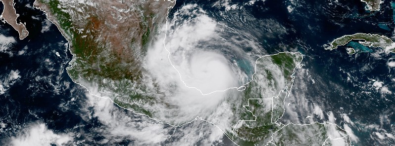
At 21:00 UTC on August 9, 2017, Franklin became the first hurricane of the 2017 Atlantic hurricane season. The system is expected to hit the Mexican state of Veracruz tonight (CDT) or early Thursday, August 10. Heavy rains brought by this storm will be capable of producing life-threatening flash floods and mudslides. A dangerous storm surge will raise water levels by as much as 1.2 to 1.8 m (4 to 6 feet) above normal tide levels.
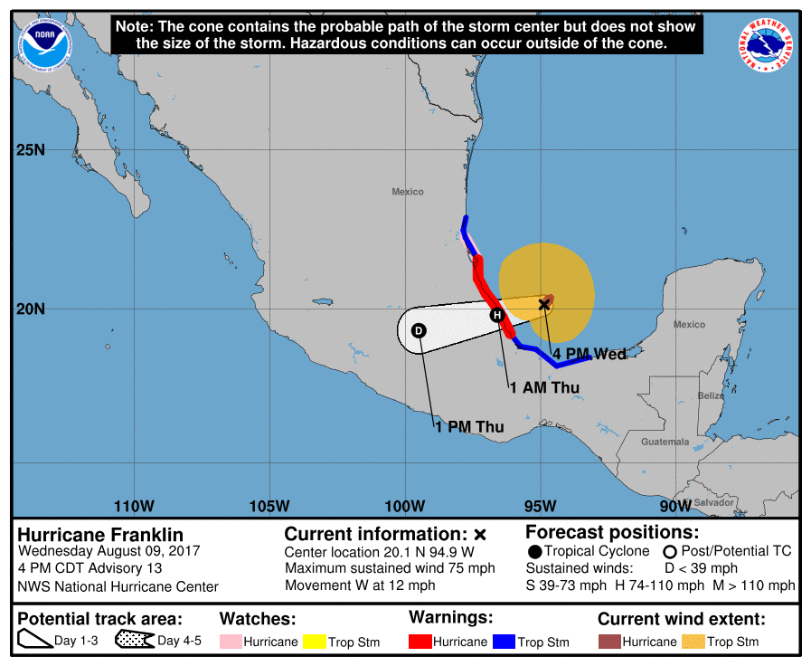
The center of Hurricane "Franklin" is located 170 km (105 miles) NE of Veracruz and 280 km (175 miles) ESE of Tuxpan, Mexico, according to the NHC. The system is moving west at 19 km/h (12 mph) with maximum sustained winds of 120 km/h (75 mph) and minimum central pressure of 984 hPa. Some additional strengthening is expected until the center crosses the coast, followed by rapid weakening.
A Hurricane Warning is in effect for the coast of Mexico from Puerto de Veracruz to Cabo Rojo. A Hurricane Watch is in effect north of Cabo Rojo to Rio Panuco. A Tropical Storm Warning is in effect for the coast of Mexico east of Puerto de Veracruz to Puerto Dos Bocas and north of Tuxpan to Barra del Tordo.
Hurricane-force winds extend outward up to 55 km (35 miles) from the center and tropical-storm-force winds extend outward up to 220 km (140 miles).
On the forecast track, the center of Franklin is expected to cross the coast in the Mexican state of Veracruz tonight or early Thursday.
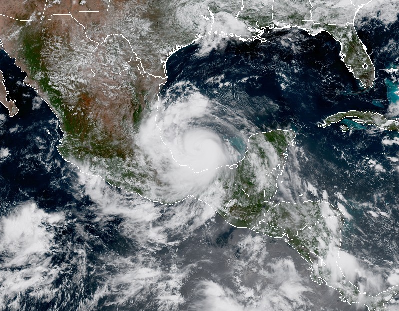
Tropical Storm Franklin at 17:55 UTC on August 9, 2017. Credit: NOAA/GOES-16, RAMMB/CIRA (Preliminary and non-operational)
Rainfall totals of 101.6 to 203.2 mm (4 to 8 inches) with isolated maximum amounts of 381 mm (15 inches) are possible across the Mexican states of Tabasco, northern Veracruz, northern Puebla, Tlaxacala, Hidalgo, Queretar and eastern San Luis Potosi in eastern Mexico. These rains will be capable of producing life-threatening flash floods and mudslides.
A dangerous storm surge will raise water levels by as much as 1.2 to 1.8 m (4 to 6 feet) above normal tide levels along the immediate coast near and to the north of where the center makes landfall in the Hurricane Warning area. Near the coast, the surge will be accompanied by large and destructive waves.
While still a tropical storm, Franklin passed over the Yucatan peninsula, Mexico, causing serious flooding.
#Franklin causa estragos en la Ciudad de Campeche….via Ancamijo Alvarado….@chematierra @webcamsdemexico pic.twitter.com/I8VNS2Bll3
— ClimaSeveroMundial (@Monttgreen) August 9, 2017
Av.Gobernadores en la.Ciudad de Campeche, Mexico…#Franklin pic.twitter.com/9Kuose8uMK
— ClimaSeveroMundial (@Monttgreen) August 9, 2017
Tremendas las inundaciones esta tarde en la Ciudad de Campeche, Mexico por la TT Franklin… pic.twitter.com/spwGUV9zQf
— ClimaSeveroMundial (@Monttgreen) August 9, 2017
Impresionantes imagenes de las severas inundaciones esta tarde en la Ciudad de Campeche, Mexico por la Tormenta Tropical Franklin..8-8-2017 pic.twitter.com/knsNpdpkCD
— ClimaSeveroMundial (@Monttgreen) August 9, 2017
Franklin is the 1st hurricane of the 2017 Atlantic hurricane season. The average Atlantic 1st hurricane formation date is August 10.
Featured image: Tropical Storm "Franklin" at 18:10 UTC on August 9, 2017. Credit: NOAA/GOES-16, RAMMB/CIRA (Preliminary and non-operational)
Commenting rules and guidelines
We value the thoughts and opinions of our readers and welcome healthy discussions on our website. In order to maintain a respectful and positive community, we ask that all commenters follow these rules.