
Worst flooding in last 50 years devastates Ellicott City, Maryland

Featured image: Ellicott City, Maryland flood aftermath - July 2016. Credit: WJLA via AP
Massive flooding hit the Ellicott City in Maryland on the evening of Saturday, July 30, 2016 (local time). The Governor Larry Hogan declared a state of emergency on the next day. At least two people died, and local infrastructure suffered severe damage, according to the local official, the worst in the last 50 years.
The rainstorm brought about 165 mm (6.5 inches) to the city between 19 and 21:00 hours on July 30 (local time). Intense flooding swept away hundreds of vehicles and inflicted damage to almost every building along the Main Street.
Video credit: Associated Press
Video credit: WBAL-TV 11 Baltimore
“It looks like the set of a disaster movie. Cars everywhere, cars on top of cars, parts of the road are gone, many parts of the sidewalk are gone, storefronts are completely gone. No one has ever seen devastation like this in Ellicott City or anywhere in Howard County. There are a lot of businesses that are going to be hurting for a long time. There are a lot of people that lost their apartments and their homes,” said Allan Kittleman, the Howard County Executive.
The local authorities reported five buildings were completely devastated, about 30 others suffered considerable damage, and over 170 vehicles got stranded in the street area and along the river.
Video credit: Central Video
Video credit: Howard County REACT
According to Jason Elliott, a meteorologist at the National Weather Service (NWS) in Sterling, Virginia, a series of intense thunderstorms of such a long duration caused the flooding: “It’s just a matter of the heavy rain being that long in duration. It just happened to set up over that area. Everything funneled toward that Main Street area. There are hills on both sides, the rivers on the third side. In this case, the Patapsco River was coming up, too. We believe there were some contributions to the flood from both directions,” Elliott explained.
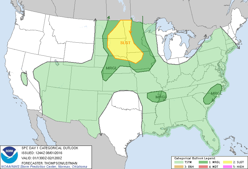
Image credit: NOAA/NWS/SPC
The NWS has forecast isolated to widely scattered severe storm across the northern Plains and upper Mississippi Valley throughout the day, with possible damaging wind gusts and large hail. In the area between northeast Arkansas and western Tennessee and the eastern Carolinas, isolated strong wind gusts may occur.
Commenting rules and guidelines
We value the thoughts and opinions of our readers and welcome healthy discussions on our website. In order to maintain a respectful and positive community, we ask that all commenters follow these rules.