
New threat developing in West Pacific – Tropical Storm “Hagupit”

Featured image: Invest 95W captured by Aqua/MODIS satellite on November 30, 2014. (Credit: LANCE Rapid Response/MODIS/WorldView)
As Tropical Storm Sinlaku dissipates over Indo-China Peninsula, a new tropical threat is organizing near the Caroline Islands. This tropical disturbance is currently identified as Invest 95W, but it will soon become the next named system in the Western Pacific Ocean. When the system develops tropical storm conditions, JMA will upgrade it into Tropical Storm "Hagupit".
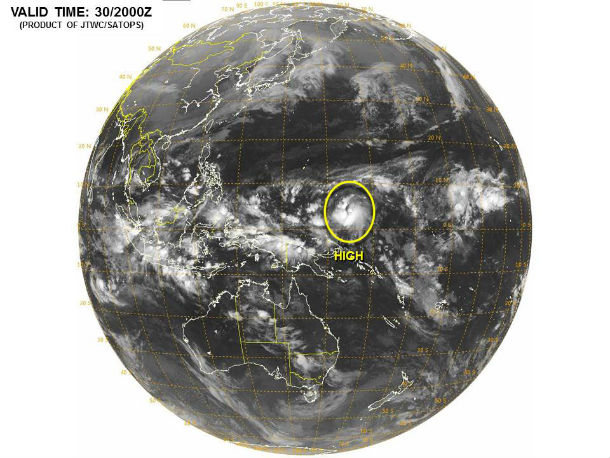
JTWC estimates the winds in area to be 35 – 45 km/h (20 – 30 mph). The system is moving west-northwestward at speed of 17 km/h (10 mph). The dynamic models are indicating rapid development as the system tracks west-northwestward. According to JTWC, potential for the development of a significant tropical cyclone within the next 24 hours is high.
Very warm sea surface temperatures and very low vertical wind shear ahead of the system will provide the fuel for showers and strong thunderstorms as well as strong winds.
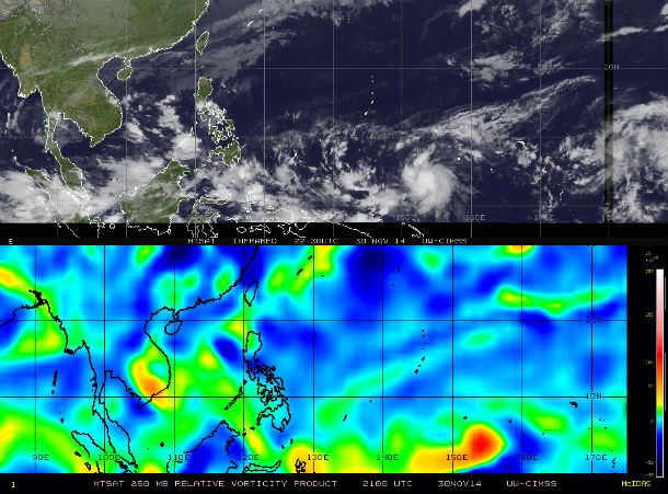
MTSAT IR and 850MB vorticity satellite images taken at 21:00 UTC on November 30, 2014. (Credit: NOAA/UW-CIMSS)
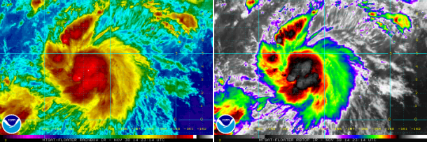
MTSAT's IR satellite images of the system's center taken at 23:14 UTC on November 30, 2014. (Credit: NOAA/MTSAT)
Most of the forecast models present two possible scenarios. The first track leads the system to sharp recurve into the Philippine Sea, crossing the Volcano Islands into the Northwest Pacific waters, and dissipating without bringing major impacts to significant populations.
The second scenario would be a more westerly track, bringing the cyclone into the southern Philippines and impacting much more significant population. This would be similar path as it was the case with devastating typhoons like Bopha and Haiyan.
We truly hope for first scenario.
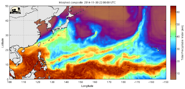
Very warm sea surface temperatures and very low vertical wind shear ahead of the system will provide the fuel for stronger development. (Credit: MIMIC-TPW/CIMSS)
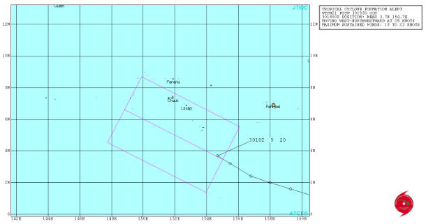
Forecast track by Joint Typhoon Warning Center. (Credit: JTWC)
Nine tropical cyclones have crossed the Philippines this year. Tropical Storm Sinlaku was just a Tropical Depression when it moved over the Philippines last week. Despite it being “only” a tropical depression, it caused 4 deaths and 8 people are still missing.
Commenting rules and guidelines
We value the thoughts and opinions of our readers and welcome healthy discussions on our website. In order to maintain a respectful and positive community, we ask that all commenters follow these rules.