
Strong earthquake M6.1 struck South Sandwich Islands
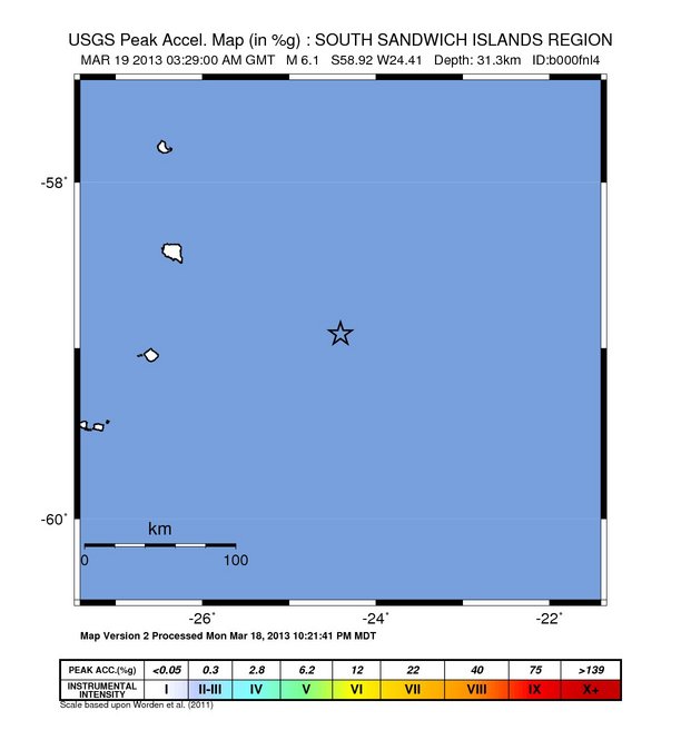
Image credit: USGS Shake Map
Strong earthquake M6.1 struck South Sandwich Islands on Tuesday, March 19, 2013 at 03:29:00 UTC. Epicenter of the earthquake was located 121 km (75 miles) E of Bristol Island, Antarctica at coordinates 58.915°S, 24.410°W. USGS registered depth of 31.3 km (19.4) miles whereas EMSC reported M6.0 at depth of 100 km (62.13 miles).
According to GDACS, this earthquake can have a low humanitarian impact based on the Magnitude and the affected population and their vulnerability.
There are no people living within 100 km radius of the earthquake.
| Magnitude | 6.1 |
|---|---|
| Date-Time |
|
| Location | 58.915°S, 24.410°W |
| Depth | 31.3 km (19.4 miles) |
| Region | SOUTH SANDWICH ISLANDS REGION |
| Distances | 121 km (75 miles) E of Bristol Island, Antarctica 2665 km (1655 miles) ESE of Ushuaia, Argentina 2900 km (1801 miles) SE of Rio Gallegos, Argentina 2906 km (1805 miles) ESE of Punta Arenas, Chile |
| Location Uncertainty | horizontal +/- 16.7 km (10.4 miles); depth +/- 3.4 km (2.1 miles) |
| Parameters | NST= 52, Nph= 61, Dmin=903.9 km, Rmss=1.36 sec, Gp= 43°, M-type=regional moment magnitude (Mw), Version=7 |
| Source |
|
| Event ID | usb000fnl4 |
Intensity shake map of the earthquake. Credits: USGS
Commenting rules and guidelines
We value the thoughts and opinions of our readers and welcome healthy discussions on our website. In order to maintain a respectful and positive community, we ask that all commenters follow these rules.