
One of the strongest geomagnetic storms in years subsiding
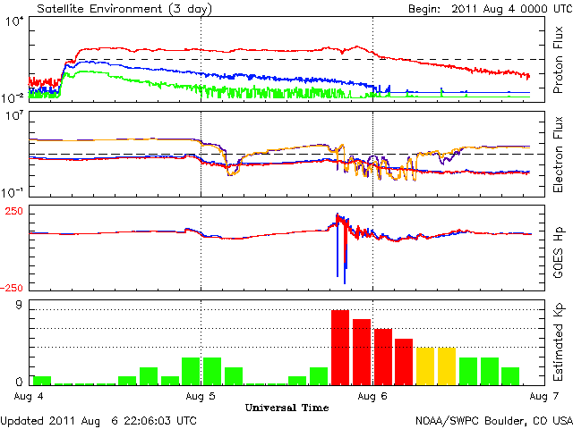
Image credit: TW
Earth's magnetic field is still reverberating from a CME strike on August 5th that sparked one of the strongest geomagnetic storms in years. Registering 8 on the 0 to 9 "K-index" scale of magnetic disturbances, the storm, at its maximum, sparked auroras across Europe and in many northern-tier US states.
The storm is subsiding now, but it could flare up again as gusty solar wind continues to buffet Earth's magnetic field. High-latitude sky watchers should remain alert for auroras.
Planetary K-index
Now: Kp= 2 quiet
24-hr max: Kp= 6 storm
Interplanetary Mag. Field
Btotal: 6.4 nT
Bz: 6.0 nT north
Solar wind
speed: 451.8 km/sec
density: 0.0 protons/cm3
The Solar Wind increased to around 700 km/s after the initial shock and the Bz tilted sharply south (-20nt). Had the incoming CME shock hit about 4 hours later than it did, the visible aurora in North America would have been much better. By the time it got dark out, most of the show was over. This event was short in duration compared to previous storms in the past, nonetheless, it was great to see.
The biggest Geomagnetic Storm of Solar Cycle 24 thus far is over as the K-Index is now below 5. Minor geomagnetic activity may persist through the day on Saturday due to the elevated solar wind levels. At its peak the storm was briefly close to the G4 Level and visible Aurora was seen in Northern Europe and also parts of Canada and northern USA.
The storm also stirred up quite a bit of activity in northern EU and NA on the 6 meters (50mhz) and even the 2 meter (144mhz) Ham Radio bands. I was able to work close to 40 aurora contacts on 6m and one on 2m. (SolarHam)
The geomagnetic field is expected to be unsettled to active on 07 August as a recurrent coronal hole high speed stream is expected to become geoeffective. Levels are expected to decrease to quiet to unsettled on 08 August. Mostly quiet conditions are expected on 09 August.

Earlier reporting
Nothing on Watchers was published in the last 24 hours. These are older articles.
- On October 22, 2017, a single flash of lightning stretched 515 miles from eastern Texas to near Kansas City, a distance that takes eight hours to drive, and nobody realized how far it had gone until scientists went back through the satellite data years later Epicenter
- CPC posts a slight risk of heavy rain from the Gulf Coast to the Northeast urban corridor November 25-29, and a moderate risk of West Coast wind and Sierra snow on November 25
- Florida's east coast faces a moderate flash flood risk Wednesday through Friday, with 4 to 8 inches of rain forecast and the St. Johns River near Cocoa already in major flood at 17.13 feet
- Cyclone Akvan to make landfall between Nellore and Visakhapatnam around noon on November 20, IMD forecasts 120-130 km/h winds gusting to 145
