
Series of Atlantic storms to hit Ireland and UK, Storm Dylan first
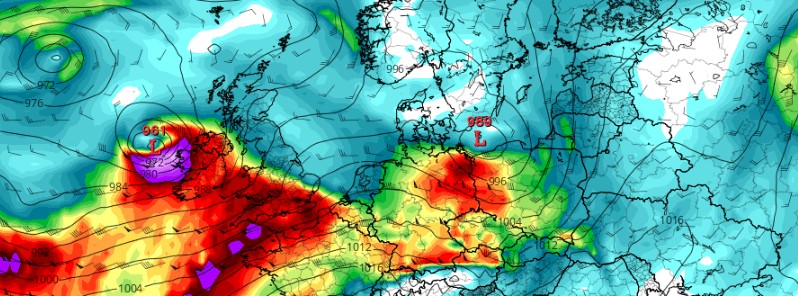
Featured image: Storm Dylan model location at 00:00 UTC, December 31, 2017. Credit: ECMWF, TropicalTidbits.com
A series of low-pressure systems are expected to affect Ireland and the United Kingdom over the next couple of days. The first one is a rapidly strengthening Storm "Dylan," expected to track northeastwards close to Connacht and Ulster coasts of Ireland on Saturday night and then move toward Northern Ireland and NW Scotland. Status Orange and Yellow severe weather warnings are in effect in parts of Ireland and Yellow and Amber in parts of the UK.
Storm Dylan is expected to develop in the east Atlantic on Saturday night, December 30, track northeastwards close to Connacht and Ulster coasts of Ireland tonight, December 30 and Sunday, December 31 and then close to Northern Ireland and into Scotland on New Years Eve, December 31.
In Ireland, the biggest impact from the storm will be in western and northern counties with west to southwest winds reaching mean speeds of 65 to 80 km/h (40 – 50 mph) with gusts of 110 to 125 km/h (65 – 77 mph). High seas along the west coast too with the risk of coastal flooding.
Status Orange Wind Warning is in effect for Connacht, Cavan, Monaghan, Donegal, Longford, Louth, Westmeath, Meath and Clare. Status Yellow Wind Warning is in effect for Dublin, Carlow, Kildare, Kilkenny, Laois, Wexford, Wicklow, Offaly, Cork, Kerry, Limerick, Tipperary and Waterford where west to southwest winds will reach mean speeds of 45 to 65 km/h (28 – 40 mph) with gusts of 90 to 110 km/h (56 – 68 mph).
In the United Kingdom, strong winds and rain, heavy in places, are expected Saturday night, December 30 and into Sunday morning as Storm Dylan moves in from the Atlantic, the UK Met Office warns. Met Éireann named the storm on Friday because the strongest winds are expected to affect the Republic of Ireland, however, the UK will see impacts as well and National Severe Weather Warnings for wind are now in force for parts of Northern Ireland and southwest Scotland, the office said.
The storm is expected to track northeastwards close to Northern Ireland and into Scotland on New Years Eve. This will bring some very strong winds to these areas with gusts of 90 to 110 km/h (56 – 68 mph) expected for many parts and a short period of gusts of 110 – 130 km/h (70 – 80 mph) for some places. The winds will ease from the west as the low continues to move northeast, winds easing down in the early afternoon.
"While the strongest winds from Storm Dylan will be over the Republic of Ireland, very strong winds will also affect Northern Ireland, southern Scotland and northern England," Steve Ramsdale, Chief Forecaster for the Met Office said. "Travel disruption is likely as well as power cuts and the chance of tiles being blown off roofs. Large waves and coastal debris may also be another hazard in coastal districts."
Further south, Storm Dylan is also bringing more wet weather and a Yellow weather warning for rain is in place for southwest England and South Wales on Saturday night. The rain is expected to be heavy in places, causing possible transport disruption, due to surface water and spray, and the potential for localized flooding.
As #StormDylan moves across the UK through Saturday night and Sunday, the strongest of the winds will be across parts of Scotland and Northern Ireland with gusts up to 80 mph. Stay #weatheraware pic.twitter.com/h1AExiz3AG
— Met Office (@metoffice) December 30, 2017
Dylan will move away from the UK on New Year’s Eve leaving a windy, colder and showery day for many, with some snow over high ground in the north.
"New Year’s Day will feature wintry showers in the north and the unsettled weather looks likely to continue through the first week of January with further bouts of wet and windy weather. In particular, some very strong and gusty winds, together with thundery downpours are likely on Wednesday and may cause some disruption," Ramsdale said.
Make sure that you and those around you are prepared for winter weather and can cope with its impacts, the office said.
I'm a dedicated researcher, journalist, and editor at The Watchers. With over 20 years of experience in the media industry, I specialize in hard science news, focusing on extreme weather, seismic and volcanic activity, space weather, and astronomy, including near-Earth objects and planetary defense strategies. You can reach me at teo /at/ watchers.news.
Commenting rules and guidelines
We value the thoughts and opinions of our readers and welcome healthy discussions on our website. In order to maintain a respectful and positive community, we ask that all commenters follow these rules.