• Widespread snow, freezing rain, and strong winds forecast as cross-country storm impacts Canada

    A cross-country storm is forecast to affect multiple regions of Canada from March 23 through midweek, bringing snow to western and central areas before spreading mixed precipitation and stronger impacts into parts of Ontario, Quebec, and Atlantic Canada. The highest-confidence snowfall totals, reaching 20 to 40 cm (8 to 16 inches) in parts of Newfoundland and elsewhere in Atlantic Canada, are expected to create hazardous travel conditions, reduced visibility, and local transport disruptions.
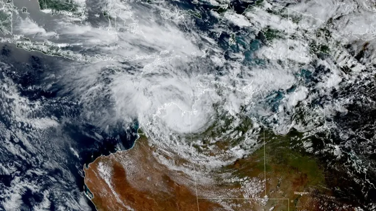

  • Heavy rainfall and flooding impact Northern Territory as ex-Tropical Cyclone Narelle moves west

    Heavy rainfall from ex-Tropical Cyclone Narelle triggered flooding across parts of the Northern Territory, Australia, between March 21 and 23, 2026, inundating properties, disrupting infrastructure, and prompting evacuations. As of March 23, the system was moving west across the Kimberley and had a high chance of redeveloping into a tropical cyclone over waters off Western Australia by March 25, with further strengthening forecast. Severe weather was expected to continue across northern Kimberley through March 24.

  • Tropical Cyclone Narelle weakens after Queensland landfall, forecast to re-intensify over Gulf of Carpentaria

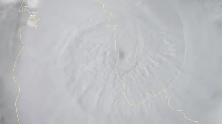
    Tropical Cyclone Narelle made landfall over the Queensland coast at 07:00 AEST on March 20 (21:00 UTC on March 19), as a high-end Category 4 system after briefly reaching Category 5 intensity a day earlier. The cyclone crossed the coast approximately 75 km (47 miles) south of Lockhart River, weakened to Category 2 by the afternoon, and began moving offshore toward the Gulf of Carpentaria. Destructive winds, heavy rainfall, and coastal flooding were reported across affected areas.

  • Severe thunderstorms kill 19, injure over 50 in Karachi, Pakistan

    Severe thunderstorms accompanied by heavy rain and gusty winds struck Karachi, Pakistan overnight on March 18–19, 2026, killing at least 19 people and injuring more than 50. The deadliest incident occurred in Mawachh Goth, Baldia, where a wall collapse killed 13 people, while six others died in separate rain-related incidents across the city. Authorities launched rescue and medical response operations.

  • Second kona low threatens renewed flooding in Hawaiʻi after record-breaking storm

    A second Kona low is expected to affect the Hawaiian Islands beginning the evening of March 19, 2026, bringing additional rainfall to areas already impacted by record-breaking flooding from a previous storm. A Flood Watch is in effect from 18:00 LT on March 19 through 18:00 LT on March 22 for Maui County, Oʻahu, and Hawaiʻi Island.

  • Storm Therese brings heavy rainfall, flood and landslide risk to Canary Islands, Spain

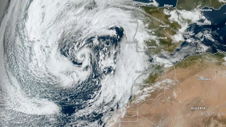
    Storm Therese began affecting the Canary Islands, Spain, on March 19, 2026, bringing strong winds, heavy rain, rough seas, and snowfall at high elevations. The severe weather is forecast to persist until at least March 2, with rainfall totals of over 300 mm (12 inches) being forecast in parts of La Palma and Tenerife, increasing the risk of flooding and landslides. Meanwhile, wind gusts above 90 km/h (56 mph) and waves over 5 m (16 feet) are expected.

  • Kona low brings extreme rainfall to Maui and Oʻahu, causing flooding and landslides across Hawaiʻi

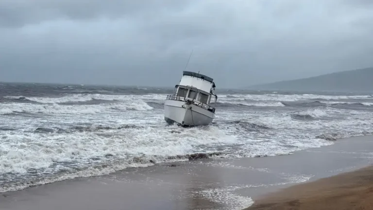
    A slow-moving Kona low brought extreme rainfall to the Hawaiian Islands between March 10–16, 2026, producing record-breaking totals at multiple long-term stations, particularly on Maui and Oʻahu. Honolulu and Kahului both set new daily rainfall records on March 13, while multi-day accumulations on Maui reached up to about 1 170 mm (46 inches), triggering flooding, landslides, and widespread disruption.

  • Category 5 Severe Tropical Cyclone Narelle forecast to cross Far North Queensland on March 20

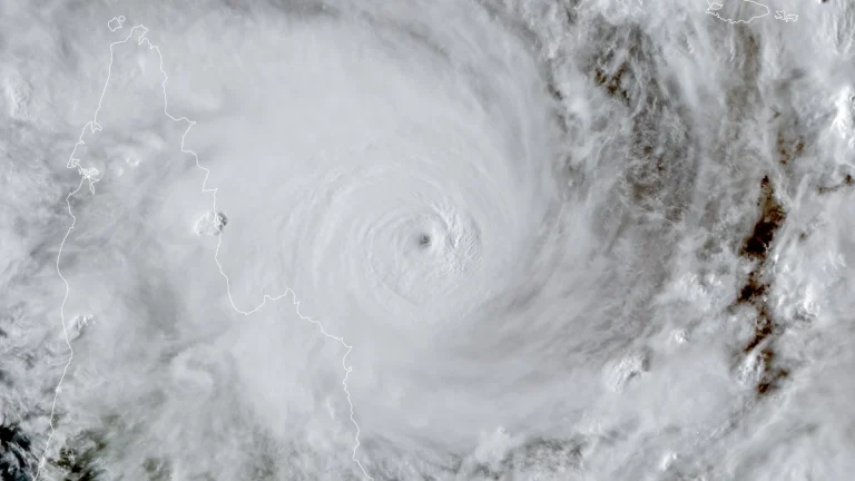
    Severe Tropical Cyclone Narelle intensified into a Category 5 system on March 19, 2026, and is forecast to cross the Cape York Peninsula between Lockhart River and Cape Melville, Queensland, on the morning of March 20. Very destructive wind gusts of more than 250 km/h (155 mph), heavy rainfall of 100 to 350 mm (4 to 14 inches), and dangerous coastal conditions including abnormally high tides and large waves are forecast near and south of the landfall area, although slight weakening to a high-end Category 4 before crossing remains possible.