Polar vortex threatening Great Plains with record-low temperatures
The polar vortex is stretching southwards for the 10th time this season threatening to bring record-breaking cold temperatures across the United States through the next week.


The polar vortex is stretching southwards for the 10th time this season threatening to bring record-breaking cold temperatures across the United States through the next week.
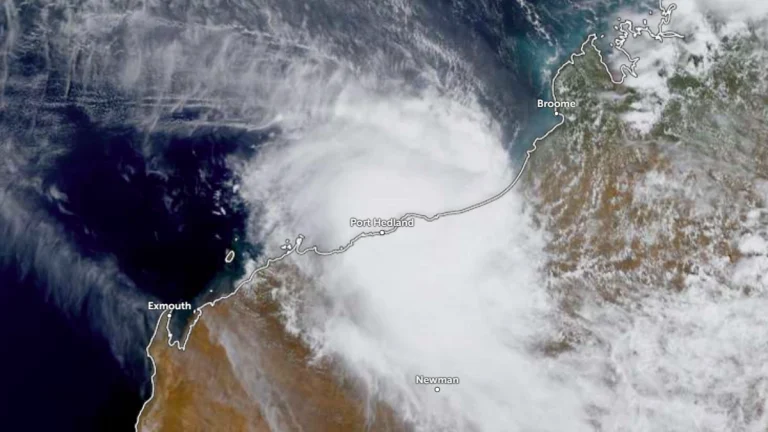
Category 5 Tropical Cyclone Zelia made landfall over Western Australia’s coast between Pardoo and Port Hedland at 12:30 local time (LT) on Friday, February 14, 2025, with winds up to 290 km/h (180 mph). The cyclone caused extensive damage and prompted emergency response efforts.

A powerful storm system triggered severe flooding in Portoferraio, Elba Island, on February 14, 2025, following an intense downpour that brought 65 mm (2.56 inches) of rain in just one hour.
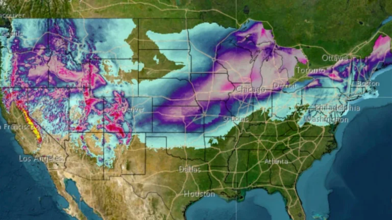
A coast-to-coast winter storm is set to move across the United States starting Friday, February 14, 2025, bringing heavy snow, ice, and severe weather from the Rockies to the Northeast. The system is expected to intensify as it moves east, impacting millions with snow accumulations, icy conditions, and potential flash flooding.
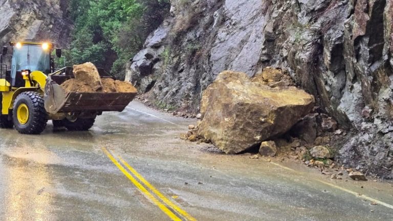
An atmospheric river triggered multiple debris flows and flash floods across California after it brought heavy rains and mountain snow to much of the state on Thursday, February 13, 2025. Multiple flood alerts and evacuation warnings were issued, with the local authorities reporting widespread damage and multiple rescues.
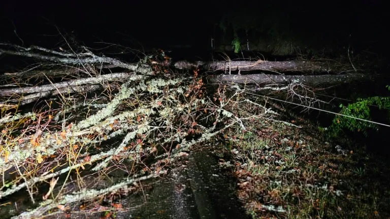
A damaging tornado swept through Columbia town in Marion County, Mississippi on Wednesday, February 12, 2o25, downing more than 70 power poles, and leaving around 100 customers without power.
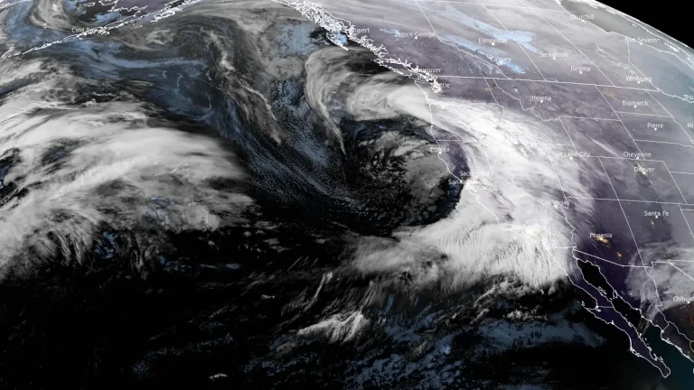
An atmospheric river is forecast to bring heavy precipitation to California today and in the coming days, with significant snowfall expected in the Sierra Nevada and flood risks across multiple regions.

A powerful winter storm swept through southern Ontario, Canada on Wednesday, February 12, 2025, bringing over 20 cm (7.9 inches) of snow to some areas and creating hazardous travel conditions across the region. Schools along with other institutions have been closed off for Thursday, February 13 due to the storm with stronger winds in the forecast and dangerous travel conditions being likely to continue.
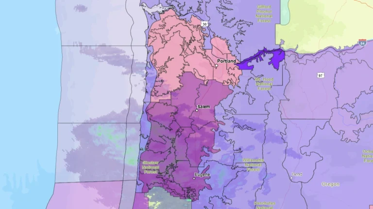
An Ice Storm Warning has been issued for the Central and Southern Willamette Valley, the Central Oregon Coast Range Lowlands, and the Central Oregon Coast Range as winter storms bring hazardous conditions to the region. The warning will be in effect from 01:00 local time (LT) on February 13 to 04:00 LT on February 14, with significant ice and snow accumulation expected.
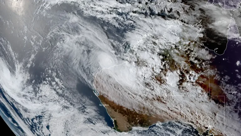
Severe Tropical Cyclone Zelia rapidly intensified after forming off the coast of Western Australia on February 11, 2025, reaching Category 5 strength at 03:00 UTC on February 13. The system remains slow-moving over warm ocean waters north-northwest of Port Hedland and is expected to maintain Category 5 intensity until landfall on February 14.