
Brownsville, Texas, on the Mexican border, had not seen measurable snow since 1895, until it fell on Christmas Eve 2004
About 3.8 cm (1.5 inches) of snow was enough to make Christmas 2004 historic in Brownsville, Texas. The city on the Mexican border had gone nearly 110 years without a recorded measurable snowfall. Flurries had occurred during that interval, but the storm that arrived late on Christmas Eve left enough accumulation for the Lower Rio Grande Valley’s first recorded white Christmas.
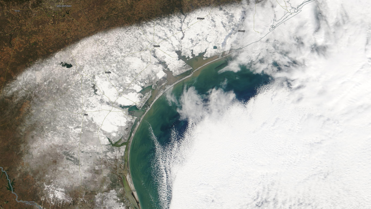
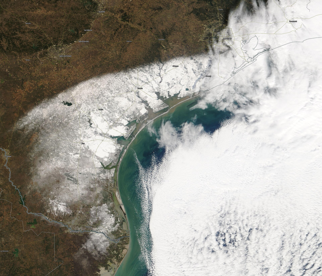
Satellite image of South Texas and northeastern Mexico on December 25, 2004, showing the snow left by the Christmas Eve–Christmas morning storm. Brownsville is labeled near the lower edge. Credit: NASA EOSDIS Worldview, via Wikimedia Commons (public domain).
The National Weather Service’s December storm report places the onset of snow across Deep South Texas after 04:00 UTC on December 25 (22:00 CST on December 24). It continued through the night and ended around 10:00 UTC (04:00 CST), leaving snow on the ground for Christmas morning.
The event combined an unusually long gap in Brownsville’s snowfall record with the holiday timing. Farther north, the same system produced substantially greater accumulations, but along the Mexican border even a modest covering was enough to draw residents outside with cameras. The NWS documented people remaining awake into the early morning to photograph and film it.
The record gap was about accumulation, not every flurry
A post-event analysis by NWS Brownsville forecasters Kurt M. Van Speybroeck, Jesus Haro, Andrew Patrick and Jason Straub identified February 1895 as the city’s previous measurable snowfall. Their review distinguished accumulation from flakes or mixed precipitation that left no measurable snow.
In standard NWS terminology, snowfall below about 2.5 mm (0.1 inch) is a trace. A trace can confirm that snow occurred without establishing a measurable accumulation, making the distinction essential to Brownsville’s record.
The analysis counted 27 occurrences of frozen precipitation from 1870 through 2005, a category including flurries, ice pellets, and sleet. It specifically noted snow flurries in December 1997. That history rules out describing the interval as a century in which no snowflakes fell.
The nearly 110-year interval is an observed gap, not a calculated return period. A later NWS review also acknowledged possible twentieth-century accumulations not accounted for by observers. The defensible comparison is therefore the documented Brownsville record, rather than a claim about every location across the wider Valley.
Cold air and an approaching disturbance arrived together
A cold front crossed Brownsville on December 22, followed by another surge of Arctic air. By Christmas Eve, cold air was established across the region and held against the Sierra Madre Oriental foothills in northeastern Mexico. An upper-level low moving across northern Mexico brought Pacific moisture and the rising motion needed to produce precipitation.1
NWS Corpus Christi’s reconstruction describes precipitation changing from a wintry mix to snow as colder air moved south and evaporation helped cool the atmosphere. A freezing surface temperature alone would not have guaranteed snow: the air above also had to be cold enough for flakes to survive their descent.4
The broader circulation resembled the McFarland pattern, a configuration associated with major freezes in the Lower Rio Grande Valley. In a later study, NWS researchers compared several freeze and snow events and emphasized that an Arctic outbreak is necessary but insufficient for these snowfalls. Moisture, atmospheric lift and the vertical temperature profile must also align.
The warning began before snow was certain
The first Special Weather Statement was issued at 23:10 UTC on December 20 (17:10 CST). It warned of “the potential for a mixture of wintry precipitation late Thursday night and early Friday.” That was an early alert to the developing risk, rather than a settled prediction of snow falling on Christmas Eve night.
As Christmas approached, successive model runs and observations increased confidence. NWS Brownsville’s event account describes freeze warnings followed by winter weather advisories and, later on Christmas Eve, winter storm warnings for heavy snow. The forecast evolved as the timing and type of precipitation became clearer.5
There was still an important limitation. Ronald F. Morales Jr.’s later analysis of the storm found that operational models had not predicted its narrow heavy-snow band, even at the event’s onset. Anticipating an unusual regional snowfall and locating its most intense band were separate forecasting problems.
One storm produced very different snowfall totals
The NWS Brownsville storm summary listed substantial variation across the Valley and nearby coast. These are reported storm totals for named locations, rather than a uniform depth across each community.
| Location | Reported storm-total snowfall |
|---|---|
| Brownsville | 3.8 cm (1.5 inches) |
| Harlingen and San Benito | 3.8 cm (1.5 inches) each |
| South Padre Island | 6.4 cm (2.5 inches) |
| Port Isabel and Rio Grande City | 7.6 cm (3 inches) each |
| McAllen and Raymondville | 8.9 cm (3.5 inches) each |
| Hebbronville | 12.7 cm (5 inches) |
Farther north, NWS Corpus Christi’s official account gives 11.2 cm (4.4 inches) at Corpus Christi International Airport and 31.8 cm (12.5 inches) at Victoria. Both exceeded those locations’ February 1895 totals over a 24-hour period, although the earlier calendar-day records remained because the 2004 snowfall was divided between December 24 and 25.
Morales examined radar mosaics, weather observations, and atmospheric analyses to investigate the heavier bands. His study identified at least two distinct bands and reported snowfall rates of 5–10 cm (2–4 inches) per hour in the heavy-band region. Those intensities were not representative of Brownsville’s much smaller total.
The white Christmas gave way to a rapid thaw
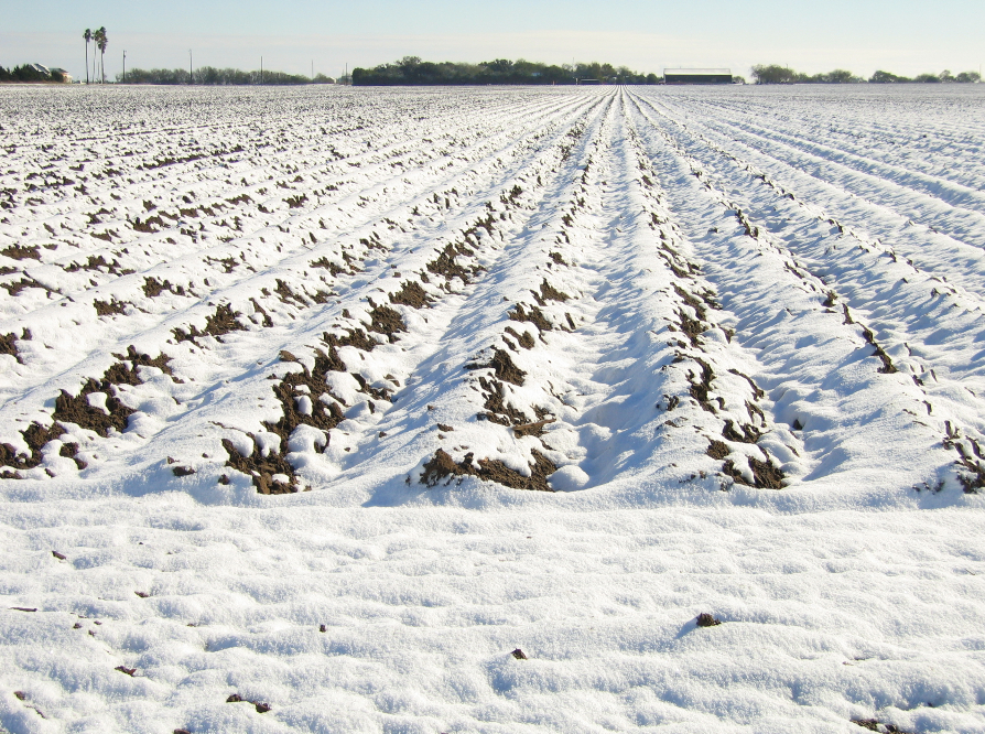
Clearing skies and sunshine quickly changed conditions on Christmas Day. Brownsville reached 11.1 °C (52 °F), and the snow melted rapidly. The short duration helps explain the importance of the photographs and video taken during the night: they documented a covering that was already disappearing later on Christmas Day.
In its contemporary storm log, the NWS described the snowfall as having been greeted with “joy and excitement.” The same report calls it the Lower Rio Grande Valley’s first recorded white Christmas. Neither description requires presenting the event as the region’s heaviest snowstorm or as something that could happen only once in a person’s lifetime.
Snow returned in 2017; later cold brought a different result
Brownsville did not have to wait another century. On December 8, 2017, measurable snow was observed at Brownsville/South Padre Island International Airport for the first time since 2004. In the wider Valley, a new upper-level disturbance cooled the atmosphere, changing rain and sleet to snow; heavier accumulations again favored particular bands and locations.
The 2004 storm had become a useful comparison. NWS researchers reviewing the 2017 event found that recognition of the McFarland pattern still helped forecasters identify rare winter-weather potential. Their analysis also documented differences between forecast precipitation types and what observers recorded, illustrating why the temperature profile mattered alongside the broad circulation.
January 2025 supplied a contrasting example. While a separate Gulf Coast winter storm brought blizzard warnings farther east, the Rio Grande Valley received mainly freezing rain or drizzle. The local NWS analysis identified a deep warm layer aloft that melted falling snow before the water froze on cold surfaces.
That contrast explains why forecasting another Brownsville snowfall requires more than watching the thermometer near the ground. The decisive question is whether moisture and lift arrive while the atmosphere is cold enough through the layers the precipitation must cross.
References
1 South Texas storm data, December 2004 – National Weather Service Brownsville/Rio Grande Valley – December 2004 reporting period.
2 Van Speybroeck, K. M., Haro, J., Patrick, A., and Straub, J. The Rio Grande Valley Christmas Snowstorm: A Once in a Lifetime Event – National Weather Service Brownsville – undated post-event analysis.
3 Guide to Forecast Matrices – National Weather Service Morristown – undated; snowfall and trace definitions.
4 South TX White Christmas 2004 – National Weather Service Corpus Christi – December 24–25, 2004 event account; publication date not stated.
5 White Christmas Dream Becomes Reality for the Lower RGV, 2004! – National Weather Service Brownsville/Rio Grande Valley – December 24–25, 2004 event account; publication date not stated.
6 RGV Receives Widespread Snow, December 8th, 2017 – National Weather Service Brownsville/Rio Grande Valley – December 8, 2017 event account.
7 Schroeder, J. J., Birchfield, C. D., Bogorad, G., and Goldsmith, B. S. Old and New Perspectives on Forecasting Rare Snowfall Events in the Lower Rio Grande Valley of Texas – NOAA/National Weather Service Brownsville/Rio Grande Valley – 2018 research poster.
8 Morales, R. F. Jr. The Historic Christmas 2004 South Texas Snow Event: Diagnosis of the Heavy Snow Band – National Weather Service Corpus Christi – online version updated/corrected July 31, 2007.
9 January 20–22 Cold Weather and Ice Event – National Weather Service Brownsville/Rio Grande Valley – January 2025 event analysis.

Rishav Kothari is Editor-in-Chief of The Watchers, where he runs the newsroom and covers earthquakes, volcanoes, severe weather and space weather.
Published in the last 24 hours
- How did one flash of lightning, lasting about seven seconds, stretch 829 km across five US states, beat the previous record by 61 km, and only be recognized as the longest ever measured nearly eight years later?
- China's giant sinkholes shelter endangered Magnolia but leave isolated populations genetically vulnerable Epicenter
- Strong and shallow M6.4 earthquake hits Santa Cruz Islands, Solomon Islands
