
Debris from 1980 eruption causes bridge collapse at Mount St. Helens
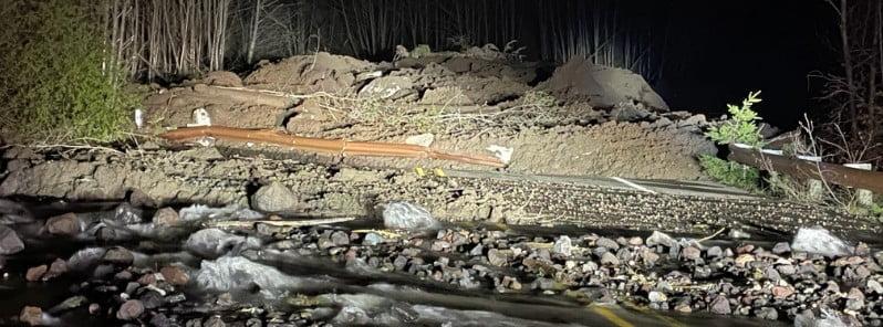
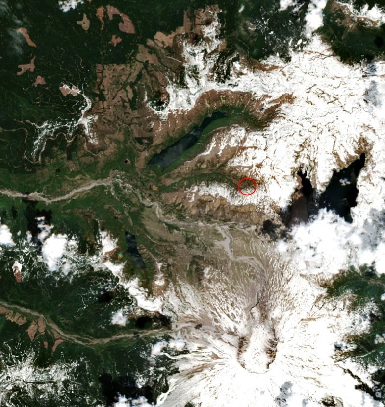
Image credit: Copernicus EU/Sentinel-2, EO Browser, The Watchers. Acquired on May 15, 2023
A significant debris flow occurred in Mount St. Helens’ South Coldwater Creek at 20:45 LT on May 14, 2023, leading to the destruction of a SR 504 bridge. This incident cut off access and power to the Johnston Ridge Observatory, prompting the evacuation of a dozen people and a dog by helicopter.
A large debris flow originating from remnants of the cataclysmic 1980 avalanche and eruption of Mount St. Helens caused severe disruption in the area on May 14, 2023. The event, which occurred at 20:45, led to the collapse of a SR 504 bridge in South Coldwater Creek. This unfortunate incident effectively severed access and power supply to the Johnston Ridge Observatory.
Following the landslide, evacuation measures were swiftly put into place. The King County Sheriff’s Air Support Unit confirmed through a Twitter post at around 11:00 LT on May 15 that they had successfully completed the evacuation of a dozen people, along with a dog, from the Johnston Ridge Observatory located near the volcano.
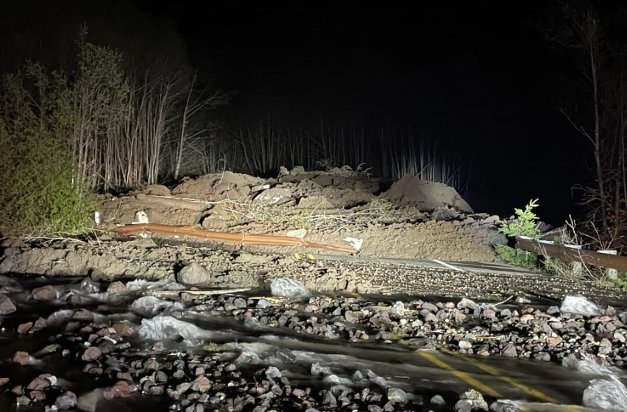
As of Monday afternoon, state transportation officials have reported that the road remains inaccessible in both directions at the seasonal gate near milepost 45. Motorists are advised to anticipate a prolonged closure due to the incident. There is also growing concern that the road may have sustained significant structural damage, as per officials’ statements.
Interestingly, the debris flow was detected on seismic data at nearby stations. The event might be associated with several days of warm weather leading up to the incident, although this has not been definitively confirmed.
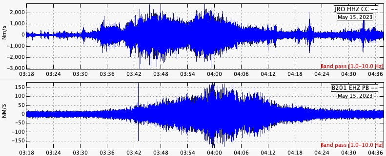
Despite the power loss disrupting a major telemetry hub for Mount St. Helens monitoring, the Pacific Northwest Seismic Network (PNSN) stations on the volcano continue to supply critical data. It is important to note that there is no volcanic unrest associated with this debris flow, thus assuaging concerns of a potential eruption.
The Cascades Volcano Observatory (CVO) continues to closely monitor the situation and the surrounding environment of the volcano.
I'm a dedicated researcher, journalist, and editor at The Watchers. With over 20 years of experience in the media industry, I specialize in hard science news, focusing on extreme weather, seismic and volcanic activity, space weather, and astronomy, including near-Earth objects and planetary defense strategies. You can reach me at teo /at/ watchers.news.
Commenting rules and guidelines
We value the thoughts and opinions of our readers and welcome healthy discussions on our website. In order to maintain a respectful and positive community, we ask that all commenters follow these rules.