
Multiple large and extremely dangerous tornadoes touch down in Nebraska
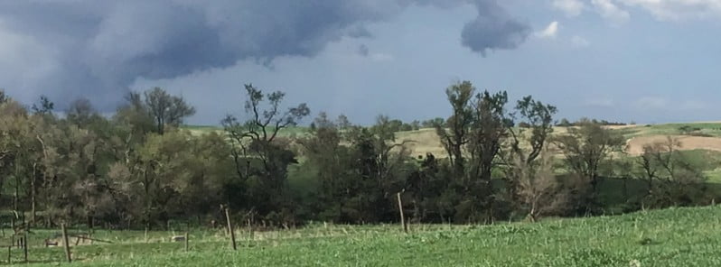
Image credit: NWS Hastings
Several tornadoes, described as large and extremely dangerous, wreaked havoc across various parts of Nebraska on Friday, May 12, 2023, causing considerable damage, including destroying farm buildings and downing power lines. 50 Tornado Warnings were issued in the state on that day, the most in a single day since 1998.
Nebraska experienced a series of severe weather events as multiple tornadoes, some of them extremely dangerous, touched down across the state on Friday, causing significant damage.
The first tornado report came in just after 12:30 CDT near Arnold, Custer County, according to the local emergency management office and the National Weather Service. Several hours later, a second tornado was observed near Spalding, followed by another about 8 km (5 miles) south of Lindsay.
The tornado that tracked west of Spalding crossed over 20.9 km (13 miles) of rural terrain. Minor damage was observed to center pivots, trees, power poles, and vehicles. This tornado was rated as EF-1 with a max wind speed of 170 km/h (105 mph), the NWS office in Hastings reported.
A particularly large and extremely dangerous tornado was reported near Bartlett at 15:55 CDT. A tornado warning was issued for parts of Garfield and Wheeler Counties as the storm moved through the area. Just minutes later, around 16:00 CDT, another tornado was spotted near Petersburg, located in Boone County. This tornado left a trail of destruction, including damage to small farm buildings and debris scattered across Highway 32.
In southeastern Nebraska, a rope tornado was spotted near Table Rock on Saturday afternoon. The region was also pelted by baseball-sized hail as the damaging storm made its way through.
At around 17:30 CDT, North Bend was hit by another round of tornadoes. Multiple farmsteads were damaged, and power lines were downed in the area. The National Weather Service issued warnings of a “large and extremely dangerous tornado” as the storm cell continued moving northeast. At least two people were injured.
A multiple vortex tornado was also observed near Hopper which was characterized by rain-wrapping curtains, according to a National Weather Service employee. The tornado’s path was approximately 0.8 km (0.5 miles) wide as it passed east of Scribner.
This weather event had severe consequences for local farming, with a commercial cattle feedlot near Uehling suffering extensive damage and resulting in the escape of several hundred cattle. Reports of significant farmstead damage continued to pour in from near Oakland into Friday evening.
These tornadoes in Nebraska were part of a broader weather pattern that also brought tornadoes to Oklahoma and Kansas on the same day. In total, the National Weather Service’s Storm Prediction Center listed at least 34 preliminary tornado reports for Friday.
References:
1 Multiple extremely dangerous tornadoes touch down in Nebraska – AccuWeather – May 12, 2023
2 2 hurt from large tornadoes rolling through Nebraska as week of severe storms drags on – FOX Weather – May 13, 2023
I'm a dedicated researcher, journalist, and editor at The Watchers. With over 20 years of experience in the media industry, I specialize in hard science news, focusing on extreme weather, seismic and volcanic activity, space weather, and astronomy, including near-Earth objects and planetary defense strategies. You can reach me at teo /at/ watchers.news.
Commenting rules and guidelines
We value the thoughts and opinions of our readers and welcome healthy discussions on our website. In order to maintain a respectful and positive community, we ask that all commenters follow these rules.