
Severe thunderstorms drop grapefruit-sized hail over Texas, historic hailstorm over Florida, U.S.
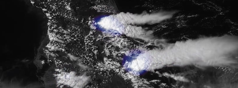
Image credit: NOAA/GOES-East, RAMB/CIRA. Acquired at 20:20 UTC on April 26, 2023
Severe thunderstorms produced intense hailstorms over parts of the southern US on Wednesday, April 26, 2023, with golf ball to grapefruit-sized hail reported over parts of Texas and a historic hailstorm over Florida. As of April 26 evening, the Storm Prediction Center had received more than six dozen reports of severe weather from Texas through Georgia and Florida. This multiday severe weather threat began on April 25 and is expected to continue through Thursday, with the chance of damaging winds, large hail, and tornadoes along the Gulf Coast.
Severe thunderstorms dropped large hail and triggered warnings over parts of the South on April 26, as the southern US remained in an unsettled weather pattern that shows no signs of immediate clearing.
A Severe Thunderstorm Watch was issued for a large part of the Florida Peninsula on April 26, and a Tornado Watch was hoisted for Central Texas through the evening. The big impacts in both regions came from hail.
The National Weather Service (NWS) office in Lubbock, Texas, announced that it would send out a survey team to investigate damage in Dickens County, located 100 km (60 miles) east of Lubbock, after a Particularly Dangerous Situation (PDS) Tornado Warning was issued on April 25. A wind gust of 145 km/h (90 mph) was reported in McAdoo, Texas, and a local emergency manager said a roof had been blown off a gas station in that community.
The Dickens County Sheriff’s Office also reported multiple windows had been blown out in the town of Dickens due to wind-driven hail. The NWS received reports of teacup-sized hail, measuring 7.6 cm (3 inches) in diameter.
On April 26, a storm triggered several Tornado Warnings and Flash Flood Warnings for communities around Waco. In addition, hail measuring approximately 10 cm (4 inches) in diameter was also reported in the Waco area, and Waco recorded a wind gust of approximately 101 km/h (63 mph) in the early evening hours.
The Groesbeck Police Department reported that it responded to at least one water rescue after a car drove around a barricade and got stuck in high water. All occupants were safely removed from the car’s roof by first responders, with no reported injuries.
Late Wednesday afternoon, storms started to impact the Dallas/Fort Worth metro area, leading to a ground stop at Dallas/Fort Worth International Airport.
The thunderstorms also brought heavy rainfall to Central Texas, with over 76 mm (3 inches) of rain falling in just a few short hours.
As of 08:00 UTC (03:00 CDT) on April 27, 26 461 customers were without power in Texas and 11 139 in Louisiana. This is about 105 300 people in both states.
In the past few days, Central Florida has experienced a surge in severe storms, resulting in destructive hail and damaging winds. Images and videos depicting hail the size of baseballs, along with fallen trees and roofs collapsing in Brevard County, including the city of Melbourne, have gained significant attention on social media. Hail has also been reported in Sumter, Marion, Lake, and Osceola counties, as well as in northern Palm Beach County.
As the line of storms progresses across the South on Thursday, April 27, a significant portion of Mississippi, Alabama, and Louisiana will face the potential for severe weather throughout the day. Although the intensity of the storms might temporarily weaken late in the morning, they could regain strength in the afternoon and early evening due to daytime heating.
The primary hazards on Thursday will include strong winds, flash flooding, and frequent lightning. Additionally, there is a chance of a few tornadoes and/or waterspouts in the Interstate 10 corridor, stretching from southeastern Louisiana to the Florida Panhandle. Several instances of damaging hail are also expected. Major cities such as Jackson, Mississippi; Birmingham and Montgomery, Alabama; and New Orleans are among those at risk on Thursday.
The full spectrum of severe weather — including high winds, large hail, flash flooding, frequent lightning strikes and perhaps a few tornadoes— will be possible with the strongest thunderstorms in Texas on Friday, according to AccuWeather forecasters.
This new round of severe weather — or at least heavy, gusty thunderstorms — will progress eastward across the Southern states on Saturday and Sunday.
References:
1 Storms drop grapefruit-sized hail over Texas during unsettled weather pattern across South – Fox Weather – April 26, 2023
2 Severe thunderstorms to continue pestering southern US – AccuWeather – April 26, 2023
3 See photos, videos of destructive hail pounding cars and homes across Central Florida – Miami Herald – April 26, 2023
I'm a dedicated researcher, journalist, and editor at The Watchers. With over 20 years of experience in the media industry, I specialize in hard science news, focusing on extreme weather, seismic and volcanic activity, space weather, and astronomy, including near-Earth objects and planetary defense strategies. You can reach me at teo /at/ watchers.news.
Commenting rules and guidelines
We value the thoughts and opinions of our readers and welcome healthy discussions on our website. In order to maintain a respectful and positive community, we ask that all commenters follow these rules.