
Rapidly deepening low brings heavy snowfall and strong winds to New Zealand
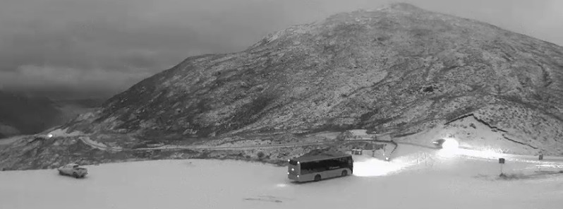
Image credit: New Zealand Met Service
A rapidly deepening low is moving east across central New Zealand on Sunday, August 8, 2021, into early Monday. This low is bringing heavy snow to low levels and severe gale southerlies across the central and northern districts of the country.
The heaviest snow is expected in northern Canterbury and southern Marlborough above 200 m (650 feet), and central and southern parts of the North Island, which is likely to disrupt travel, damage trees, and powerlines, and cause stress to livestock.
People are advised to keep up to date with the latest forecasts in case any changes are made or further areas are added.
State Highway 7 west of Hanmer Springs is closed, and traffic on State Highway 1 south of Kaikoura is slow due to the snow, RNZ reports. In addition, State Highway 8 from Lake Pukaki to Lake Tekapo in Canterbury has been closed due to snow settling on the road.
Heavy snow has already affected many major roads across the South Island while Cook Strait ferries have been canceled until Monday morning due to poor sailing conditions.
Snowfall continues overnight and into Monday
Snow will spread north across the North Island this evening and into Monday.
There is even a possibility that the highest terrain in the north will see a light snow flurry.
Details: https://t.co/Yjbq0jfCz1 ^Ash pic.twitter.com/qsoD6hYaV9
— MetService (@MetService) August 8, 2021
For comparison, here is a snap of the Crown Range Road at 8:00am yesterday (Saturday) Ash pic.twitter.com/DCGzLIJcSb
— MetService (@MetService) August 7, 2021
Most of the South Island had maximum temperatures in the single digits today, thanks to the polar blast, but Haast was the exception with a high of 12C. Northland lived up to its tag as "the winterless north" with Whangarei snagging the top temperature of 19C for Sunday. ^GB pic.twitter.com/saWiN2QmU3
— MetService (@MetService) August 8, 2021
The wild weather will continue on Monday, August 9, before easing as a narrow ridge of high pressure pushes across the country.
Another active front will move onto the South Island on Thursday, August 12.
I'm a dedicated researcher, journalist, and editor at The Watchers. With over 20 years of experience in the media industry, I specialize in hard science news, focusing on extreme weather, seismic and volcanic activity, space weather, and astronomy, including near-Earth objects and planetary defense strategies. You can reach me at teo /at/ watchers.news.
Commenting rules and guidelines
We value the thoughts and opinions of our readers and welcome healthy discussions on our website. In order to maintain a respectful and positive community, we ask that all commenters follow these rules.