
Lava flow at Pacaya volcano heads toward inhabited areas, Guatemala
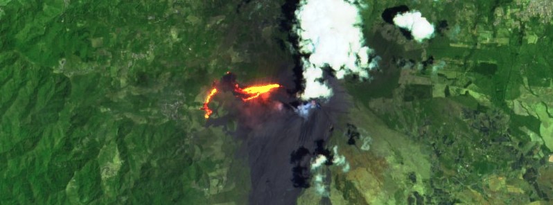
Featured image: False color image of lava flow at Pacaya volcano on March 30, 2021. Credit: Copernicus EU/Sentinel-2, TW
High-level effusive activity continues at Pacaya volcano, Guatemala with columns of abundant ash lasting from minutes to hours, reaching 3 km (9 850 feet) above sea level and traveling 7 km (4.3 miles) in a southerly direction on March 30. 2021. On March 29, the lava flow reached coffee plantations and swallowed up an abandoned house near the village of El Patrocinio.
The activity is causing ashfall in the communities to the south of the volcano, such as Finca El Chupadero and Los Pocitos.
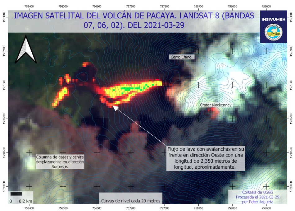
The effusive activity continues to feed the lava flow on the west flank, with a length of 2 850 m (9 350 feet) as of March 30.
ACTUALIZACIÓN VOLCÁN DE PACAYA
Flanco Oeste en cercanías del patrocinio, diámetro de apróximadamente 2,700 metros.Imágenes: Marvin Alfaro, observador INSIVUMEH
INSIVUMEH Prevención para una Mejor Nación #SomosINSIVUMEH #Guatemala #VolcandePacaya pic.twitter.com/zbD0xmn6mK
— INSIVUMEH Guatemala (@insivumehgt) March 29, 2021
Actividad volcán #Pacaya 30 marzo 2021 Flujo de lava del flanco oeste que se desvió a dirección sur con una longitud de 2,850mts aproximadamente
Video: Vulcanología Insivumeh#SomosINSIVUMEH #Guatemala #ElCivNoSeDetiene pic.twitter.com/uQfNBQOMfW
— INSIVUMEH Guatemala (@insivumehgt) March 31, 2021
INSIVUMEH seismic stations register constant tremors, associated with the rise of magma, as well as continuous degassing in the crater.
It is not ruled out that more lava flows are generated in other flanks or the generation of degassing columns with abundant ash, INSIVUMEH reported at 14:07 UTC on March 30.
On March 29, lava flow reached the coffee plantations and swallowed up an abandoned house near the village of El Patrocinio, CONRED reported.
It continues to advance between 50 and 60 m (160 – 195 feet) per day.
The next community is El Patrocinio, located 1.5 km (0.93 miles) from where the lava flow is currently located, CONRED said on March 30.
Flujo de lava de volcán #Pacaya avanza en la parte alta de la Breña parte de la comunidad el Patrocinio
Video : Romilio Peralta Observador InsivumehInsivumeh Prevención para una Mejor Nación #SomosINSIVUMEH #Guatemala pic.twitter.com/qo79q6wCLW
— INSIVUMEH Guatemala (@insivumehgt) March 30, 2021
Se reporto hoy que la Lava del #volcán #Pacaya alanzo la aldea de El Patrocinio no se reportaron heridos, En consecuencia se realizo una reunión de emergencia de autoridades departamentales, municipales y locales ejecuten acciones y planes de respuesta. #Guatemala pic.twitter.com/yL5JJU209P
— Celeste Centaury (@CCentaury) March 31, 2021
The communities surrounding the Pacaya volcano have their response plans that were updated last year and CONRED has conducted drills and simulations with them as part of the preparation.
They have alert systems to inform the neighbors and have identified the sound of prevention and the alarm to evacuate.
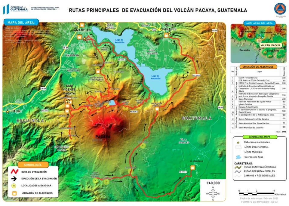
CONRED said the general population should know their local response plan, have their family response plan and a 72-hour backpack for each member of the family, as well as an emergency kit for pets and animals.
Pacaya volcano on March 30, 2021 – False Color. Credit: Copernicus EU/Sentinel-2, TW
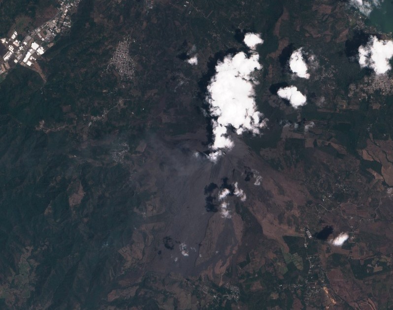
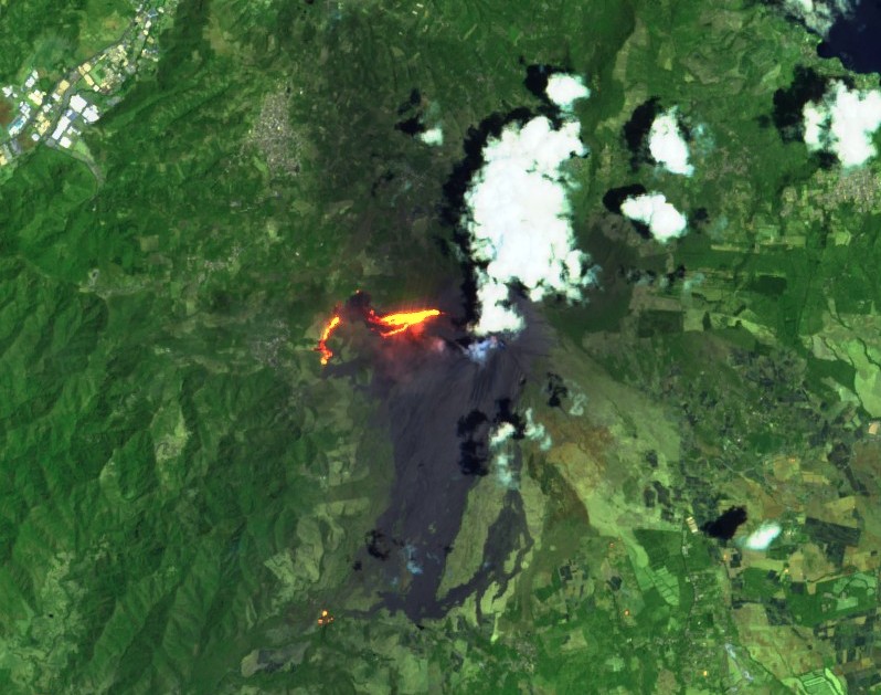
Pacaya volcano on March 30, 2021 – Natural Color. Credit: Copernicus EU/Sentinel-2, TW
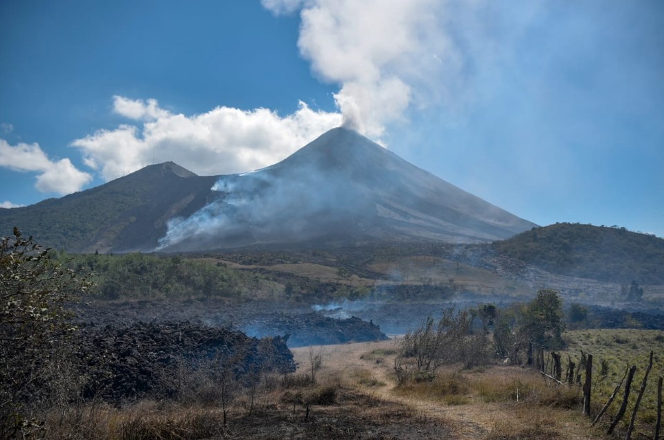
Image credit: CONRED
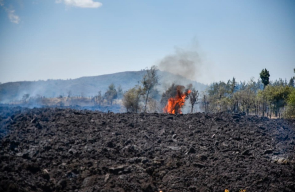
Image credit: CONRED
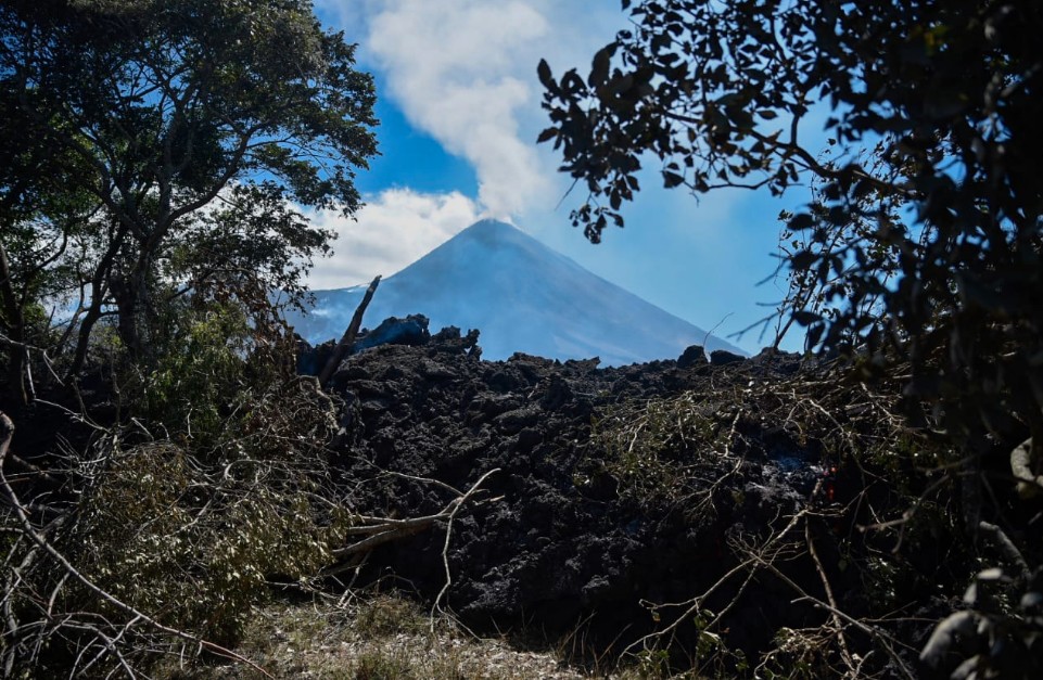
Image credit: CONRED
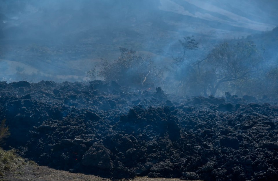
Image credit: CONRED
Geological summary
Eruptions from Pacaya, one of Guatemala's most active volcanoes, are frequently visible from Guatemala City, the nation's capital.
This complex basaltic volcano was constructed just outside the southern topographic rim of the 14 x 16 km (8.7 x 9.9 miles) Pleistocene Amatitlán caldera. A cluster of dacitic lava domes occupies the southern caldera floor.
The post-caldera Pacaya massif includes the ancestral Pacaya Viejo and Cerro Grande stratovolcanoes and the currently active Mackenney stratovolcano.
The collapse of Pacaya Viejo between 600 and 1 500 years ago produced a debris-avalanche deposit that extends 25 km (15 miles) onto the Pacific coastal plain and left an arcuate somma rim inside which the modern Pacaya volcano (Mackenney cone) grew.
A subsidiary crater, Cerro Chino, was constructed on the NW somma rim and was last active in the 19th century.
During the past several decades, activity has consisted of frequent strombolian eruptions with intermittent lava flow extrusion that has partially filled in the caldera moat and armored the flanks of Mackenney cone, punctuated by occasional larger explosive eruptions that partially destroy the summit of the growing young stratovolcano. (GVP)
I'm a dedicated researcher, journalist, and editor at The Watchers. With over 20 years of experience in the media industry, I specialize in hard science news, focusing on extreme weather, seismic and volcanic activity, space weather, and astronomy, including near-Earth objects and planetary defense strategies. You can reach me at teo /at/ watchers.news.
Commenting rules and guidelines
We value the thoughts and opinions of our readers and welcome healthy discussions on our website. In order to maintain a respectful and positive community, we ask that all commenters follow these rules.