
Elevated unrest continues at Taal volcano with 212 earthquakes in 24 hours, Philippines
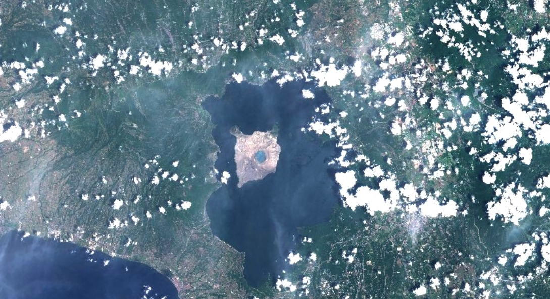
Image credit: Copernicus EU/Sentinel-2
Alert Level 2 remains in place over Taal volcano, Philippines, as of Wednesday, March 31, 2021. At this level, sudden phreatic explosions, minor ashfalls, volcanic tremors, and lethal accumulations of volcanic gas may threaten areas within the volcano.
In 24 hours to 00:00 on March 31, the Taal Volcano Network recorded 212 volcanic earthquakes in the area, including 168 episodes of volcanic tremors with durations of up to 20 minutes, and 44 low-frequency volcanic earthquakes, according to PHIVOCLS.
Activity at the Main Crater included weak emission of steam-laden plumes from fumarolic vents that rose up to 5 m (16 feet).
On Tuesday, March 30, sulfur dioxide emission averaged 1 229 tonnes per day.
A temperature high of 71.8 °C (161 °F) was last measured from the Main Crater Lake on March 4.
"Ground deformation parameters from electronic tilt, continuous GPS and InSAR data analysis indicated a very slow and steady inflation and expansion of the Taal region since after the January 2020 eruption," wrote PHIVOLCS.
Alert Level 2 or Increased Unrest is currently in place over the volcano, but PHIVOLCS noted that the unrest has been elevating and is under continuous evaluation.
Authorities warned the public that at this level, sudden phreatic explosions, minor ashfalls, volcanic tremors, and lethal accumulations of volcanic gas may happen and threaten areas within the volcano.
Entry is strictly prohibited into Taal Volcano Island and Taal's Permanent Danger Zone, particularly the vicinities of the Main Crater and the Daang Kastila fissure, as well as boating on Taal Lake.
Pilots were also advised to avoid flying near the volcano as airborne ash and ballistic fragments from sudden eruptions may pose risk to aircraft.
DOST-PHIVOLCS is closely monitoring the volcano's activity.

Image: Taal volcano on March 31, 2021. Credit: Copernicus EU/Sentinel-2
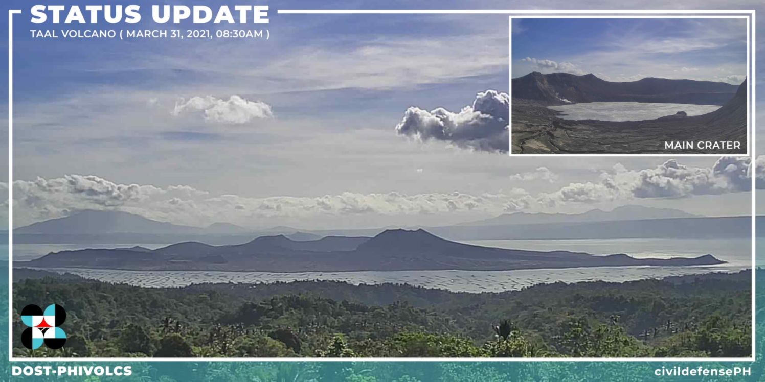
Image credit: DOST-PHIVOLCS
Geological summary
Taal is one of the most active volcanoes in the Philippines and has produced some of its most powerful historical eruptions. Though not topographically prominent, its prehistorical eruptions have greatly changed the topography of SW Luzon.
The 15 x 20 km (9 x 12 feet) Talisay (Taal) caldera is largely filled by Lake Taal, whose 267 km2 (103 mi2) surface lies only 3 m (9.8 feet) above sea level.
The maximum depth of the lake is 160 m (525 feet), and several eruptive centers lie submerged beneath the lake. The 5 km (3.1 miles) wide Volcano Island in north-central Lake Taal is the location of all historical eruptions.
The island is composed of coalescing small stratovolcanoes, tuff rings, and scoria cones that have grown about 25% in the area during historical time. Powerful pyroclastic flows and surges from historical eruptions have caused many fatalities. (GVP)
Commenting rules and guidelines
We value the thoughts and opinions of our readers and welcome healthy discussions on our website. In order to maintain a respectful and positive community, we ask that all commenters follow these rules.