
Earthquake swarm under Mauna Loa volcano, Aviation Color Code remains at Yellow, Hawaii
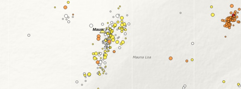
Image credit: USGS/HVO
A small swarm of shallow seismicity, that began at 11:00 UTC on March 18, 2021, is occurring beneath the upper Ka‘ōiki seismic zone, under Mauna Loa’s southeast flank and northwest of Kīlauea's summit, Hawaii. Mauna Loa Volcano is not erupting; other monitoring data streams remain stable and show no signs of increased activity.
The USGS Hawaiian Volcano Observatory (HVO) has recorded over 40 earthquakes beneath the upper Ka‘ōiki seismic zone, about 21 km (13 miles) WNW of Volcano. The earthquakes are occurring in a cluster about 2 km (1.2 miles) wide and 0.5 – 6 km (0.5 – 4 miles) below the surface.
The largest event in the sequence, so far, was M3.5 earthquake, with the bulk of the events being less than M2 and not widely reported by residents. Reported felt events were described as weak shaking, with a maximum Intensity of II on the Modified Mercalli Intensity Scale.
Clustering of shallow earthquakes in this region does not mean an eruption is imminent, HVO said.
The observatory has recorded shallow earthquakes in this area for many decades across several eruptive cycles at both Kīlauea and Mauna Loa.
"These earthquakes do not show any signs of magmatic involvement and are part of normal re-adjustments of the volcano due to changing stresses within it. Other monitoring data streams for Kīlauea and Mauna Loa, including ground deformation, gas, and imagery, show no signs of increased activity."
HVO continues to closely monitor geologic changes, seismicity, deformation, and gas emissions at Kīlauea and Mauna Loa volcanoes.
Mauna Loa is the largest active volcano on our planet, rising gradually to 4 170 m (13 681 feet) above sea level. Its long submarine flanks descend an additional 5 km (3 miles) below sea level to the ocean floor.
The ocean floor directly beneath Mauna Loa is, in turn, depressed by the volcano's great mass of another 8 km (5 miles). This places Mauna Loa's summit about 17 km (56 000 feet) above its base. The enormous volcano covers half of the Island of Hawaiʻi.
Mauna Loa last erupted 35 years ago, in 1984.
Eruptions typically start at the summit and, within minutes to months of eruption onset, about half of the eruptions migrate into either the Northeast or Southwest Rift Zones.
Since 1843, the volcano has erupted 33 times with intervals between eruptions ranging from months to decades.
Eruptions at Mauna Loa tend to produce voluminous, fast-moving lava flows that can impact communities on the east and west sides of the Island of Hawaiʻi. Since the mid-19th century, the city of Hilo in east Hawaiʻi has been threatened by seven Mauna Loa lava flows.
Mauna Loa lava flows have reached the south and west coasts of the island eight times: 1859, 1868, 1887, 1926, 1919, and three times in 1950.
Alert Level remains at Advisory, and Aviation Color Code at Yellow since July 2, 2019.
In VONA released on July 2, 2019, HVO said earthquake and ground deformation rates at Mauna Loa Volcano have exceeded long-term background levels over the past several months.
"An eruption is not imminent and current rates are not cause for alarm. However, they do indicate changes in the shallow magma storage system at Mauna Loa."
I'm a dedicated researcher, journalist, and editor at The Watchers. With over 20 years of experience in the media industry, I specialize in hard science news, focusing on extreme weather, seismic and volcanic activity, space weather, and astronomy, including near-Earth objects and planetary defense strategies. You can reach me at teo /at/ watchers.news.
Commenting rules and guidelines
We value the thoughts and opinions of our readers and welcome healthy discussions on our website. In order to maintain a respectful and positive community, we ask that all commenters follow these rules.