
Eruptions at Semeru volcano generate spectacular pyroclastic flows, Indonesia

Image credit: @harywp_
A significant eruption occurred at the Indonesian Semeru volcano on December 1, 2020, generating a large pyroclastic flow and forcing thousands of residents to flee their homes. According to the CVGHM, the volcano has now entered the stage of generating frequent pyroclastic flows. The eruption came just 2 days after a high-level eruption at Lewotolo volcano on Lembata island forced nearly 5 000 people to evacuate.
MAGMA Indonesia reported that an average of 40 eruptive earthquakes per day has been recorded from October 1 to November 30. Rock avalanches from the peak have continuously occurred since October 19.
The number of avalanches significantly increased on November 28, followed by pyroclastic flows with a maximum sliding distance of 1 000 m (3 280 feet) to the southeast portion of the slope.
On December 1, a spectacular pyroclastic flow was observed from the summit dome with a sliding distance between 2 and 11 km (1 and 7 miles) towards the southeast.
As a result, dozens of livestock perished in the Pronojiwo District. In addition, 10 heavy-duty mining equipment were damaged.
Amazing photos of glowing lava and activity at the crater of #Semeru volcano in East Java captured yesterday 28th November.
Photos by @aris_volcano pic.twitter.com/5PLIlk6BiX
— Øystein Lund Andersen (@OysteinVolcano) November 29, 2020
Rockfall from the crater of Semeru volcano, East Java – captured in August 2014.
It will be intetesting to go back to the area again, to observe the ongoing activity at Semeru. Tomorrow I should be on the way there! pic.twitter.com/g6vvd2gQMX
— Øystein Lund Andersen (@OysteinVolcano) December 1, 2020
Lava flowing from the Mount Semeru volcano causes a stream to steam in Lumajang, East Java, Indonesia
Juni Kriswanto pic.twitter.com/b7iRkbLkTU
— AFP News Agency (@AFP) December 2, 2020
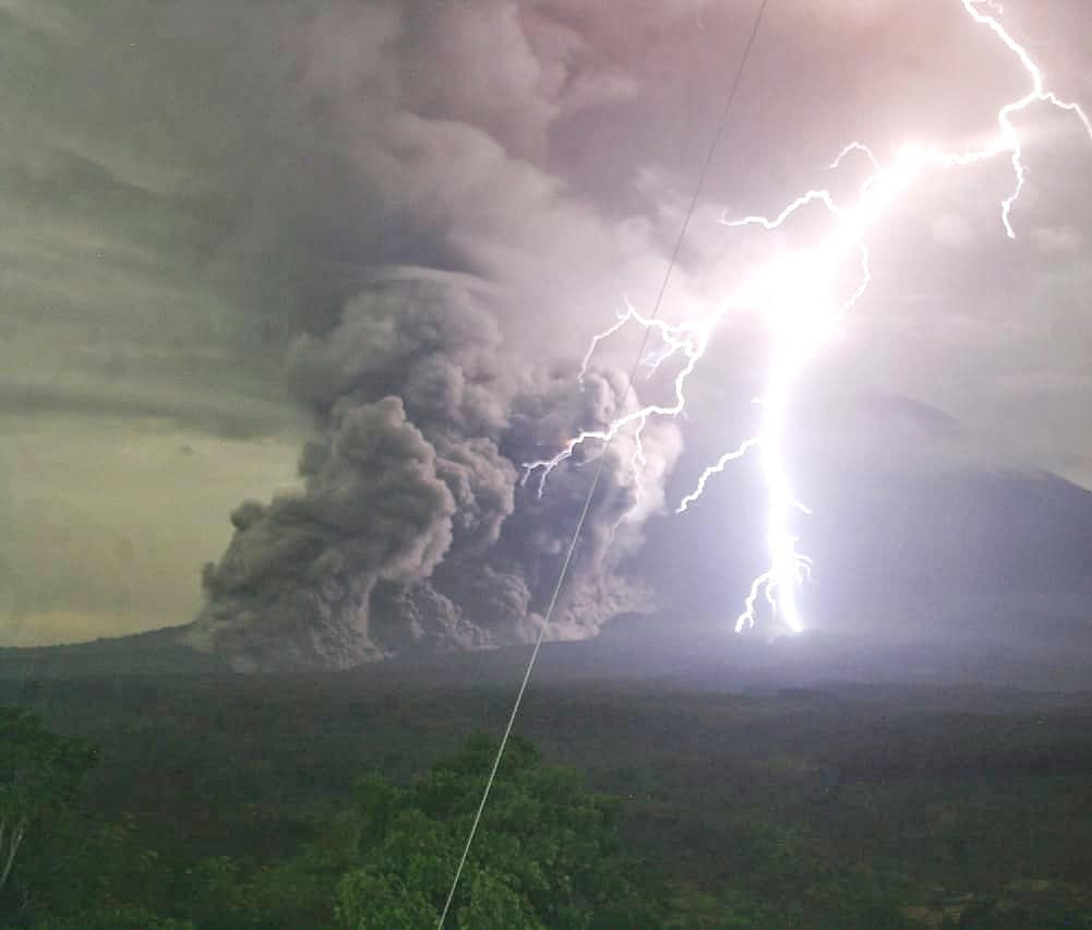
Image credit: @harywp_/Twitter
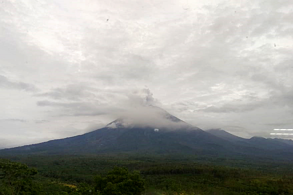
Image credit: Lumajang Regency
In its Volcanic Ash Advisory issued 19:57 UTC on November 30, the Darwin VAAC reported a high-level eruption to 15.2 km (50 000 feet / FL500) a.s.l. and raised the Aviation Color Code to Red.
However, in VA Advisory issued 23:21 UTC on the same day, the center said they reassessed the previously reported eruption to FL500 as likely thunderstorm activity — meaning no such eruption took place.
You can see it centered in the video below:
The Indonesian National Board for Disaster Management (BNPB) said the Lumajang Rapid Response Team has been deployed in disaster-prone areas to monitor the situation.
Thousands of residents have been displaced and any activity has been prohibited within a 4 km (2.5 miles) radius of the active crater of the volcano, authorities said.
The BPBD of Lumajang has also given evacuation orders for residents in Curah Koboan Hamlet, Supiturang Village, and Rowobaung Hamlet, Oro-Oro Ombo Village, Pronojiwo District, and Kajar Kuning Village, Sumberwuluh Village, Candipuro District.
Dini hari sekitar pukul 01.23 terjadi Awan Panas Guguran dari kawah gunung Semeru, jarak luncur 3 – 4 km dari puncak, dan mengarah ke curah kobokan.
.
Suara dentuman sampai sekarang beberapa kali terdengar, warga sekitar lereng sudah ada yang mengungsi.#semeru #Desember pic.twitter.com/jWJKWDUj6i— pendakiawp (@pendaki_awp) December 1, 2020
Satu hari pasca Semeru meletus pic.twitter.com/SNsnt9qEkt
— JOS MBULET (@JosMbulet) December 2, 2020
The eruption on Semeru took place just two days after a high-level eruption at Lewotolo ejected ash up to 15.2 km (50 000 feet) above sea level, prompting nearly 5 000 people to evacuate.
The last high-level eruption at Semeru took place at 12:25 UTC on May 16, 2020. The eruption ejected ash up to 14 km (46 000 feet) above sea level.
Geological summary
Semeru, the highest volcano on Java, and one of its most active, lies at the southern end of a volcanic massif extending north to the Tengger caldera. The steep-sided volcano, also referred to as Mahameru (Great Mountain), rises above coastal plains to the south.
Gunung Semeru was constructed south of the overlapping Ajek-ajek and Jambangan calderas.
A line of lake-filled maars was constructed along a N-S trend cutting through the summit, and cinder cones and lava domes occupy the eastern and NE flanks. Summit topography is complicated by the shifting of craters from NW to SE.
Frequent 19th and 20th-century eruptions were dominated by small-to-moderate explosions from the summit crater, with occasional lava flows and larger explosive eruptions accompanied by pyroclastic flows that have reached the lower flanks of the volcano.
This volcano is located within the Bromo Tengger Semeru-Arjuno, a UNESCO Biosphere Reserve property.
Commenting rules and guidelines
We value the thoughts and opinions of our readers and welcome healthy discussions on our website. In order to maintain a respectful and positive community, we ask that all commenters follow these rules.