
Alert level raised to 3 as seismic activity increases at Merapi volcano, Indonesia
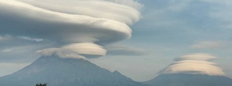
Image credit: Merapi Uncover
The alert level at Indonesia's Merapi has been raised from level 2 to 3 (on a scale of 1 – 4) on November 5, 2020, after a significant increase in seismicity. The volcanic-tectonic activity has remained elevated since powerful eruptions on June 21, when the volcano ejected ash up to 6 000 m (20 000 feet) above sea level.
After the explosive eruption of Merapi on June 21, there was a shortening of the base distance in the Northwest Babadan-RB1 sector by 4 cm (1.5 inches).
The distance shortening continued at a rate of about 3 mm (0.12 inches) per day until September.
The seismicity then intensified since October as the shortening rate reached 11 cm (4.3 inches) per day.
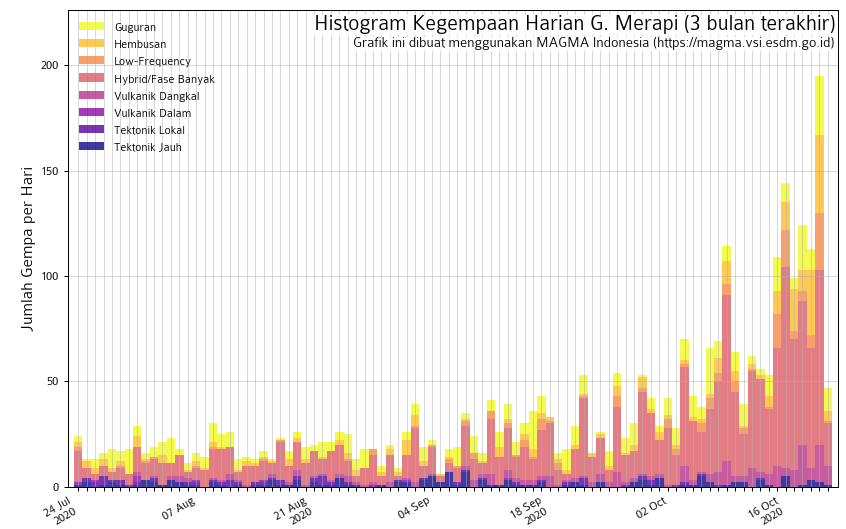
As of November 3, no new lava dome has been observed. However, under these conditions, a rapid extrusion of magma or an explosive eruption is possible.
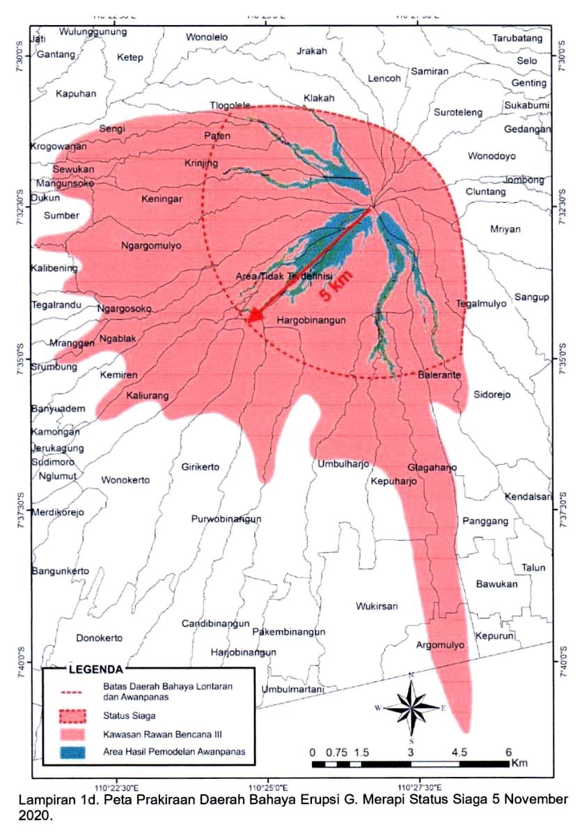
The warning bulletin stated that ballistic impacts and pyroclastic flows may affect an area of about 5 km (3 miles) from the main crater.
This prompted authorities to raise the alert level to 3, with 4 being the highest, as of November 5.
Miners were advised to stop activities in the river channels nearby. Tourists were also warned not to engage in activities, including climbing the mountain.
Merapi's last major eruption in 2010 claimed 347 lives and forced 20 000 people to evacuate.
Keindahan merapi yg penuh misteri.. pic.twitter.com/Gkoo3ykbLM
— Lucy (@Lucybexs1) November 5, 2020
lenticular clouds above Merapi & Merbabu
05-11-2020 05:27 pic.twitter.com/WzZk1kpne7— ꦨꦪꦸ ꦫꦃꦩꦮꦤ꧀ (@bayurhmwn) November 4, 2020
Gunung Lawu, Gunung Arjuna, Gunung Merapi.
Dear Earthling, please "Fasten Your Seat Belt"And..
Dear Aliens, be very gently, please
Thank you : just kidding pic.twitter.com/BRkfxZYxZW— Agung (@Jelantik5) November 5, 2020
Merapi cloud this morning pic.twitter.com/JOku9Zijjn
— dhs168 (@dhs168) November 5, 2020
Lawu, merapi, merbabu, pagi ini mereka janjian udah gak ada kata2 lagi #Al-khaliq pic.twitter.com/Y7qVTxPqqi |@DeepAss5
— IG: Merapi Uncover (@merapi_uncover) November 5, 2020
Geological summary
Merapi, one of Indonesia's most active volcanoes, lies in one of the world's most densely populated areas and dominates the landscape immediately north of the major city of Yogyakarta. It is the youngest and southernmost of a volcanic chain extending NNW to the Ungaran volcano.
Growth of Old Merapi during the Pleistocene ended with major edifice collapse perhaps about 2 000 years ago, leaving a large arcuate scarp cutting the eroded older Batulawang volcano.
Subsequently, the growth of the steep-sided Young Merapi edifice, its upper part unvegetated due to frequent eruptive activity, began SW of the earlier collapse scarp.
Pyroclastic flows and lahars accompanying growth and collapse of the steep-sided active summit lava dome have devastated cultivated lands on the western-to-southern flanks and caused many fatalities during historical time. (GVP)
Commenting rules and guidelines
We value the thoughts and opinions of our readers and welcome healthy discussions on our website. In order to maintain a respectful and positive community, we ask that all commenters follow these rules.