Rare October ice storm hits Oklahoma, leaving more than 300 000 customers without power
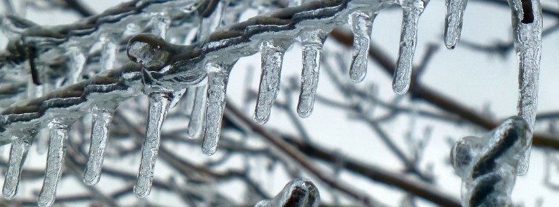
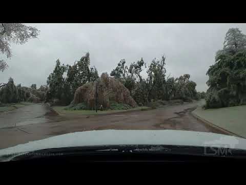
A rare October ice storm hit Oklahoma on Tuesday, October 27, 2020, causing traffic chaos and leaving more than 300 000 customers without power. A state of emergency was declared for 47 counties. NWS offices in Norman and Tulsa have issued their first-ever ice storm warnings in October.
911 was flooded with calls on Tuesday as a potent winter storm — named Billy by The Weather Channel — coated trees with as much as 13 mm (0.5 inches) of ice, resulting in downed trees and powerlines, and disrupted traffic. Some locations in Oklahoma and Texas could see as much as 25 mm (1 inch) of total ice accretion before this event is over.
As of 21:00 UTC, 309 000 customers across the state are still without power. More than half of them are in the Oklahoma City metropolitan area, where schools were closed today.
The storm brought snow, ice and freezing temperatures from Montana to New Mexico over the past couple of days. It came on the heels of another early-season winter storm which hit parts of the northern U.S. last week, breaking scores of snowfall records in Montana, Iowa, and Minnesota.
Areas of snow, sleet, and freezing rain will continue over the next couple of days from the southern Rockies into the southern High Plains, with significant icing from northern Texas to central and western Oklahoma, NWS forecasters noted.





"A rather volatile weather pattern is in store from the southern Rockies to the Deep South and Mid-Atlantic states during the next couple of days as a major winter storm interacts with Hurricane 'Zeta' — the 28th tropical cyclone in this extremely active hurricane season — which is forecast to make landfall on the central Gulf Coast late on Wednesday," NWS forecasters Snell and Kong noted.
The energetic cold upper low that is responsible for the recent widespread snowfall down the Rockies will deliver more snow from the southern Rockies into the High Plains through Wednesday.
An additional 75 to 150 mm (3 to 6 inches) of snow can be expected over the southern High Plains, including Northwest New Mexico to the Texas Panhandle, with lesser amounts in the southern Rockies. Meanwhile, as the low lifts milder air northward from the western Gulf of Mexico, a swath of freezing rain and mixed precipitation is forecast to continue into early Wednesday morning from northern Texas to western/central Oklahoma.
Hazardous ice accumulations are expected for west-central Texas and southern Kansas.
By Wednesday morning, the once frigid air-mass will moderate as warmer southerly flow should lead to a changeover from ice to rain throughout much of the central and southern Plains, but some lingering snow and ice are possible in eastern New Mexico, southeast Colorado, and both the Texas and Oklahoma panhandles.
The cold upper low will also play a large role in steering Hurricane "Zeta" northward across the Gulf of Mexico toward the central Gulf Coast. The eastern Louisiana coast appears to be the most likely location where Zeta will make landfall late on Wednesday.
Featured image: F Delventhal

Commenting rules and guidelines
We value the thoughts and opinions of our readers and welcome healthy discussions on our website. In order to maintain a respectful and positive community, we ask that all commenters follow these rules.