
Increase in frequency of severe cyclones over the North Indian Ocean
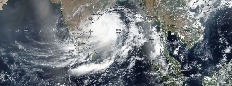
Featured image: Extremely Severe Cyclonic Storm Fani on May 2, 2019. Credit: NASA/NOAA, Suomi NPP/VIIRS
From 1981 to 2017, statistics show that an average of five cyclones developed over the North Indian Ocean per year. However, recent studies indicate that there has been an increase in the frequency of cyclone formation from 2017 to 2019. As a result, there was also a rise in incidences of flooding due to very heavy and extremely heavy rainfall in the last three years.
During the years 1891 to 2017, an average of five cyclones developed over the North Indian Ocean in a year– four over the Bay of Bengal and one over the Arabian Sea.
However, recent observations by the India Meteorological Department (IMD) and studies show that there has been an increase in frequency in the formation of severe cyclones from the years 2017 to 2019.
In 2017, a total of three cyclones– two over the Bay of Bengal and one over the Arabian Sea– was recorded. In 2018, the total number of cyclones increased to seven– four over the Bay of Bengal and three over the Arabian Sea. In 2019, the figure further rose to eight– three over the Bay of Bengal and five over the Arabian Sea.
The data indicates that 2019 witnessed the development of more intense cyclones over the Arabian Sea. With the occurrence of five cyclones during that year, 2019 also ties with the record of 1902 for the highest yearly cyclone frequency over the region.
Intense to very intense rainfall activity increased as well in the last three years, resulting in more flood events.
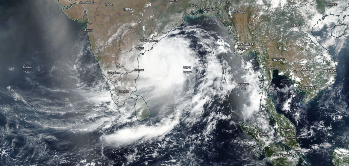
Extremely Severe Cyclonic Storm Fani on May 2, 2019. Image credit: NASA/NOAA, Suomi NPP/VIIRS
In 2017, there were 1 824 stations that recorded very heavy rainfall between 115.6 to 204.4 mm (4.5 to 8 inches) during the Monsoon season (June to September). 261 stations recorded extremely heavy rainfall between 204.5 mm (8 inches) or more.
The numbers increased in 2018 as 2 181 and 321 stations registered very heavy rainfall and extremely heavy rainfall events, respectively. It further rose last year, 2019, as 3 056 reported very heavy rainfall events while 554 reported extremely heavy rainfall events.
The data indicates that there is a steady increase in the frequency of heavy rainfall events during the past three years.
The IMD uses quality observations from radars, satellites, as well as conventional and automatic weather stations for monitoring cyclones and forecasting weather.
This includes INSAT 3D, 3DR and SCATSAT satellites, Doppler Weather Radars (DWRs) along the coast and Automated Weather Stations (AWS), Automatic Rain Gauges (ARGs), and meteorological buoys and ships.
The operational implementation of an improved suite of forecasting models upgraded the weather prediction capability through the assimilation of all available satellite radiance worldwide and radar data for the production of forecast products over national, regional, and megacity domains.
Could the changing radio-atmospheric conditions possibly be affecting the weather? Microwaves reflect off of water and the ionosphere and 5G consists of massive amount of microwave energy being pumped into the atmosphere. Microwaves reflect off of water, thus creating thermal energy. Could the increased usage of radar, and cell phone telecommunications advances over the last century be the real cause of global warming? That would explain the confusion, in that the problem is not fossil fuels. The telecommunications industry is becoming larger than the oil industry at this point. They wouldn’t want the world to know that their technology is microwaving the planet. They own all the media outlets. So they can blame gasoline and hide their radio-pollution.
Tell me why this is a good or bad theory. I have no idea, I am just asking the questions that nobody seems to want to ask.
Hi Andre, what is the reason for the magnetic pole moving about ?
2017/2019, the magnetic north pole crossed the antimeridian
and in 2020/2021 → 2024 it will be the LOMONOSOV ridge with already tangible climate changes, regardless of the CO².
It is purely the earth’s magnetic field that has an influence on the consequences of the solar activity by the 3D path followed across the earth’s crust.