
Tropical Storm “Dolphin” nears Japan, very strong winds, heavy rain and rough seas expected
Featured image: Tropical Storm "Dolphin" at 07:00 UTC on September 23, 2020. Credit: NOAA/GOES-16, RAMMB/CIRA
Tropical Storm "Dolphin" formed well south of mainland Japan on September 22, 2020, as the 12th named storm of the 2020 Pacific typhoon season.
According to the Japan Meteorological Agency (JMA), Dolphin is expected to travel close to the areas from eastern through northeastern Japan on September 24 and 25, bringing strong winds, heavy rain, and rough surf.
- Very strong winds are expected on the Pacific side of the country.
- Heavy rainfall is expected, with up to 200 mm (7.8 inches) in the Tokai region and Izu Islands.
- JMA is urging residents to be on their guard against flooding, rough seas, landslides, thunderstorms, tornadoes, and hailstorms.
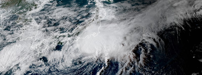
At 06:00 UTC on September 23, the center of Severe Tropical Storm "Dolphin" was located about 400 km (250 miles) S of Tokyo, Japan.
According to the JMA, the storm had maximum sustained winds near the center of 100 km/h (60 mph) and gusts to 150 km/h (90 mph). It was moving NE at 20 km/h (12 mph) with a minimum central pressure of 980 hPa.
"The hybrid (subtropical) system is embedded within the subtropical westerlies but has maintained a strong poleward outflow channel and warm sea surface temperatures to offset the strong vertical wind shear," JTWC forecasters noted at 09:00 UTC on September 23.
"Therefore, the system's convective structure has strengthened over the past six hours and now appears to be more tropical in nature."
Dolphin is expected to start weakening on September 24 as it moves near the coast and dissipate on September 25.
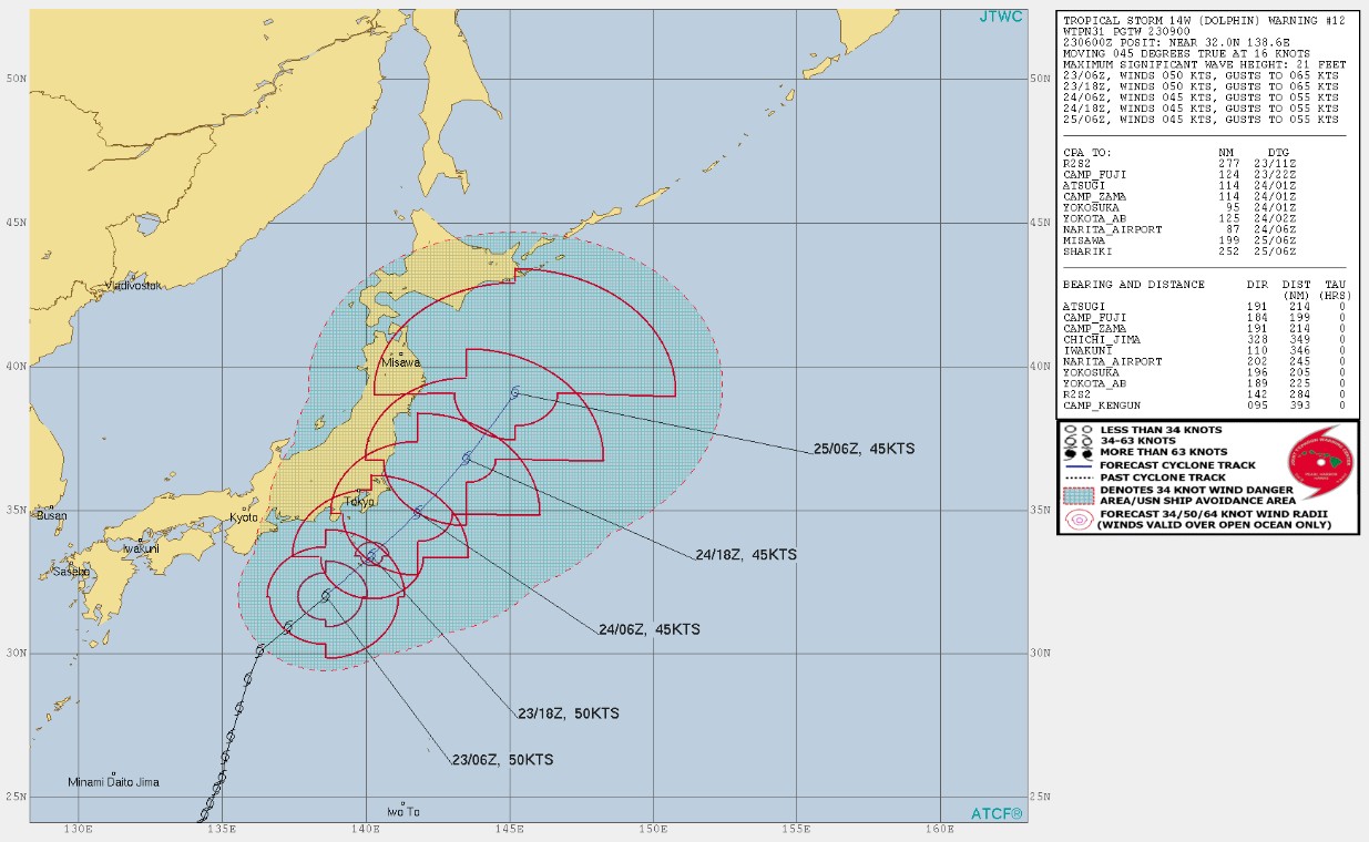
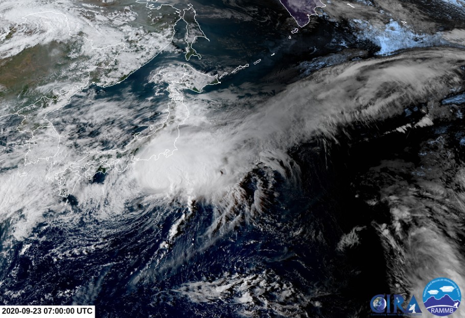
Image credit: NOAA/GOES-16, RAMMB/CIRA
JMA expects winds up to 90 km/h (56 mph) affecting the Izu Islands south of Tokyo and the Kanto region of eastern Japan through September 24. Winds up to 72 km/h (45 mph) are expected in Tohoku, Tokai and Kinki regions.
Maximum wind gusts of 126 km/h (80 mph) are forecast to affect Izu Islands and Kanto region, and 108 km/h (67 mph) in Tohoku and Kinki regions.
In 24 hours to 06:00 LT on September 24 (00:00 UTC on September 24), Dolphin could bring up to 200 mm (7.8 inches) of rain to the Tokai region and Izu Islands, 150 mm (5.9 inches) to the Kanto-Koshin region, and 80 mm (3.1 inches) to the Tohoku region.
I'm a dedicated researcher, journalist, and editor at The Watchers. With over 20 years of experience in the media industry, I specialize in hard science news, focusing on extreme weather, seismic and volcanic activity, space weather, and astronomy, including near-Earth objects and planetary defense strategies. You can reach me at teo /at/ watchers.news.
Commenting rules and guidelines
We value the thoughts and opinions of our readers and welcome healthy discussions on our website. In order to maintain a respectful and positive community, we ask that all commenters follow these rules.