
Tropical Storm “Beta” makes landfall, expected to stall inland over Texas
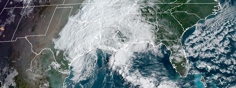
Featured image: Tropical Storm "Beta" at 13:50 UTC on September 22, 2020. Credit: NOAA/GOES-16, RAMMB/CIRA
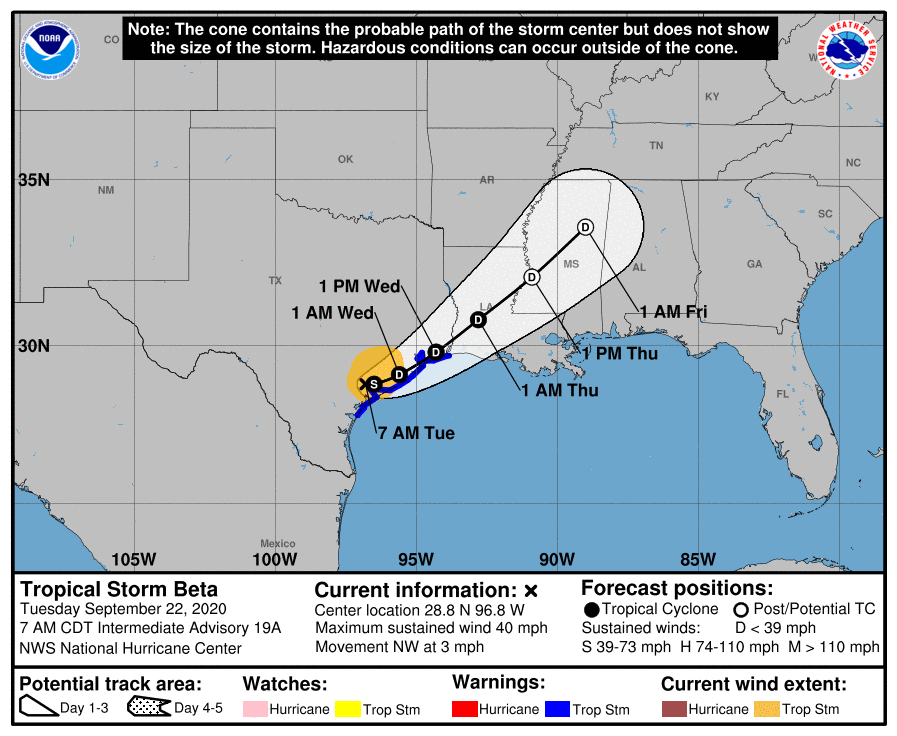
Tropical Storm "Beta" made landfall near the southern end of Matagorda Peninsula, Texas — about 10 km (6 miles) N of Port O'Connor — at 04:00 UTC on September 22, 2020, with maximum sustained winds of 75 km/h (45 mph) and minimum central pressure of 999 hPa.
- Beta is the 9th named storm to make landfall in the continental U.S. (CONUS) this year. This tied 2020 with the 1916 Atlantic hurricane season for the most named storm to make CONUS landfall in an Atlantic hurricane season on record.
- Significant flash and urban flooding is occurring and will continue for the middle and upper Texas coast today. The slow motion of Beta will continue to produce a long duration rainfall event from the middle Texas coast to southern Louisiana.
A Storm Surge Warning is still in effect for Sargent, Texas to Sabine Pass including Galveston Bay. A Tropical Storm Warning is in effect for Port Aransas, Texas to Sabine Pass.
At 12:00 UTC on September 22, Beta's center was located about 15 km (10 miles) ESE of Victoria and 55 km (35 miles) W of Palacios, Texas. The storm was moving NW at 6 km/h (3 mph) with maximum sustained winds of 65 km/h (40 mph) and minimum central pressure of 999 hPa.
Significant flash and urban flooding is occurring and will continue for the middle and upper Texas coast today, NHC forecasters noted.
The slow motion of Beta will continue to produce a long duration rainfall event from the middle Texas coast to southern Louisiana. Flash, urban, and minor river flooding is likely.
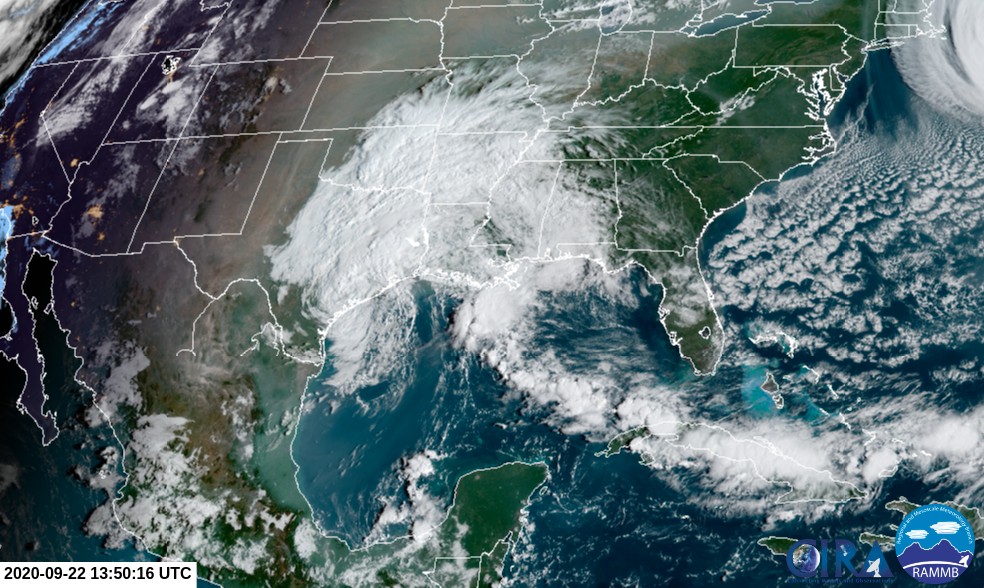
Tropical Storm "Beta" at 13:50 UTC on September 22, 2020. Credit: NOAA/GOES-16, RAMMB/CIRA
Periods of rainfall will continue into the ArkLaTex region and spread east into the Lower Mississippi Valley and portions of the Southeast through the end of the week. Flash, urban, and isolated minor river flooding is possible.
Storm surge flooding will continue throughout the morning, around the times of high tide along portions of the Texas coast within the storm surge warning areas.
Tropical-storm-force winds will continue near portions of the Texas coast within the warning area today.
"Beta is expected to stall inland over Texas today but will then begin to move slowly toward the east-northeast tonight," NHC forecaster Stewart noted.
"An east-northeast to northeast motion with increasing forward speed is expected Wednesday through Friday. On the forecast track, the center of Beta will move inland over southeastern Texas through Wednesday and then over Louisiana and Mississippi Wednesday night through Friday."
I'm a dedicated researcher, journalist, and editor at The Watchers. With over 20 years of experience in the media industry, I specialize in hard science news, focusing on extreme weather, seismic and volcanic activity, space weather, and astronomy, including near-Earth objects and planetary defense strategies. You can reach me at teo /at/ watchers.news.
Commenting rules and guidelines
We value the thoughts and opinions of our readers and welcome healthy discussions on our website. In order to maintain a respectful and positive community, we ask that all commenters follow these rules.