
Tropical Storm “Beta” forms in the Gulf of Mexico, heavy rainfall expected along northwest Gulf Coast
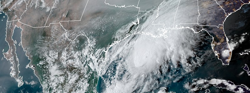
Featured image: Tropical Storm "Beta" at 22:40 UTC on September 19, 2020. Credit: NOAA/GOES-16, RAMMB/CIRA
Tropical Storm "Beta" formed in the Gulf of Mexico at 21:00 UTC on Friday, September 18, 2020. This is the 23rd named storm of the 2020 Atlantic hurricane season and the 10th so far this month — a record for September.
Storm Surge and Tropical Storm or Hurricane Watches will likely be required for portions of the western Gulf coast tonight or on Saturday, NHC forecasters said.
- The storm is currently moving NNE at 15 km/h (9 mph). However, a slow-motion toward the west is expected by Saturday night (LT), September 19, and into the next week.
- Heavy rainfall and flooding is expected along the northwest Gulf Coast starting Sunday, September 20, and lasting for several days as the storm tracks slowly toward and along or offshore of the coast.
- Beta could briefly strengthen into a hurricane as it approaches the western coast of the Gulf of Mexico late Sunday or Monday, September 21.
Beta's center was located about 545 km (335 miles) ENE of Tampico, Mexico, and 450 km (280 miles) ESE of the mouth of the Rio Grande at 21:00 UTC on September 18. The storm had maximum sustained winds of 65 km (40 mph) and a minimum central pressure of 1 004 hPa.
Swells are expected to increase and reach the coast of Texas and the Gulf Coast of Mexico over the weekend, generated by a combination of Beta and a cold front entering the northern Gulf of Mexico. These swells are likely to cause life-threatening surf and rip current conditions.
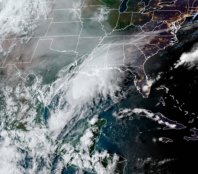
Tropical Storm "Beta" at 22:40 UTC on September 19, 2020. Credit: NOAA/GOES-16, RAMMB/CIRA
I'm a dedicated researcher, journalist, and editor at The Watchers. With over 20 years of experience in the media industry, I specialize in hard science news, focusing on extreme weather, seismic and volcanic activity, space weather, and astronomy, including near-Earth objects and planetary defense strategies. You can reach me at teo /at/ watchers.news.
we know the number of hurricanes will go up in 2020. Can the wind speed go up?. If the hurricane is in the Gulf of Mexico, can the wind reach 200mph ?