
Heavy snow blankets Saudi Arabian NW province of Tabuk, Lebanon and Syria
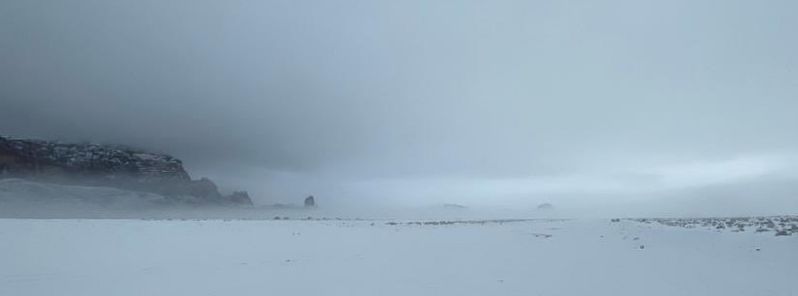
Image credit: Turki Al-Shalahi @wether_almhed
Residents of the Saudi Arabian northwestern province of Tabuk took to social media to share stunning scenes of heavy snow that started on Thursday night, January 9, 2020. During the same period, severe weather struck parts of the Middle East, with rain in the UAE, hailstorms in Alexandria, Egypt and rain and snowstorms in Lebanon and Syria.
"Can you imagine? This is not Russia, or Italy, or Norway," resident Shaher Bin Atiyah posted on Twitter, along with a video of massive layers of snow. Another resident named Abdul Majid Al-Sharif also shared footage of the snow. "How beautiful is this white color?" he posted.
Fahad Al Shamal shared a photo of two men camping next to a bonfire in the middle of a field covered in snow. "This is my village," his caption said.
The Emirate of Tabuk stated on Twitter its plans to provide aid in the areas hit by snow, as well as the civil defense directorate's emergency plan in case of emergency.
"With the follow-up of His Highness the Emir of the region of Tabuk, head of the main civil defense committee in the region, security authorities in the region are making all preparations to implement their plans and provide services in the regions where [the] snow [is falling] in the region."
تخيلوا معي
ليست روسيا ولا ايطاليا ولا النرويجانها الفاتنه محافظة #حقل pic.twitter.com/JPoVjvChYV
— شاهر بن عطيه (@alemranishaher) January 10, 2020
#تبوك_الان جمال اللون الأبيض pic.twitter.com/maod5cEYuE
— الشريف زياد (@Ziyad___sh) January 10, 2020
On March 31, 2019, the mountains of northwestern Saudi Arabia turned white after heavy spring snow. Clouds started to form early morning and by sunset, snow blanketed the entire area. According to Eid Al-Madhlaani, a climate researcher, it was highly unusual to see snow in late March.
Even residents were surprised to see the snow, including Nayef Al-Harby and Mohammad Al-Shammari, who said it was their first time to witness such snow in the region. "This is the first time we have seen the top of Jabal Al-Lawz blanketed in white, we’ve been waiting for this during the past days so we can come to enjoy the weather."
"#سبق" تواصل الرصد.. مشاهد جديدة لثلوج #تبوك.https://t.co/K6DIxLnKA1 pic.twitter.com/6Z3UtqYros
— صحيفة سبق الإلكترونية (@sabqorg) January 10, 2020
ماشاء الله ثلوج اليوم #تبوك_الان pic.twitter.com/32D3PE5Lig
— عبدالمجيد الشريف (@AlshariF_344) January 10, 2020
وهنا تتضح كثافة الهطول الثلجي في علقان عبر عضو فريق #عواصف_تبوك منصور الحربي pic.twitter.com/Rhxwy4uhf5
— فريق عواصف تبوك (@tabukstorms) January 10, 2020
شهدت مرتفعات #تبوك هطولًا للثلوج هذه الليلة#استمتع بالمشاهدة#فيديو_متداول pic.twitter.com/JGC3UDZj7a
— طقس العرب – السعودية (@ArabiaWeatherSA) January 10, 2020
شاهد
تساقط الثلوج على مرتفعات #الظهر شمال #تبوك
تصوير تركي الشلاحي pic.twitter.com/QDiiISIwdh
— ⛈ طقس مهدالذهب ⛈ (@wether_almhed) January 10, 2020
Meanwhile, on Thursday night, light to moderate rain across the UAE strengthened to heavy downpour, especially in western parts. Hail, thunder, and lightning were also reported in Abu Dhabi and Al Dhafra. Hailstorms were reported in Alexandria, Egypt and snowstorms in Lebanon and Syria.
Spectacular video of extremely deep snow (130 cm) in Kfardebian, Lebanon (at 1900 m ASL) today, Jan 10th. Thanks to Elias Kamal Saadeh, the admin of @lebanonweatherforecast – Lebanon Weather Forecast – LWF for the report! Video posted with permission. pic.twitter.com/tjRXxajsH6
— severe-weather.EU (@severeweatherEU) January 10, 2020
More deep snow impression from Lebanon yesterday, Jan 9th. Thanks to Anthony Bassil for the report – posted with permission. pic.twitter.com/9cZhVaHup4
— severe-weather.EU (@severeweatherEU) January 10, 2020
On Friday, the rain was lighter but winds reached 70 km/h (43 mph), particularly in coastal areas were waves roared up to 3 m (9 feet).
According to an NCM official, since January 9, "cold air is descending towards the UAE from the western region and the Red Sea. Right now both the upper air and surface have low pressure. And, when the cold air mass reaches the UAE and there is low pressure, it helps to generate clouds."
Furthermore, rain– with a chance of thunder and lightning– is expected to continue especially over northern and eastern coastal areas on Saturday, January 11.
On Sunday, January 12, partly cloudy conditions with some rain over northern and eastern coastal areas are likely. Freezing rain and some snow are also expected on mountaintops. Wind speeds will reach 55 km/h (34 mph), and rough seas are forecast particularly in the Arabian Gulf.
Jings! looks like there’s been so much snow and so cold – bright sunshine yet the trees are still coated – must be so cold. But what a great job of snow clearance! Puts the UK & Europe to shame. Thanks for posting this report