
Steam explosion at Great Sitkin volcano, alerts raised, Alaska
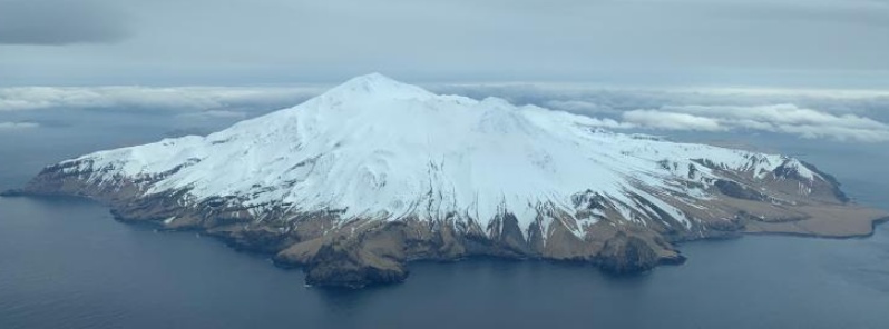
Featured image: Great Sitkin on April 27, 2019. Image credit: USGS/AVO, Dave Clum
A small steam explosion at 05:40 UTC on June 2, 2019 (21:40 AKDT June 1) was detected at Great Sitkin volcano in local seismic data, the Alaska Volcano Observatory reports.
No corresponding signal was seen in regional infrasound data or cloudy satellite observations. Low-level seismic activity was elevated just before and after the event. In response to this activity, AVO is raising the Aviation Color Code YELLOW and Alert Level to ADVISORY.
Great Sitkin is monitored with a local real-time seismic network, which will typically allow AVO to detect changes in unrest that may lead to an explosive eruption. Rapid detection of an ash-producing eruption would be accomplished using a combination of seismic, infrasound, lightning, and satellite data.
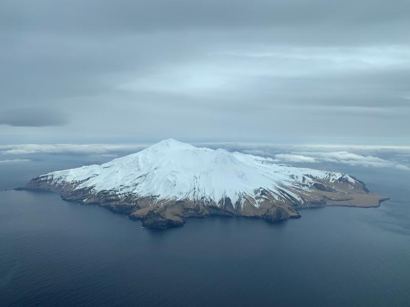
Great Sitkin on April 27, 2019. Image credit: USGS/AVO, Dave Clum
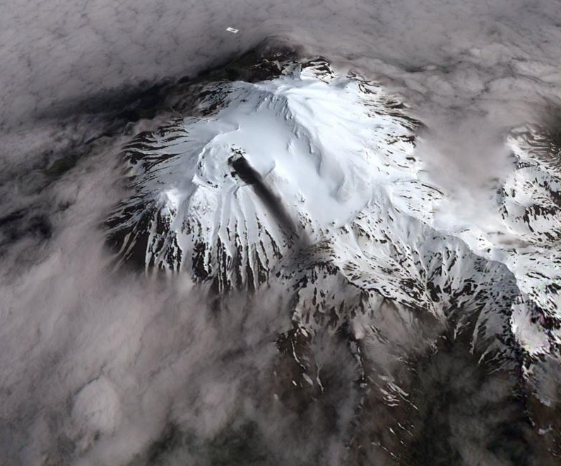
Sentinel-2 satellite image of Great Sitkin acquired on June 11, 2018 at 23:00 UTC showing an ash deposit extending for about 2 km to the southwest. Ash was likely deposited during the brief explosion on June 10, 2018. Minor steaming from a vent through the 1974 lava flow is also visible in this image. View is from the southwest. Image credit: ESA Sentinel-2; Schneider, David
Great Sitkin volcano is monitored by a five-station seismic network on Great Sitkin Island and with additional seismic stations on the nearby islands of Igitkin, Adak, Kagalaska, and Kanaga. A six-element infrasound array to detect explosions (atmospheric pressure waves) was installed on Adak Island in June 2017.
This volcano forms much of the northern side of Great Sitkin Island. A younger parasitic volcano capped by a small, 0.8 x 1.2 km (0.5 – 0.7 miles) ice-filled summit caldera was constructed within a large late-Pleistocene or early Holocene scarp formed by massive edifice failure that truncated an ancestral volcano and produced a submarine debris avalanche. Deposits from this and an older debris avalanche from a source to the south cover a broad area of the ocean floor north of the volcano. The summit lies along the eastern rim of the younger collapse scarp.
Deposits from an earlier caldera-forming eruption of unknown age cover the flanks of the island to a depth up to 6 m (20 feet). The small younger caldera was partially filled by lava domes emplaced in 1945 and 1974, and five small older flank lava domes, two of which lie on the coastline, were constructed along the northwest- and NNW-trending lines.
Hot springs, mud pots, and fumaroles occur near the head of Big Fox Creek, south of the volcano.
Historical eruptions have been recorded since the late-19th century.
I'm a dedicated researcher, journalist, and editor at The Watchers. With over 20 years of experience in the media industry, I specialize in hard science news, focusing on extreme weather, seismic and volcanic activity, space weather, and astronomy, including near-Earth objects and planetary defense strategies. You can reach me at teo /at/ watchers.news.
Commenting rules and guidelines
We value the thoughts and opinions of our readers and welcome healthy discussions on our website. In order to maintain a respectful and positive community, we ask that all commenters follow these rules.