
Eruption at Agung volcano, Bali, Aviation Color Code raised to Orange
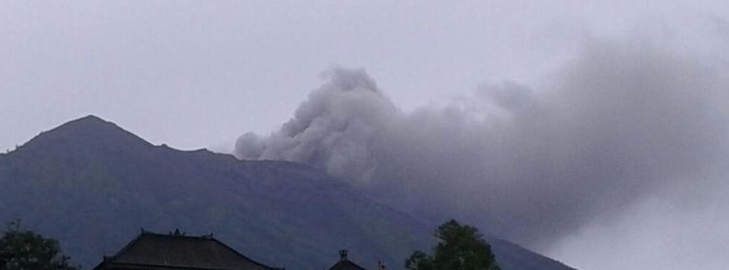
Featured image: The eruption of Agung volcano around 09:00 UTC on November 21, 2017. Credit: BNPB
A small-scale phreatic eruption started at Agung volcano, Bali at 09:05 UTC (17:05 WITA) on November 21, 2017, forcing authorities to raise the Aviation Color Code from Yellow to Orange.
The best estimate of the ash-cloud top is around 3 842 m (12 294 feet) above sea level. This is about 840 m (2 778 feet) above the crater. "Ash cloud is drifting to the southeast and may be higher than what can be clearly seen by ground observations. Eruption and ash emission continues," CVGHM said 09:39 UTC.
Gunung Agung meletus mengeluarkan asap dan abu kelabu tebal dengan tekanan sedang pada 21/11/2017 pukul 17:05 WITA. Tinggi letusan maksimum 700 meter dari puncak kawah. Status Siaga (level 3). Radius 6-7,5 km dilarang ada aktivitas masyarakat. Masyarakat dihimbau tenang. pic.twitter.com/bw63qSbh2y
— Sutopo Purwo Nugroho (@Sutopo_BNPB) November 21, 2017
— Ali (@Ali_Di_Bali) November 21, 2017
Sutopo Purwo Nugroho, the spokesman of the national disaster agency, reminded residents not to enter the exclusion zone of 6 – 7.5 km (3.7 – 4.6 miles) around the crater and to stay calm.
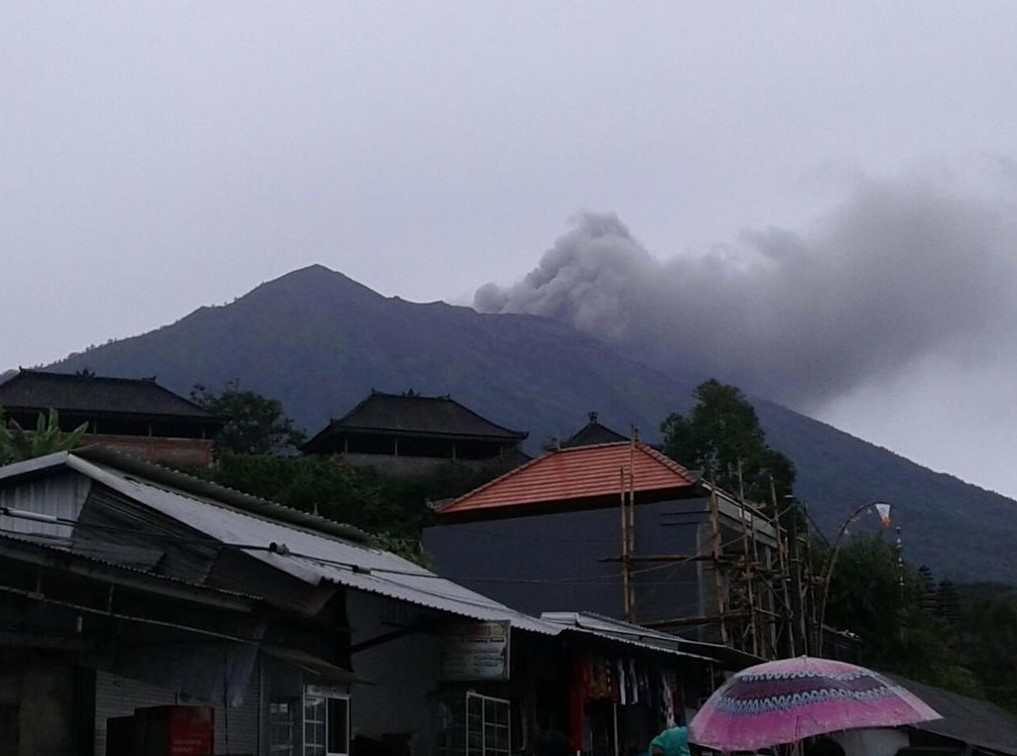
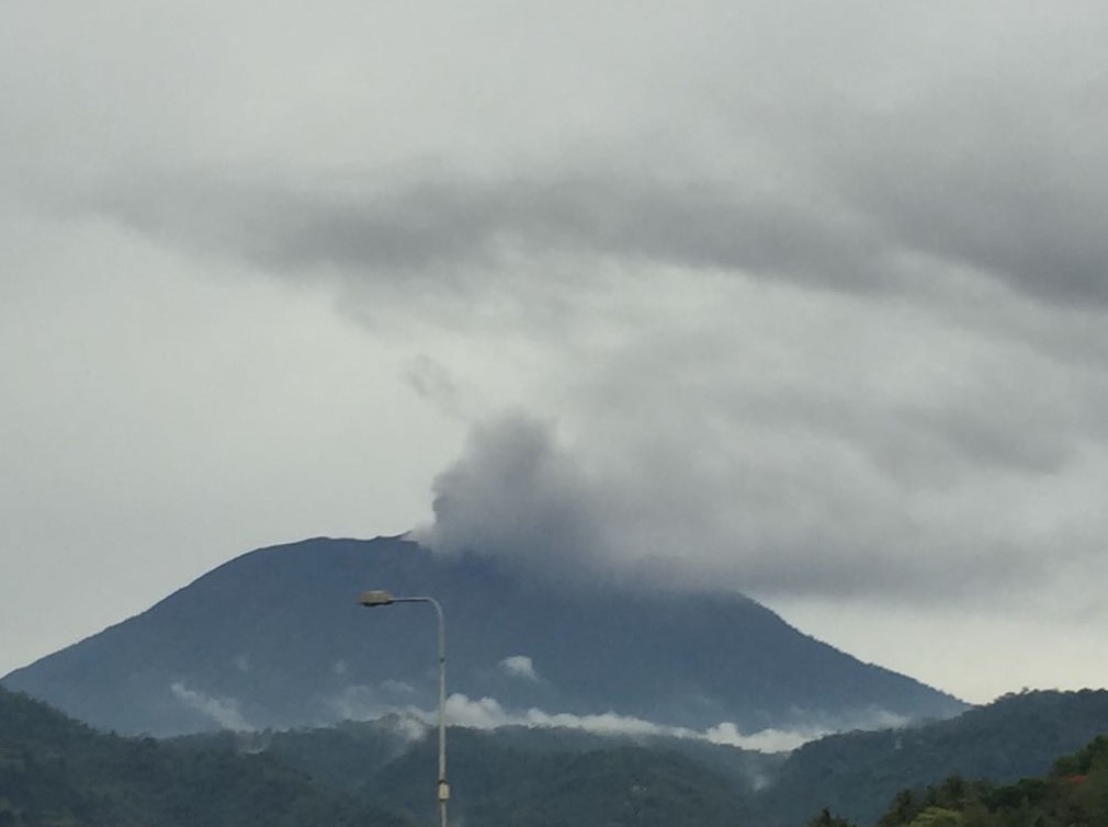
The eruption of Agung volcano around 09:00 UTC on November 21, 2017. Credit: BNPB
The eruption of Agung volcano around 09:00 UTC on November 21, 2017. Credit: BNPB
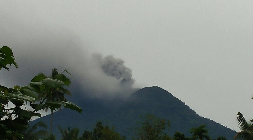
The eruption of Agung volcano around 09:00 UTC on November 21, 2017. Credit: Sutopo Purwo Nugroho, BNPB
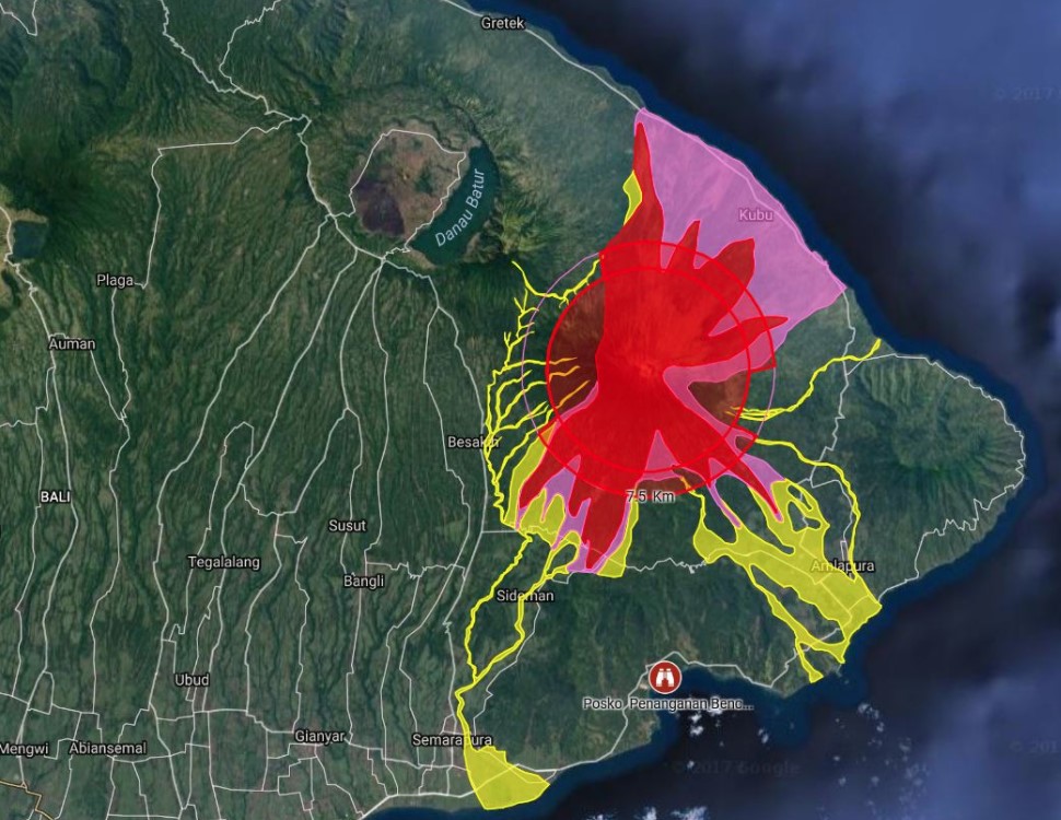
Agung volcano hazard zones
Seismicity under the volcano is still declining:
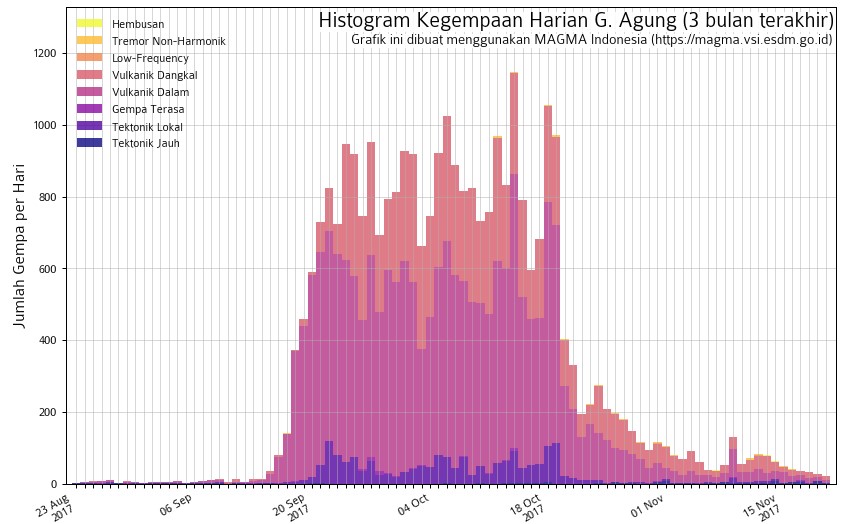
Agung volcano seismicity from August 23 to November 21, 2017
"Agung is not spewing and people are not panicked. At this time the eruption is small and everyone should be encouraged to stay calm, be alert, and watch official information sources," volcanologist Janine Krippner said. Janine is closely monitoring Agung and reporting since the crisis started.
Geological summary
Symmetrical Agung stratovolcano, Bali's highest and most sacred mountain, towers over the eastern end of the island. The volcano, whose name means " Paramount," rises above the SE caldera rim of neighboring Batur volcano, and the northern and southern flanks of Agung extend to the coast.
The 3142-m-high (10 308 feet) summit contains a steep-walled, 500-m-wide (1 640 feet), 200-m-deep (656 feet) crater. The flank cone Pawon is located low on the SE side.
Only a few eruptions dating back to the early 19th century have been recorded in historical time. The 1963-64 eruption, one of the world's largest of the 20th century, produced voluminous ashfall along with devastating pyroclastic flows and lahars that caused extensive damage and many fatalities.
I'm a dedicated researcher, journalist, and editor at The Watchers. With over 20 years of experience in the media industry, I specialize in hard science news, focusing on extreme weather, seismic and volcanic activity, space weather, and astronomy, including near-Earth objects and planetary defense strategies. You can reach me at teo /at/ watchers.news.
Commenting rules and guidelines
We value the thoughts and opinions of our readers and welcome healthy discussions on our website. In order to maintain a respectful and positive community, we ask that all commenters follow these rules.