
Strong and shallow M6.5 earthquake hits Java Sea, Indonesia
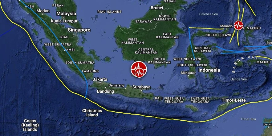
Image credit: TW/SAM, Google
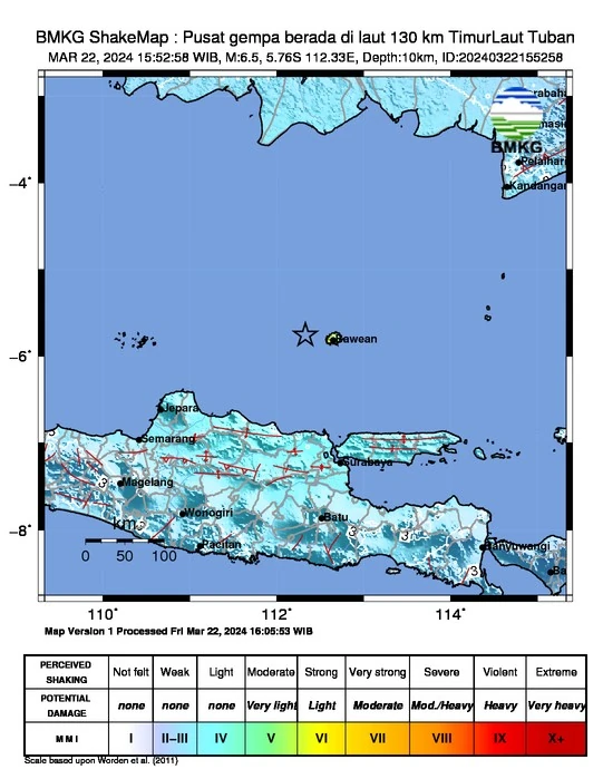
A strong and shallow earthquake registered by the BMKG as M6.5 hit Java Sea, Indonesia at 08:52 UTC (15:52 LT) on March 22, 024. The agency is reporting a depth of 10 km (6.2 miles). USGS and EMSC are reporting M6.4 at a depth of 8.5 km (4.3 miles).
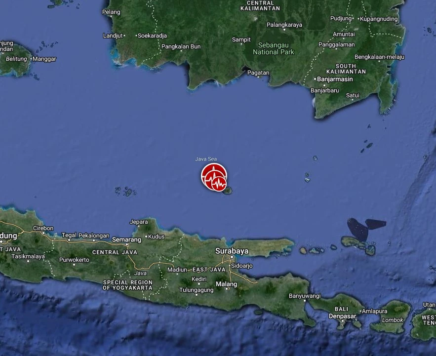
The epicenter was located 112.4 km (69.9 miles) N of Paciran (population 27 072), 137.5 km (85.5 miles) NNW of Bangkalan (population 86 250), and 159.8 km (99.3 miles) NNW of Surabaya (population 2 874 314), East Java, Indonesia.
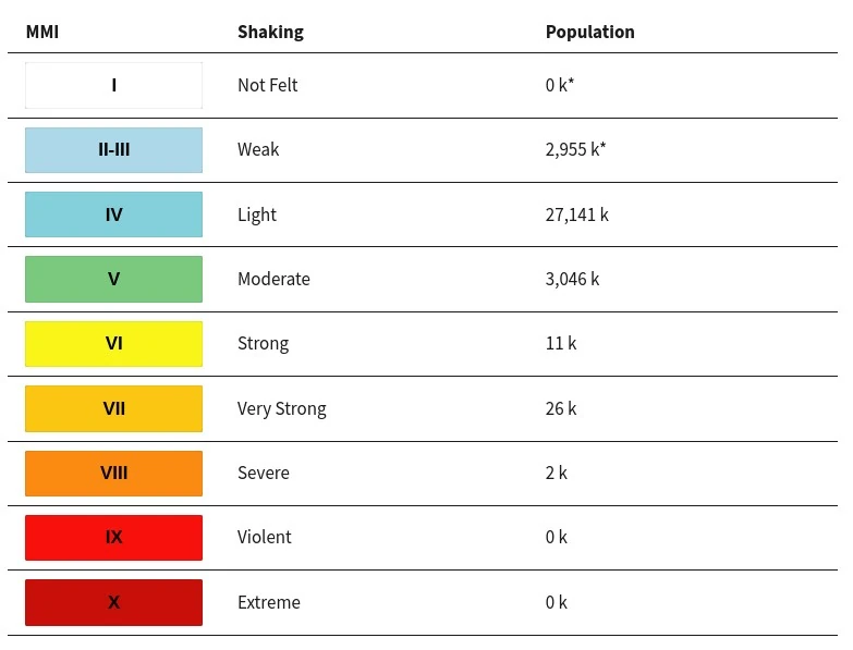
2 000 people are estimated to have felt severe shaking, 26 000 very strong, 11 000 strong and 3 046 000 moderate.
There is no tsunami threat from this earthquake.
The USGS issued a Yellow alert for shaking-related fatalities and economic losses. Some casualties and damage are possible and the impact should be relatively localized. Past yellow alerts have required a local or regional-level response.
Estimated economic losses are less than 1% of GDP of Indonesia.
Overall, the population in this region resides in structures that are vulnerable to earthquake shaking, though resistant structures exist. The predominant vulnerable building types are unreinforced brick with concrete floor and precast concrete frame with wall construction.
“Taking into account the location of the epicenter and the depth of the hypocenter, the earthquake that occurred was a shallow type of earthquake due to active fault activity in the Java Sea,” said Dr. Daryono, the Head of the BMKG Earthquake and Tsunami Center. “The results of the source mechanism analysis show that the earthquake has a strike-slip movement mechanism.”
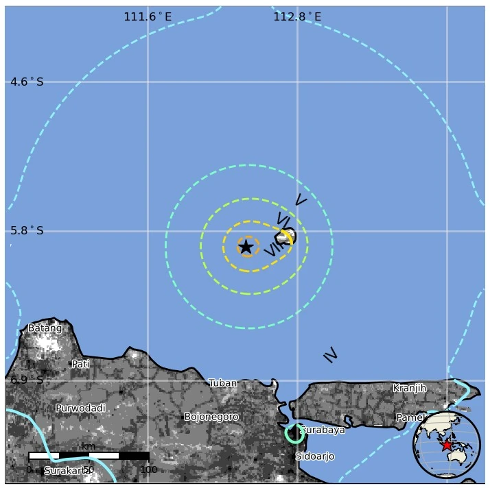
This earthquake had an impact and was felt on Bawean Island with an intensity of V-VI MMI (Vibrations were felt by almost all residents, goods/displays were thrown, light damage occurred), Blora, Madura, Gresik, Surabaya, Kab. Banjar with intensity scale III-IV MMI (If it is felt by many people in the house during the day), Mojokerto, Banjar Baru, Sampit, Banjarmasi, Martapura, Balikpapan, Tanah Grogot, Malang, Lumajang, Madiun, Nganjuk, Pasuruan, Jepara, Rembang, Demak, Kudus, Semarang with an intensity scale of II-III MMI (Vibrations felt real in the house. Vibrations were felt as if a truck was passing by), and the areas of Yogyakarta, Kulon Progo, Kebumen, Temanggung, Blitar and Solo with an intensity scale of II MMI (Vibrations felt by some people, light objects hanging swaying).
Based on reports from the community, this earthquake caused damage on Bawean Island, Daryono noted.
This earthquake is part of a series of M6.0 Java Sea earthquakes which occurred at 04:22 UTC (11:22 WIB). As of 09:15 UTC (16.15 WIB), BMKG monitoring results showed that there were 22 earthquakes in the series.
BMKG is advising the public to remain calm and not be influenced by issues whose truth cannot be justified. Residents living in the affected region are urged to avoid buildings that are cracked or damaged due to the earthquake, and check and ensure that the buildings where they live are sufficiently earthquake-resistant, or that there is no damage due to earthquake vibrations that endangers the stability of the building before they return to the house.
Estimated population exposure to earthquake shaking
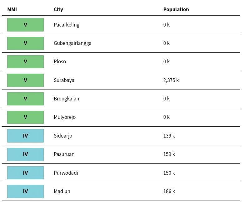
Selected cities exposed
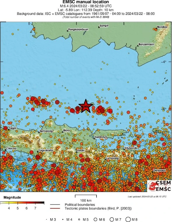
Regional seismicity
I'm a dedicated researcher, journalist, and editor at The Watchers. With over 20 years of experience in the media industry, I specialize in hard science news, focusing on extreme weather, seismic and volcanic activity, space weather, and astronomy, including near-Earth objects and planetary defense strategies. You can reach me at teo /at/ watchers.news.
Commenting rules and guidelines
We value the thoughts and opinions of our readers and welcome healthy discussions on our website. In order to maintain a respectful and positive community, we ask that all commenters follow these rules.