
Typhoon “Talim” closing in on Kyushu, after dumping record-breaking rain on Okinawa
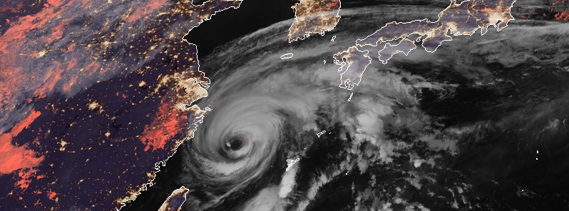
Featured image: Typhoon "Talim" at 17:40 UTC on September 14, 2017. Credit: JMA/Himawari-8 (CIRA)
After ripping through the Okinawa island chain, Japan and passing close to China, forcing the evacuation of more than 200 000 people, Typhoon "Talim" is now on its way toward mainland Japan. It is expected to be a Category 1 hurricane equivalent when it makes landfall over Kyushu, Japan on September 17.
Talim lashed southern Okinawan island chain on Wednesday, September 13, packing gusts of up to 252 km/h (156 mph), uprooting trees and knocking down power lines. More than 18 000 people were without power in the city of Miyako, home to around 54 000 people.
The Miyako-Jima Island airport measured a record-breaking 479.04 mm (18.86 inches) of rain over the 24-hour period on Wednesday. This is the most rain the island has seen in 40 years, since 1977 when reliable records began. Over a 48-hour period, the same station recorded 515.62 mm (20.30 inches), which is also a record.
At 15:00 UTC on September 15, the center of Typhoon "Talim" was located about 600 km (373 miles) SSW of Kagoshima, Kyushu. Its maximum sustained winds were 139 km/h (86 mph), making it a Category 1 hurricane equivalent on the Saffir-Simpson Hurricane Wind Scale. The typhoon is moving northeastward at a speed of 9 km/h (5.7 mph)
Due to its quasi-stationary motion over the last 24 hours, ocean upwelling has brought cooler waters to the surface leading to a weakening trend, JTWC notes.
However, the weakening trend appears to have stabilized as Talim is now accelerating east-northeastward around a deep-layered subtropical ridge to the southwest.
Talim is forecast to continue to track east-northeastward until it makes landfall. Sea surface temperatures in the region are expected to improve as the system moves away from the area of upwelled water.
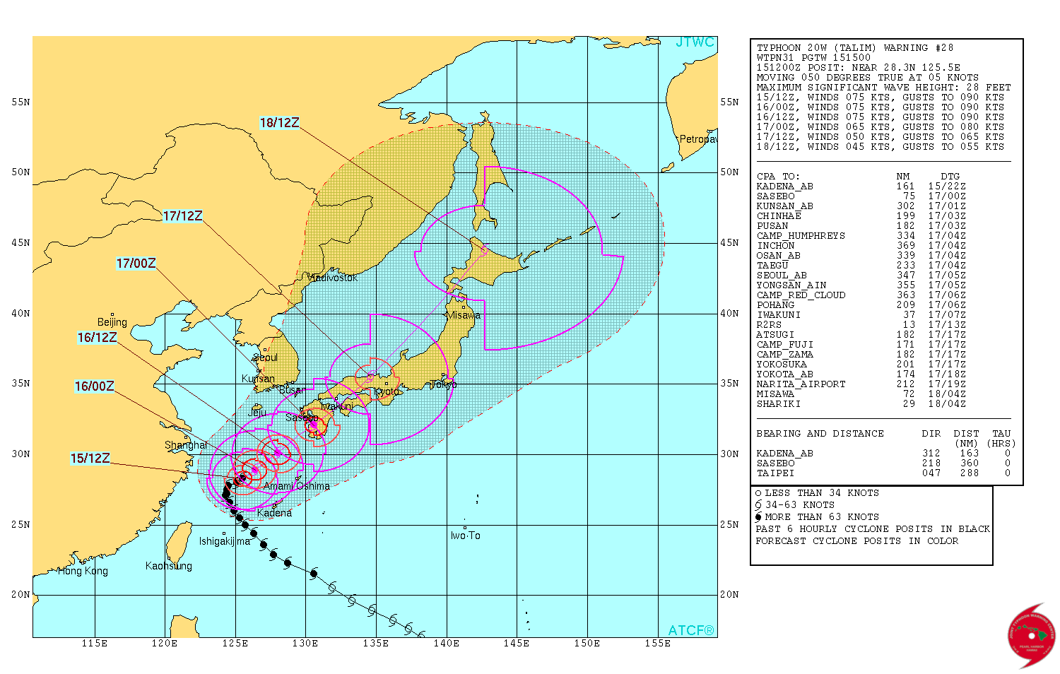
The system is expected to remain steady around 139 km/h (86 mph) over the next 36 hours as it makes landfall southeast of Sasebo, Japan around midnight UTC on September 17.
Talim will then quickly move over Shikoku and western Honshu and transition into a significant extratropical low by 15:00 UTC on September 18.
I'm a dedicated researcher, journalist, and editor at The Watchers. With over 20 years of experience in the media industry, I specialize in hard science news, focusing on extreme weather, seismic and volcanic activity, space weather, and astronomy, including near-Earth objects and planetary defense strategies. You can reach me at teo /at/ watchers.news.
Commenting rules and guidelines
We value the thoughts and opinions of our readers and welcome healthy discussions on our website. In order to maintain a respectful and positive community, we ask that all commenters follow these rules.