
Typhoon “Noru” strengthening south of Kyushu, landfall expected August 6
Featured image: Typhoon "Noru" at 11:30 UTC on August 4, 2017. Credit: UW-CIMSS
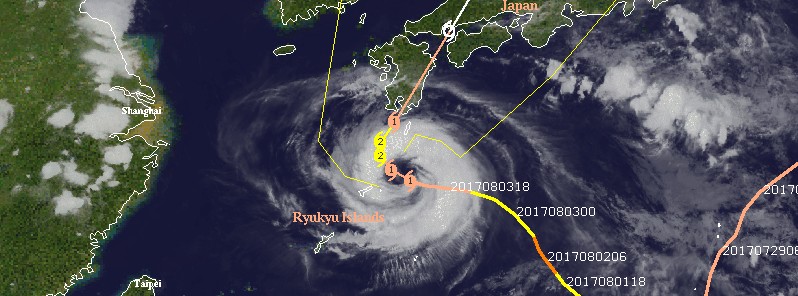
Noru, once a super typhoon, the first of the year, is slowly moving closer to the Japanese mainland and is expected to hit the southwestern coast Kyushu around 15:00 UTC on August 6, 2017. Noru is forecast to intensify to 167 km/h (103 mph) over the next 36 hours and then weaken again to Category 1 hurricane equivalent before making landfall. Warnings and Advisories for heavy rain, strong winds, high waves and thunderstorms are currently in effect for the Amami islands and southern Kyushu.
Typhoon "Noru" is bringing yet another round of heavy rain to areas devastated by floods at the beginning of July when the region was hit by unprecedented rain. Northern parts of Kyushu might, however, be spared the worst of the storm.
Noru is an extremely slow-moving storm, JMA said, noting this means there is a higher danger of floods due to extended heavy rains in one area. The Amami island chain will be hit by high winds and heavy rains from local noon Friday, August 4, with as much as 800 mm (31 inches) over the next 48 hours. Depending on how its course changes, Noru could also rake straight across Kyushu and then along Japan's main island of Honshu, but longer-term movements are still hard to pin down, JMA added.
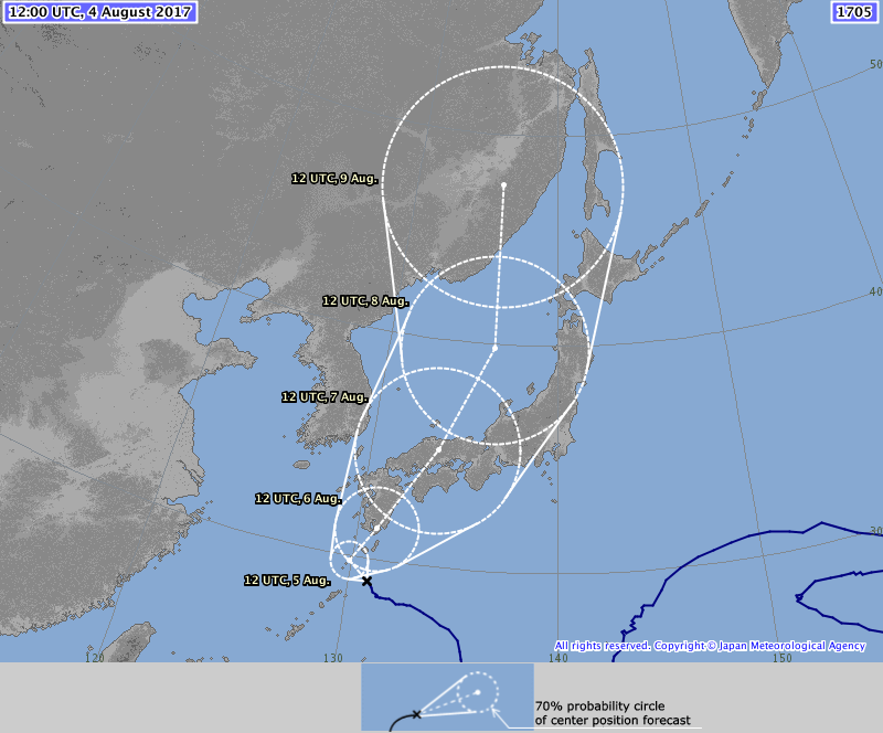
Typhoon "Noru" forecast track by JMA at 12:00 UTC on August 4, 2017
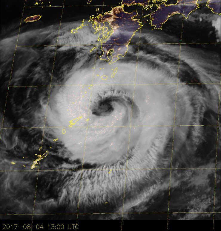
Typhoon "Noru" at 13:00 UTC on August 4, 2017. Credit: JMA/Himawari-8
At 12:45 UTC on August 4, the cyclone was located 125 km (78 miles) SSE of Toshima, Nakono-Shima and 280 km (174 miles) S of Kagoshima, Kagoshima Prefecture, according to the JMA. Noru is moving NW at an extremely slow pace with minimum central pressure of 960 hPa. Noru's maximum wind speed is 139 km/h (86 mph), as per JMA and JTWC.
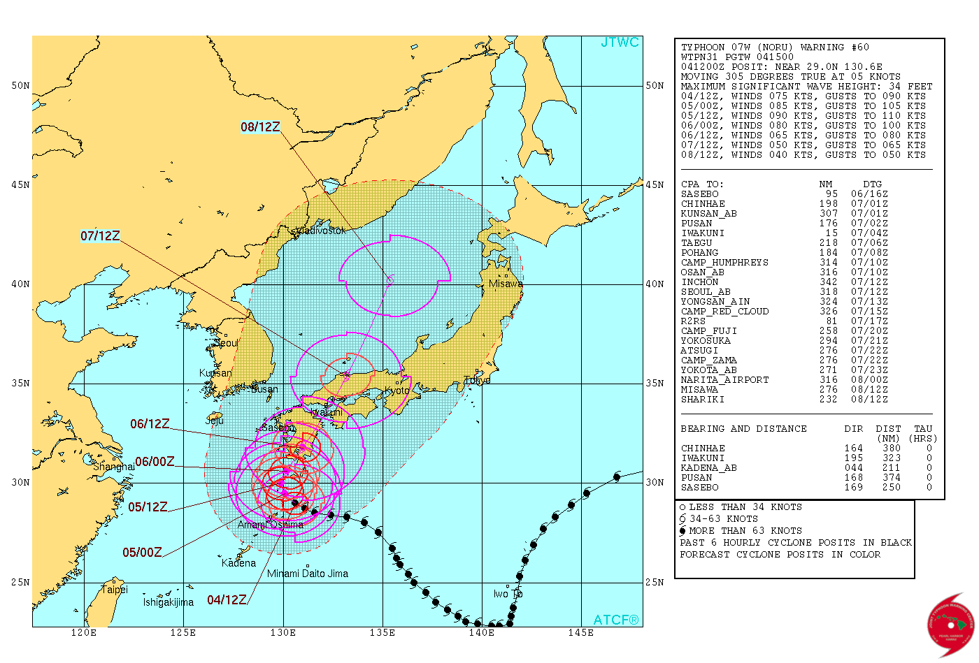
Typhoon "Noru" forecast track by JTWC on August 4, 2017
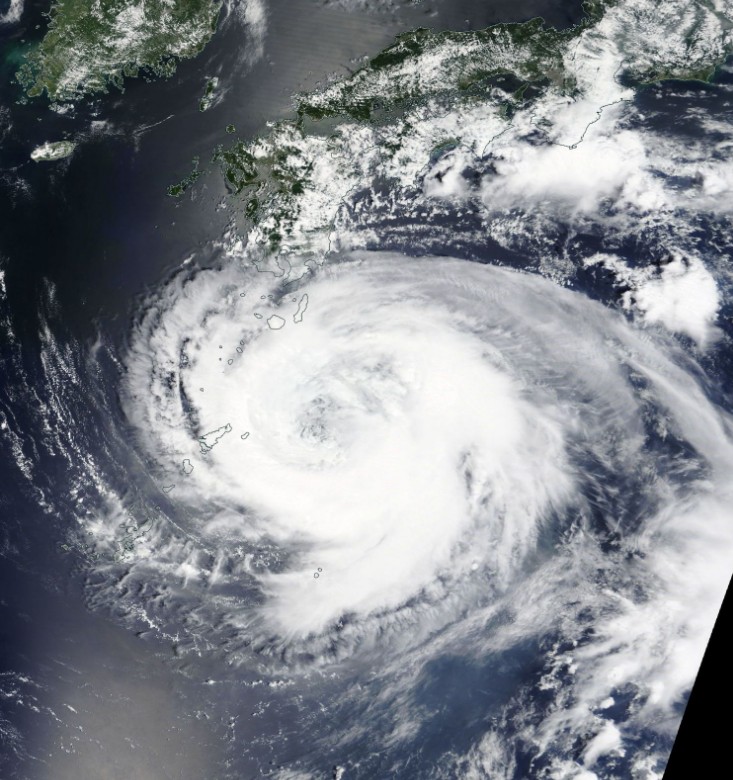
Typhoon "Noru" on August 4, 2017. Credit: NASA Terra/MODIS
By August 4, Noru has been at typhoon strength for 11.5 days, making it the longest-lived NW Pacific typhoon since Gay of 1992.
I'm a dedicated researcher, journalist, and editor at The Watchers. With over 20 years of experience in the media industry, I specialize in hard science news, focusing on extreme weather, seismic and volcanic activity, space weather, and astronomy, including near-Earth objects and planetary defense strategies. You can reach me at teo /at/ watchers.news.
Commenting rules and guidelines
We value the thoughts and opinions of our readers and welcome healthy discussions on our website. In order to maintain a respectful and positive community, we ask that all commenters follow these rules.