
Increased earthquake activity under Katla volcano, Iceland
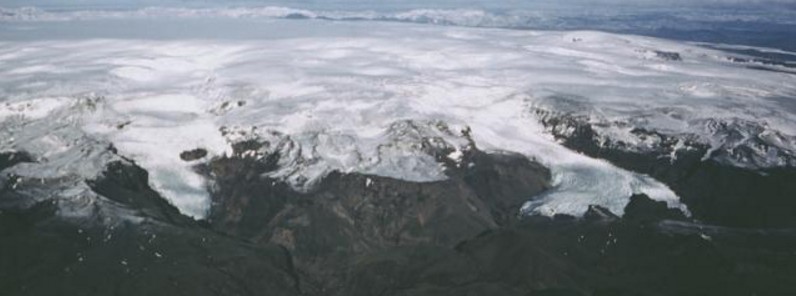
Featured image: Myrdalsjökull icecap covering Katla volcano, Iceland. Credit: Oddur Sigurdsson, 1985 (Icelandic National Energy Authority).
A series of earthquakes were registered under Iceland's Katla volcano over the past couple of days. Judging by the depth of some of the earthquakes, fresh magma is making its way upward.
There were more than 10 earthquakes in total, including M3.6 at 18:36 UTC on June 20, 2017, the strongest so far. Icelandic Meteorological Office (IMO) registered depths between 0.1 and 25.5 km (330 feet – 15.8 miles).
Volcanologist Jon Frimann speculates that the depth of some of the quakes indicates that fresh magma is making its way upward in the magma chamber as at least one of the quakes had a depth of 14.4 km (8.9 miles).
"Earthquakes like this are not unusual this time of year," IMO's Sigríður Magnea Óskarsdóttir said, adding that there are no signs of Katla erupting. There are often earthquakes in Katla over the summer, though no one is sure what exactly the reason might be. One of the theories is it connected to the glacier on top of the volcano melting.
20 eruptions have been documented at Katla between 930 and 1918, at intervals of 13 to 95 years. Since the last eruption took place in 1918, Katla is long overdue for an eruption.
This volcano is known for strong eruptions, with Volcanic Explosivity Index mostly between 4 and 6 (on a scale of 0 to 8).
Its eruption could pose a threat to civilians due to glacial flooding and significant ash generation.
Geological summary
Katla volcano, located near the southern end of Iceland's eastern volcanic zone, is hidden beneath the Myrdalsjökull icecap. The subglacial basaltic-to-rhyolitic volcano is one of Iceland's most active and is a frequent producer of damaging jökulhlaups, or glacier-outburst floods.
A large 10 x 14 km (6.2 – 8.7 miles) subglacial caldera with a long axis in a NW-SE direction is up to 750 m (2 500 feet) deep. Its high point reaches 1 380 m (4 199 feet), and three major outlet glaciers have breached its rim.
Although most historical eruptions have taken place from fissures inside the caldera, the Eldgjá fissure system, which extends about 60 km (37 miles) 18 to the NE from the current ice margin towards Grímsvötn volcano, has been the source of major Holocene eruptions.
An eruption from the Eldgjá fissure system about 934 CE produced a voluminous lava flow of about 18 km3 (4.31 mi3), one of the world's largest known Holocene lava flows.
Katla has been the source of frequent subglacial basaltic explosive eruptions that have been among the largest tephra-producers in Iceland during historical time and has also produced numerous dacitic explosive eruptions during the Holocene. (GVP)
I'm a dedicated researcher, journalist, and editor at The Watchers. With over 20 years of experience in the media industry, I specialize in hard science news, focusing on extreme weather, seismic and volcanic activity, space weather, and astronomy, including near-Earth objects and planetary defense strategies. You can reach me at teo /at/ watchers.news.
Commenting rules and guidelines
We value the thoughts and opinions of our readers and welcome healthy discussions on our website. In order to maintain a respectful and positive community, we ask that all commenters follow these rules.