
Unusual earthquakes at Katla volcano, Iceland
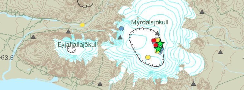
Image credit: IMO
Two earthquakes with magnitudes above M3 were detected in Mýrdalsjökull glacier on October 16, sparking discussions about a possible eruption of Katla volcano.
- The last known eruption of this volcano took place in 1918 (VEI 4). It has historically erupted once every 40 to 80 years, making it statistically long overdue for a new eruption.
In 48 hours to 13:20 UTC on October 17, the Icelandic Met Office (IMO) registered a total of 27 earthquakes in the area: 4 up to M1, 14 between M1 and M2, 6 between M2 and M3, and 3 above M3.
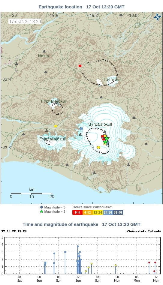
Group leader of nature monitoring at the Icelandic Met Office, Kristín Jónsdóttir, said that it is unusual for three earthquakes of the larger type to occur at short intervals in Mýrdalsjökull.1
“They were all there, because there are well-known geothermal boilers, which are actually just geothermal areas inside the caldera. There are twenty such areas inside the caldera, and these earthquakes occur near such geothermal areas. So there is always the question: are these earthquakes a sign that we are getting runoff from Katla or is this the volcano,” said Kristín.
“We have no measurements of volcanic eruptions in Katla, of which we are absolutely sure. So we don’t know exactly how the run-up is. Except only those descriptions we have from the chronicles of our ancestors. And in those descriptions it is quite clear that there are earthquakes that people feel in the vicinity and even vibrations, there are descriptions of how the water surface near Katla vibrates before an eruption occurs.”
Popular ice caves in the area have now been closed.
Geological summary
Katla volcano, located near the southern end of Iceland’s eastern volcanic zone, is hidden beneath the Myrdalsjökull icecap. The subglacial basaltic-to-rhyolitic volcano is one of Iceland’s most active and is a frequent producer of damaging jökulhlaups, or glacier-outburst floods.
A large 10 x 14 km (6.2 – 8.7 miles) subglacial caldera with a long axis in a NW-SE direction is up to 750 m (2 500 feet) deep. Its high point reaches 1 380 m (4 199 feet), and three major outlet glaciers have breached its rim.
Although most historical eruptions have taken place from fissures inside the caldera, the Eldgjá fissure system, which extends about 60 km (37 miles) to the NE from the current ice margin towards Grímsvötn volcano, has been the source of major Holocene eruptions.
An eruption from the Eldgjá fissure system about 934 CE produced a voluminous lava flow of about 18 km3 (4.31 mi3), one of the world’s largest known Holocene lava flows.
Katla has been the source of frequent subglacial basaltic explosive eruptions that have been among the largest tephra-producers in Iceland during historical time and has also produced numerous dacitic explosive eruptions during the Holocene.2
References:
1 Earthquakes In Mýrdalsjökull Start Discussions About Possible Eruption Of Katla – Reykjavik Grapevine – October 17, 2022
2 Katla – Geological summary – GVP
I'm a dedicated researcher, journalist, and editor at The Watchers. With over 20 years of experience in the media industry, I specialize in hard science news, focusing on extreme weather, seismic and volcanic activity, space weather, and astronomy, including near-Earth objects and planetary defense strategies. You can reach me at teo /at/ watchers.news.
Commenting rules and guidelines
We value the thoughts and opinions of our readers and welcome healthy discussions on our website. In order to maintain a respectful and positive community, we ask that all commenters follow these rules.