
Deadly Typhoon “Soudelor” destroys Saipan, hits Taiwan with gale force winds and extremely heavy rainfall, makes final landfall in southeast China

Featured image: Typhoon "Soudelor" at 05:40 UTC on August 8, 2015. Credit: JMA/RAMMB/CIRA (Himawari-8).
Typhoon Soudelor, the fifth super typhoon and the strongest tropical cyclone of the year so far, made landfall over central Taiwan late UTC on Friday, August 7, 2015, just north of the city of Hualien, with estimated wind speeds of 200 km/h (125 mph) – Category 3 hurricane equivalent.
It then moved over the island bringing gale force winds and extremely heavy rainfall, reemerged over Taiwan Strait, reached southeast China and made its third and final landfall in Putian City, Fujian Province around 14:00 UTC on August 8.
According to Taiwan's Central Weather Bureau, parts of Northern Taiwan have already picked up over 300 mm (12 inches) of rain in the 24 hours ahead of Soudelor's landfall. While the storm moved over the island on August 8, parts of it received over 1 329 mm (52.32 inches) of rainfall.
At least six people in Taiwan have lost their lives and at least 185 were injured, according to Taiwan's National Fire Agency
More than 4 million people have lost power at some point as Soudelor moved over the island.
An other crazy video " #Soudelor watch your house ! #taiwan pic.twitter.com/XyinT3dbPf
— Taiwan Breaking News (@TaiwanBN) August 8, 2015
Soudelor hit Putian City, southeastern China around 14:00 UTC on August 8 with maximum sustained winds of 138 km/h (86 mph) – Category 1 hurricane equivalent. Fujian, Zhejiang and Guangdong provinces (population over 200 million) will see the most significant impact through the day and early Sunday.
Soudelor is then expected to turn northward, potentially spreading heavy rain to Jiangxi, Anhui and Hubei provinces.
About 200 mm (8 inches) of rain is expected with more than 300 mm (11.8 inches) in the higher terrain.
Thousands were evacuated and millions of homes were left without power in southeast China by late August 8.
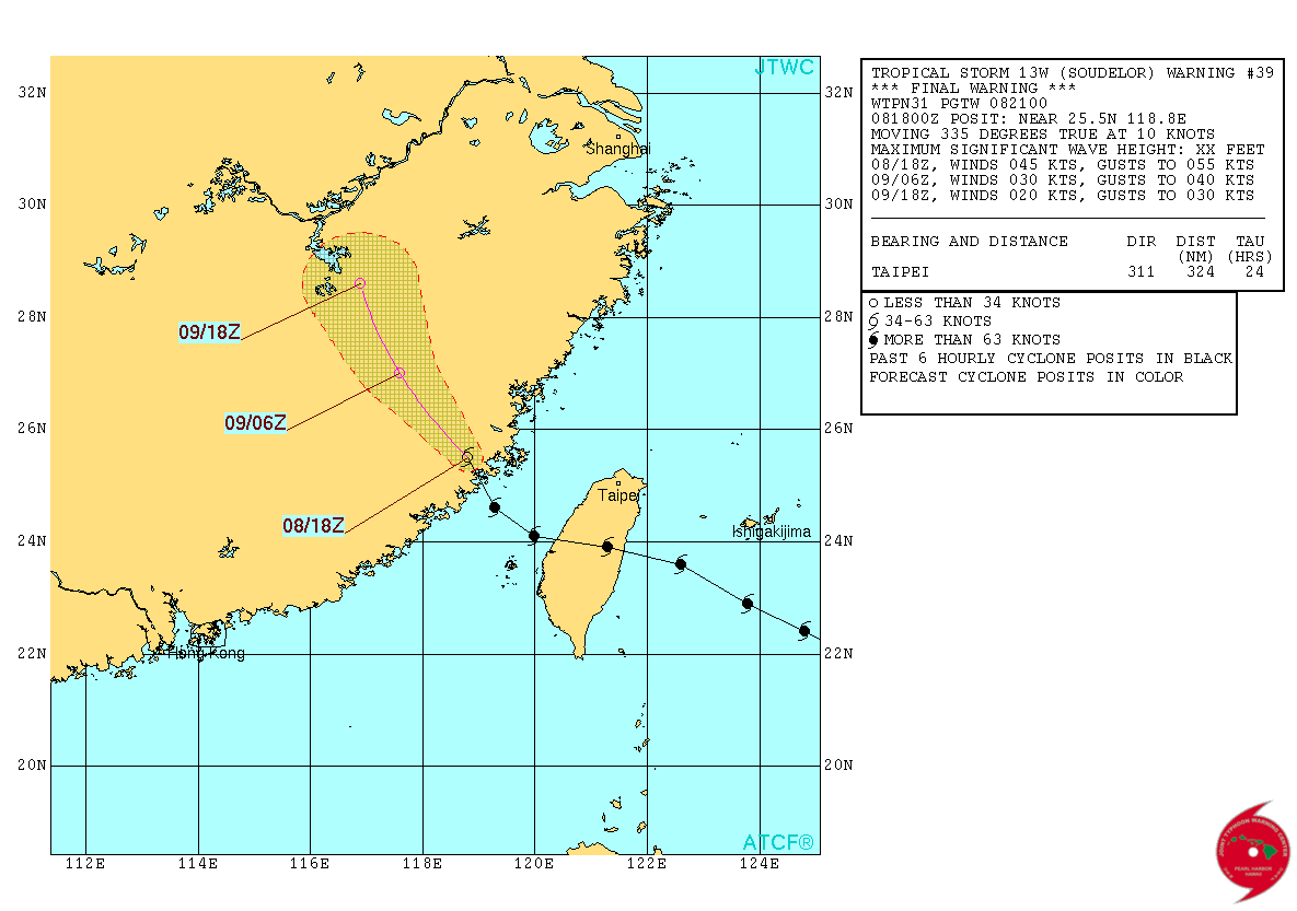
Typhoon "Soudelor" forecast track by JTWC on August 8, 2015. Image credit: JTWC/ACTF.
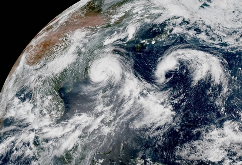
Typhoon "Soudelor" at 05:40 UTC on August 8, 2015. Credit: JMA/RAMMB/CIRA (Himawari-8).
On August 2, a day before Soudelor reached super typhoon strength, it made a direct hit to Saipan, Northern Mariana Islands generating substantial infrastructural damage. On August 5, The White House declared Saipan a disaster zone.
Late August 3, JTWC estimated Soudelor's maximum sustained winds at 287 km/h (178 mph). At 12:00 UTC on August 4, the Japan Meteorological Agency estimated Soudelor's central pressure was 900 hPa (mb), which officially made it the strongest tropical cyclone so far in 2015.
The West Pacific Basin has seen 10 typhoons so far in 2015. Of those, five have reached super typhoon strength (sustained winds of at least 240 km/h (150 mph)). The average is four for an entire year.
Year's previous strongest typhoon was Super Typhoon "Maysak" with an estimated 910 hPa.
I'm a dedicated researcher, journalist, and editor at The Watchers. With over 20 years of experience in the media industry, I specialize in hard science news, focusing on extreme weather, seismic and volcanic activity, space weather, and astronomy, including near-Earth objects and planetary defense strategies. You can reach me at teo /at/ watchers.news.
Commenting rules and guidelines
We value the thoughts and opinions of our readers and welcome healthy discussions on our website. In order to maintain a respectful and positive community, we ask that all commenters follow these rules.