
Tropical Storm “Dolores” forms south of Acapulco, Mexico
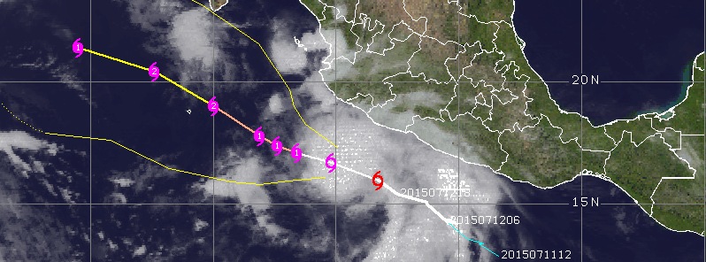
Image credit: Tropical Storm "Dolores" forecast track by UW-CIMSS on July 13, 2015.
A new tropical depression, FIVE-E, formed south of Mexico on Saturday, July 11, 2015 and strengthened into a tropical storm named Dolores on Sunday, July 12, 2015.
As of 06:00 UTC on July 13, Dolores was located about 290 km (180 miles) south of Manzanillo, Mexico. Its maximum sustained winds are 95 km/h (60 mph) and the storm is moving WNW at 20 km/h (13 mph). Minimum central pressure is 999 hPa.
NWS NHC said a Tropical storm Watch is in effect for Lazaro Cardenas to Cabo Corrientes, Mexico.
Strengthening is forecast during the next 48 hours, and Dolores is expected to become a hurricane later today.
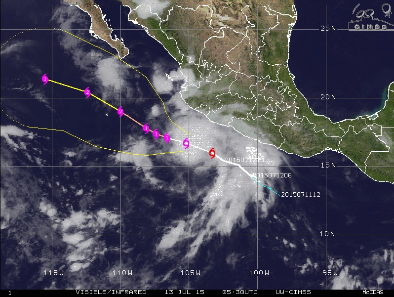
Tropical Storm "Dolores" forecast track by UW-CIMSS on July 13, 2015.
Tropical-storm-force winds extend outward up to 220 km (140 miles) from the center.
The outer rain bands of Dolores are expected to produce total rain accumulations of 5 to 10 cm (2 to 4 inches) along the southwestern coast of Mexico from the state of Oaxaca to Nayarit, with possible isolated maximum amounts of 18 cm (7 inches) through Wednesday, July 15.
Swells generated by Dolores are expected to affect the southern and southwestern coasts of Mexico during the next few days, and could cause life-threatening surf and rip current conditions.
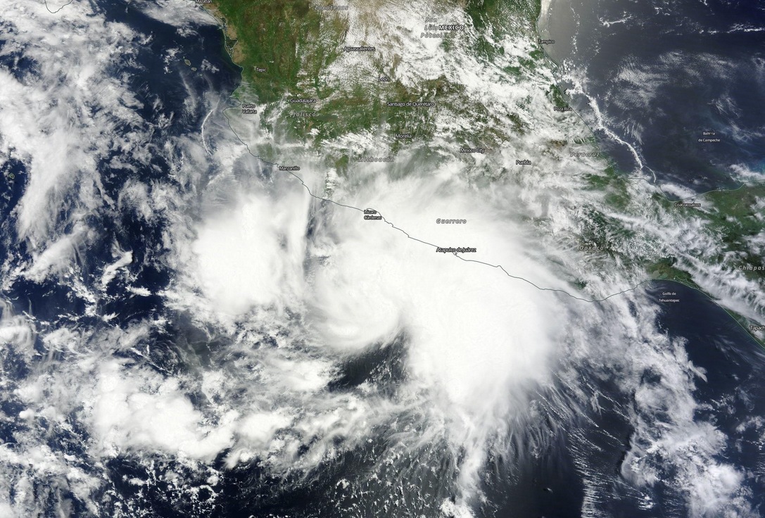
Tropical Storm "Dolores" on July 12, 2015. Image credit: NASA Terra/MODIS.
Satellite animations
- Storm-Centered Infrared (GOES 15; NOAA/SSD)
- Storm-Centered Infrared (Aviation Color Enhancement) (GOES 15; NOAA/SSD)
- Storm-Centered Water Vapor (GOES 15; NOAA/SSD)
- Storm-Centered Visible (GOES 15; NOAA/SSD)
- Storm-Centered Visible (Colorized) (GOES 15; NOAA/SSD)
- Storm-Centered Infrared (GOES 15; CIMSS)
- Storm-Centered Enhanced Infrared (GOES 15; CIMSS)
- Storm-Centered Water Vapor (GOES 15; CIMSS)
- Storm-Centered Visible (GOES 15; CIMSS)
- East Pacific Infrared (GOES 15; NOAA/SSD)
- East Pacific (Aviation Color Enhancement) (GOES 15; NOAA/SSD)
- East Pacific Water Vapor (GOES 15; NOAA/SSD)
- East Pacific Visible (GOES 15; NOAA/SSD)
- East Pacific Visible (Colorized) (GOES 15; NOAA/SSD)
I'm a dedicated researcher, journalist, and editor at The Watchers. With over 20 years of experience in the media industry, I specialize in hard science news, focusing on extreme weather, seismic and volcanic activity, space weather, and astronomy, including near-Earth objects and planetary defense strategies. You can reach me at teo /at/ watchers.news.
Commenting rules and guidelines
We value the thoughts and opinions of our readers and welcome healthy discussions on our website. In order to maintain a respectful and positive community, we ask that all commenters follow these rules.