
Typhoon “Higos” formed over Northwestern Pacific Ocean
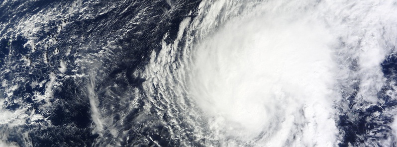
Featured image: Typhoon "Higos" on February 8, 2015. Image credit: NASA Terra/MODIS
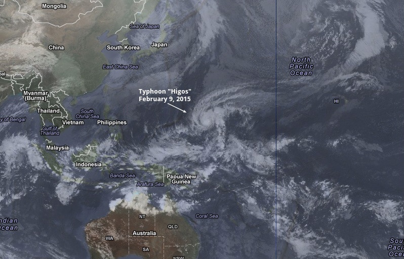
Typhoon "Higos", which started organizing late last week, continues to strengthen over open waters of Northwestern Pacific Ocean. The system is now located about 1 200 km (760 miles) east of Guam and is moving to the WNW at 7.4 km/h (4.6 mph).
At 06:00 UTC today, Higos had maximum sustained winds of 140 km/h (92 mph), and wind gusts of 185 km/h (115 mph), according to JTWC. This makes it a Category 2 storm on the Saffir-Simpson Hurricane Wind Scale.
Typhoon "Higos" on February 9, 2015. Image credit: UW-CIMSS/Google(NASA/Terrametrics). Annotation: The Watchers
Higos is expected to further intensify during the next 24 hours, but is not expected to have any direct impact on land areas. The NWS in Guam has issued high surf advisories for eastern and north eastern facing coastlines where up to 3 meter high waves can be expected through Tuesday.
By Thursday morning (February 12), Higos is forecasted to be a dissipating tropical depression about 700 km (440 miles) ENE of Saipan.
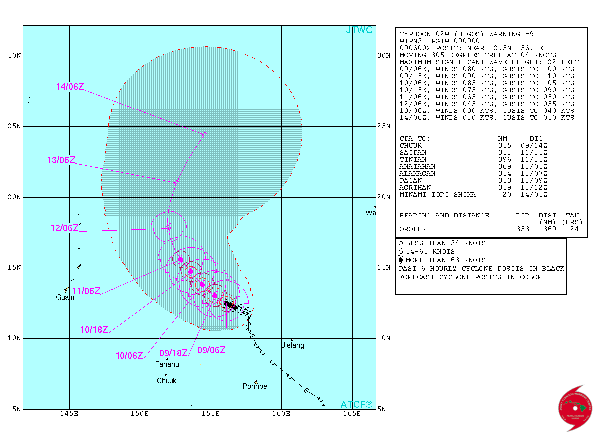
Typhoon "Higos" forecast track by JTWC on February 9, 2015.
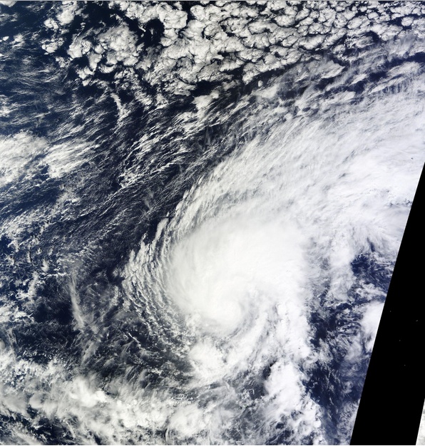
Typhoon "Higos" on February 8, 2015. Image credit: NASA Terra/MODIS
Infrared image captured by the VIIRS instrument aboard the Suomi NPP satellite at 14:51 UTC yesterday showed some very high, powerful thunderstorms with cold cloud top temperatures (yellow) around the center of circulation.
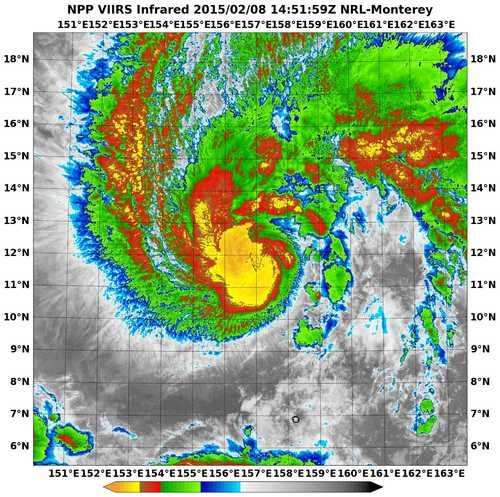
Image credit: NRL/NOAA/NASA
Satellite animations
- Storm-Centered Infrared (MTSAT; NOAA/SSD)
- Storm-Centered Infrared (Aviation Color Enhancement) (MTSAT; NOAA/SSD)
- Storm-Centered Water Vapor (MTSAT; NOAA/SSD)
- Storm-Centered Visible (MTSAT; NOAA/SSD)
- Storm-Centered Visible (Colorized) (MTSAT; NOAA/SSD)
- Storm-Centered Infrared (MTSAT2; CIMSS)
- Storm-Centered Enhanced Infrared (MTSAT2; CIMSS)
- Storm-Centered Water Vapor (MTSAT2; CIMSS)
- Storm-Centered Visible (MTSAT2; CIMSS)
- Tropical West Pacific Infrared (MTSAT2; NOAA)
- Tropical West Pacific Enhanced Infrared (MTSAT2; NOAA)
- Tropical West Pacific Water Vapor (MTSAT2; NOAA)
- Tropical West Pacific Visible (MTSAT2; NOAA)
I'm a dedicated researcher, journalist, and editor at The Watchers. With over 20 years of experience in the media industry, I specialize in hard science news, focusing on extreme weather, seismic and volcanic activity, space weather, and astronomy, including near-Earth objects and planetary defense strategies. You can reach me at teo /at/ watchers.news.
Commenting rules and guidelines
We value the thoughts and opinions of our readers and welcome healthy discussions on our website. In order to maintain a respectful and positive community, we ask that all commenters follow these rules.