
Typhoon “Kalmaegi” weakens after its second landfall
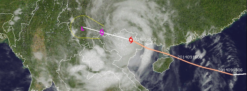
Image credit: UW-CIMSS
After hitting northeast of the main Philippine island of Luzon on Sunday, September 14, Typhoon "Kalmaegi" strengthened over the South China Sea and hit southern China and Vietnam on September 16, 2014.
As it was making its second landfall (China) it was still a typhoon with maximum sustained winds near 130 km/h (80.5 mph). It was still generating very rough surf and ocean swells up to 7 meters (22 feet).
Shortly after interaction with landmass the system weakened into a tropical storm and made a final landfall in Quảng Ninh province in northeastern Vietnam as a tropical storm.
More than 300 millimeters (6 – 12 inches) of rain fell in under 24 hours across northern Hainan Island.
Destructive winds, widespread flooding rain and an inundating storm surge are expected across the region.
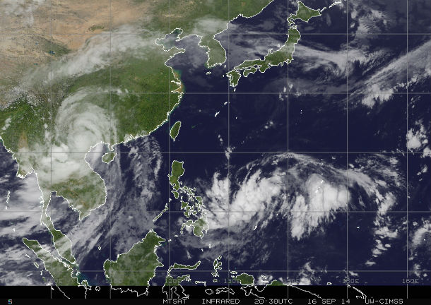
MTSAT IR satellite image at 20:30 UTC on September 16, 2014. (Credit: NOAA/MTSAT)
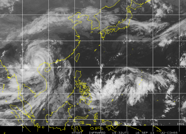
MTSAT IR satellite image of TS Kalmaegi at 19:32 UTC on September 16, 2014. (Credit: NOAA/MTSAT)
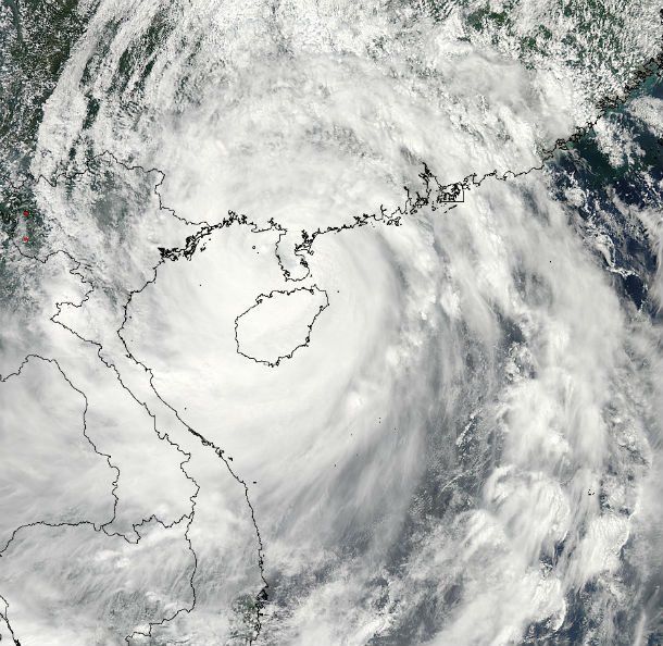
Aqua/MODIS satellite image of Typhoon Kalmaegi while crossing Haiyan Island at 06:00 UTC on September 16, 2014. (Credit: LANCE Rapid Response/MODIS)
According to latest report by JTWC issued at 21:00 UTC on September 16, 2014, the center of Tropical Storm "Kalmaegi" was located approximately 67 nm (124 km/77 miles) of Hanoi, Vietnam with maximum sustainable winds of 111 km/h (69 mph) and gusts up to 138 km/h (86 mph).
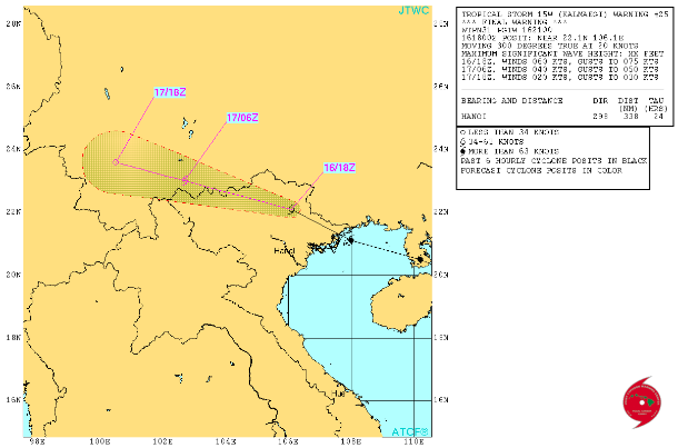
TS Kalmaegi forecast track by JTWC (Credit: JTWC)
After making a final landfall in Vietnam, flooding rainfall will spread westward into northern Laos, eastern Myanmar and Yunnan Province, China.
Satellite animations
- Storm-Centered Infrared (MTSAT2; NOAA/SSD)
- Storm-Centered Infrared (Aviation Color Enhancement) (MTSAT2; NOAA/SSD)
- Storm-Centered Water Vapor (MTSAT2; NOAA/SSD)
- Storm-Centered Visible (MTSAT2; NOAA/SSD)
- Storm-Centered Visible (Colorized) (MTSAT2; NOAA/SSD)
- Storm-Centered Infrared (MTSAT2; CIMSS)
- Storm-Centered Enhanced Infrared (MTSAT2; CIMSS)
- Storm-Centered Water Vapor (MTSAT2; CIMSS)
- Storm-Centered Visible (MTSAT2; CIMSS)
- South China Sea/West Pacific Infrared (MTSAT2; NOAA)
- South China Sea/West Pacific Enhanced Infrared (MTSAT2; NOAA)
- South China Sea/West Pacific Water Vapor (MTSAT2; NOAA)
.jpg)
Commenting rules and guidelines
We value the thoughts and opinions of our readers and welcome healthy discussions on our website. In order to maintain a respectful and positive community, we ask that all commenters follow these rules.