Swarm of earthquakes hit Vanuatu region

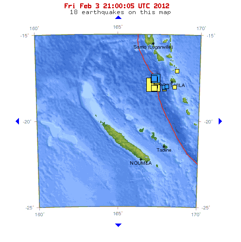
Swarm of earthquakes hit Vanuatu archipelago from the start of February. Magnitude 5.1 occur on Jan 31 at depth of 172.5 km (107.2 miles). Yesterday strong earthquake measuring 7.1 magnitude occurs at depth of 23.1 km (14.4 miles). There were no tsunami warnings issued. 7.1 was followed by 5.3 at depth of 10 km (6.2 miles), 5.0 at depth of 33.3 km (20.7 miles), 5.5 at depth of 22.8 km (14.2 miles), 5.2 at depth of 20.8 km (12.9 miles), 5.1 at depth of 31.9 km (19.8 miles) and 5.1 at depth of 17.4 km (10.8 miles).

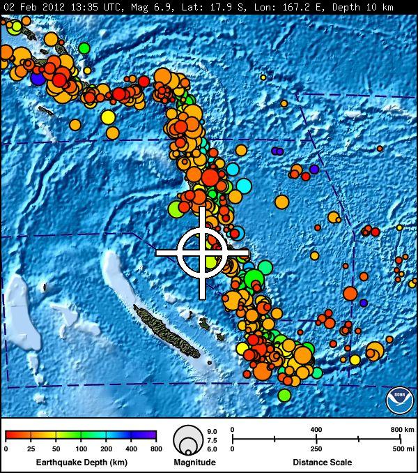
The February 2, 2012 earthquake near Vanuatu in the southwest Pacific Ocean occurred as a result of oblique-normal faulting within the lithosphere of the Australia plate. The earthquake epicenter is located just 15 km to the west of the New Hebrides Trench, the bathymetric expression of the boundary between the Australia and Pacific plates, where lithosphere of the Australia plate subducts into the mantle beneath the North Fiji Basin. At the location of this earthquake, the Australia plate moves east-northeast with respect to the Pacific plate at a velocity of approximately 84 mm/yr.
New Hebrides Trench reaches maximum depths of some 25,000 feet (7,600 metres) or more, the deepest soundings in the whole Coral Sea region. The trench is about 750 miles (1,200 km) long and 45 miles (70 km) wide and covers an area of 32,400 square miles (84,000 square km). The trench curls around the southern end of Vanuatu in a manner suggesting a diagonal symmetry with the northern end of the nearby Tonga Trench.
About a dozen earthquakes of M 7 or larger have occurred within 250 km of today’s event over the past 30 years. However, they generally occur on the megathrust interface to the east, and few have been outboard of the trench. A magnitude 7.3 normal faulting earthquake did occur to the west of the New Hebrides Trench, about 225 km to the south of today’s event, on Christmas Day in 2010.

This morning seismic activity started with magnitude 6.0 earthquake with epicenter at depth of 21.7 km (13.5 miles). Epicenter was located 116 km (72 miles) northwest of Port-Villa, Efate, 204 km (126 miles) south of Luganville, Espiritu Santo and 318 km (197 miles) northwest of Isangel, Tanna, Vanuatu (17.376°S, 167.278°E).

Featured image credit: Shirat Devorah

Commenting rules and guidelines
We value the thoughts and opinions of our readers and welcome healthy discussions on our website. In order to maintain a respectful and positive community, we ask that all commenters follow these rules.