Magnitude 6.2 earthquake hit South Sandwich Islands area

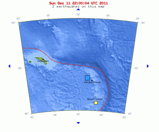
Mggnitude 6.2 earthquake hit South Sandwich Islands region today at 09:54:55 UTC (07:54:55 AM Local Time). Epicenter was 104 km (64 miles) NW of Visokoi Island, South Sandwich Islands and 354 km (219 miles) NNW of Bristol Island, South Sandwich Islands (55.980°S, 28.238°W) with depth of 115.5 km (71.8 miles) according to USGS. Magnitude 6.1 was recorded by EMSC with depth of 128 km (79.5 miles). There were no casualties because the islands are only populated with birds. South Sandwich islands are Sub-Antarctic volcanic islands.


Satellite map of the greater epicenter area
Mount Hodson is located on Visokoi Island, 56 km to the east of Leskov Island and 47 km southeast of Zavodski Island. The volcano rises 1005 m above sea level (‘visokoi‘ means ‘high‘ in Russian). Plumes were seen above the volcano in 1830 and 1930. (New Submarine Volcanoes discovered in the South Sandwich Islands – Science Thoughts)


Commenting rules and guidelines
We value the thoughts and opinions of our readers and welcome healthy discussions on our website. In order to maintain a respectful and positive community, we ask that all commenters follow these rules.