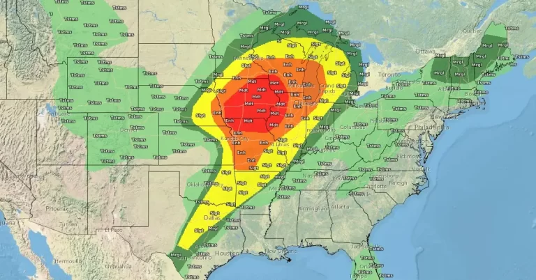
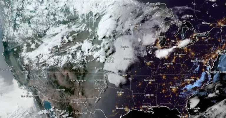
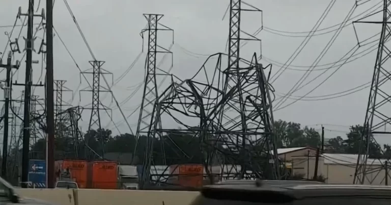
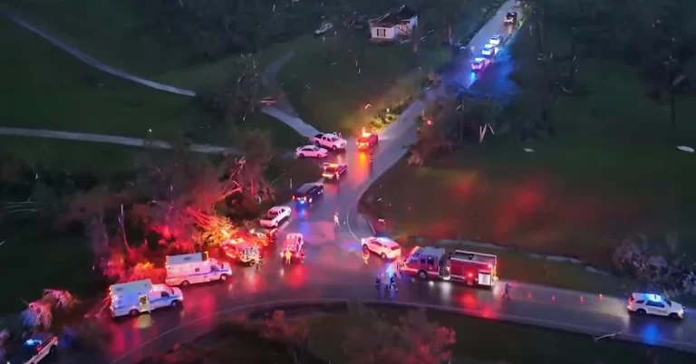
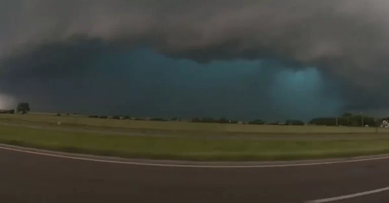
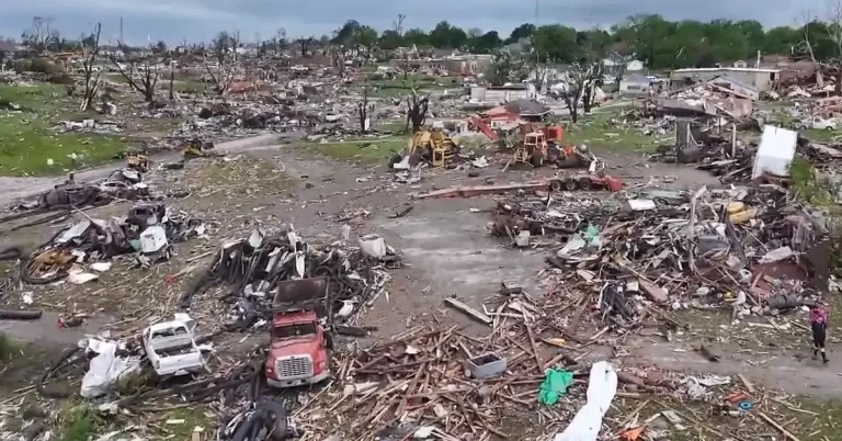
• Strong atmospheric river drops record rainfall in the Pacific Northwest, U.S.

    A powerful atmospheric river has brought record-breaking rainfall to Washington and Oregon, causing widespread flooding and two fatalities as of December 5. The National Weather Service forecasts the storms to continue until December 7. Notable impacts include record river levels, such as the Stillaguamish River reaching a historic 6.50 m (21.34 feet), and extensive property damage across both states.

  • Prolonged winter storm to batter Pacific Northwest with rain and heavy snow

    The Pacific Northwest is bracing for a prolonged winter storm that is forecasted to last through the weekend, threatening the region with a mix of heavy rain in the coastal ranges and lower Cascades and significant snowfall in the mountain passes. This event corresponds with the CW3E’s forecast of several atmospheric rivers, set to affect the area from Saturday, December 2, through the following week.

  • Major lake-effect snow event expected in Great Lakes region, threatening road closures and power outages

    As Arctic air sweeps across the Great Lakes, meteorologists are warning of the season’s first significant lake-effect snow event, poised to cause travel disruptions and potentially feet of snow in some areas. This weather phenomenon, intensifying early next week, is expected to bring hazardous conditions, particularly along I-90 and in snow-prone regions of Michigan, Ohio, and New York.

  • Intense winter storm brings heavy snow and freezing temperatures to the Plains and Rockies, U.S.

    A significant winter storm is affecting the Rockies and Plains, bringing heavy snowfall and temperatures well below normal this holiday weekend. Forecasts predict snow accumulations of 10 – 15 cm (4 – 6 inches) in western Nebraska and central Kansas, and up to 30 – 45 cm (12 – 18 inches) in southwest Colorado. The system, which is also expected to impact the eastern states early next week, poses a severe travel risk due to gusty winds and heavy snow.

  • NWS warns of rapidly changing weather conditions across the U.S., impacting Thanksgiving travel

    A vigorous cold front is currently sweeping across the western United States, bringing a mix of high-elevation snow, coastal and valley rains, and strong winds, as reported by the National Weather Service. This weather pattern is expected to rapidly progress eastward, potentially impacting Thanksgiving travel with a series of severe thunderstorms, heavy rains, and snowfall anticipated to hit the central and eastern regions of the country early next week.

  • California set for significant precipitation as atmospheric river develops

    An evolving storm system off the California coast, forecasted to develop into at least one atmospheric river, is set to deliver substantial rainfall and snowfall across the West Coast starting this weekend. With the Northeast Pacific Ocean as the stage, the interaction of several low-pressure systems is predicted to have significant impact, particularly from November 14 to 17, as per the Atmospheric River Reconnaissance field campaign.

  • Significant early-season winter storm brings heavy snowfall to portions of the Northwest, Northern Rockies, and Northern Plains

    A long-duration, early-season snowstorm began Tuesday afternoon, October 24, 2023, across portions of the Pacific Northwest, Northern Rockies, and Northern High Plains. Moderate to heavy snowfall is forecasted for these locations over the next few days. Heavy snow bands will likely result in hazardous travel conditions and poor visibility.

  • October snow in Fairbanks almost doubles the seasonal average for this time of year

    On October 22, 2023, Fairbanks, Alaska experienced an uncommon surge in snowfall, with the National Weather Service (NWS) Fairbanks office recording 8.9 cm (3.5 inches) of snow on that day alone. The snow depth in the region has reached 22.9 cm (9 inches), pushing the seasonal total to a remarkable 36.3 cm (14.3 inches), which is nearly double the usual amount for this time of year.

  • Two long-track tornadoes strike Tampa Bay, Florida

    On October 12, 2023, two long-track tornadoes swept through parts of Tampa Bay, Florida, U.S., significantly affecting Citrus, Pinellas, and Pasco counties. The early morning twisters caused extensive damage, leading to road closures and class cancellations in Citrus County.