Significant ice storm impacts Somerset, Pennsylvania
A significant ice storm impacted Somerset, Pennsylvania, on February 6, 2025, leaving roads coated in ice, stranding vehicles, and causing power outages.


A significant ice storm impacted Somerset, Pennsylvania, on February 6, 2025, leaving roads coated in ice, stranding vehicles, and causing power outages.

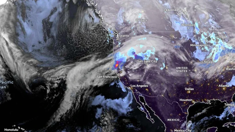
At least two people have been reported dead in Sonoma County due to the storms triggered by atmospheric rivers that have been affecting the region since January 31, 2025, leading to landslides and house collapses across the region.
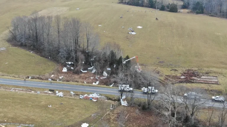
A brief EF-1 tornado swept through Hart County, Kentucky on February 6, 2025, blowing off roofs of buildings and sending debris over 180 m (590 feet) away. The tornado downed multiple trees and powerlines, causing power outages and forcing school closures in the area.

A violent storm system tore through Morgan County, Tennessee on the night of February 6, leaving widespread destruction, injuries, and loss of life, particularly in the Deer Lodge area. NWS issued multiple Tornado Warnings across eastern parts of the state, including the Knoxville area.

Two atmospheric rivers have battered the U.S. West Coast since January 31, 2025, bringing record rainfall to San Francisco and triggering landslides and flooding across California. At least one person was hospitalized.
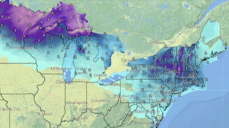
Two winter storms are set to sweep across the U.S. Midwest, Great Lakes, and Northeast starting February 5, 2025, impacting millions with power outages and treacherous icy roads, prompting several Ice Storm Warnings and Winter Weather Warnings.

A significant cold outbreak is forecast for mid-February 2025 as a Sudden Stratospheric Warming (SSW) event splits the polar vortex, with one of its cores expected to move into North America.
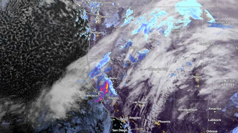
A long-duration atmospheric river (AR) continues to impact Northern California, bringing heavy precipitation, with two additional moisture pulses expected before it dissipates on Wednesday, February 5, 2025.

A mix of freezing rain and sleet will develop across parts of the Midwest and northern Mid-Atlantic from Wednesday, February 5 through Thursday, February 6, 2025, as Arctic air lingers ahead of an approaching storm system. The greatest ice accumulation risks are expected in western Maryland, the West Virginia Panhandle, and Pennsylvania, where ice buildup may cause power outages and hazardous road conditions. Elsewhere, lighter freezing rain could still lead to travel disruptions across the Great Lakes and Ohio Valley.
A strong atmospheric river (AR) is set to bring heavy rainfall to northern California starting Sunday, February 2, 2025, with forecasts indicating up to 380 mm (15 inches) in the Sierra Nevada, increasing the risk of flash floods and debris flows near the burn scars.