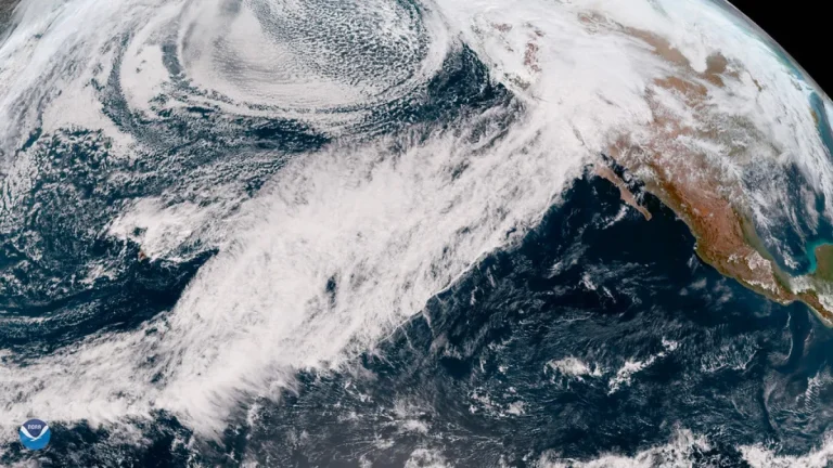
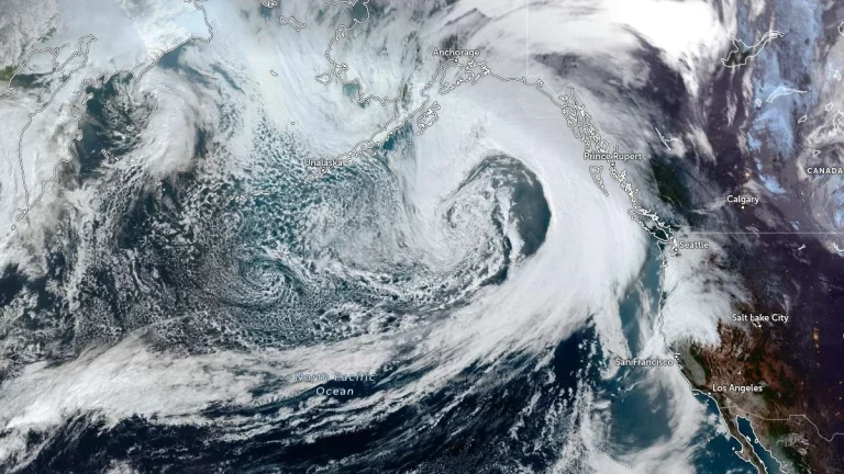
• What are atmospheric rivers and how they shape regional flood patterns

    Atmospheric rivers are long, narrow corridors of concentrated water vapor that move through the atmosphere and deliver massive amounts of rain and snow to mid-latitude coasts. These “rivers in the sky” shape flood seasons in the U.S. West Coast and Europe and are closely monitored because their intensity, duration and landfall location determine whether they bring beneficial moisture or trigger destructive floods.

  • Research shows atmospheric rivers fuel Colorado’s most extreme rainfall events

    Landfalling atmospheric rivers contributed between 21% and 78% of top-decile precipitation events across Colorado between 2000 and 2023, according to a new study by the Center for Western Weather and Water Extremes (CW3E) and the National Weather Service (NWS).

  • Pacific clues improve atmospheric river forecasts

    Researchers have been actively trying to enhance atmospheric river forecasts by collecting targeted observations over the Pacific Ocean. Through the Atmospheric Rivers Reconnaissance (AR Recon) project, aircraft, buoys, and radiosondes gather real-time data on important atmospheric variables, which are then integrated into high-resolution weather models. This approach leads to measurable gains in forecast accuracy, improving readiness along the West Coast and supporting hydrologic planning across the country.