Tropical Storm Fung Wong intensifies, landfall forecast over Luzon, Philippines
Severe Tropical storm Fung Wong intensified over the Philippines Sea on November 7, 2025, and is forecast to make landfall over the Philippines over the weekend.

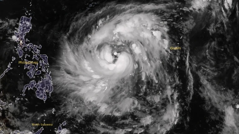
Severe Tropical storm Fung Wong intensified over the Philippines Sea on November 7, 2025, and is forecast to make landfall over the Philippines over the weekend.
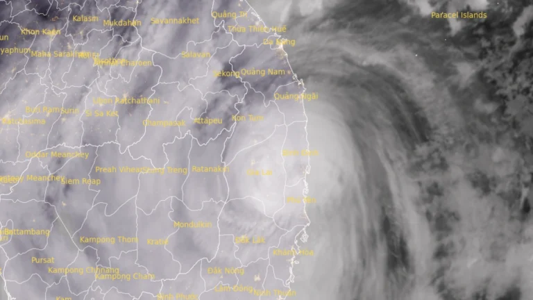
Typhoon Kalmaegi made landfall over Binh Dinh Province in central Vietnam on November 6, 2025. Heavy storm total rainfall of up to 200–600 mm (8–24 inches) is forecast across parts of Vietnam as the storm moves towards Laos and Cambodia.

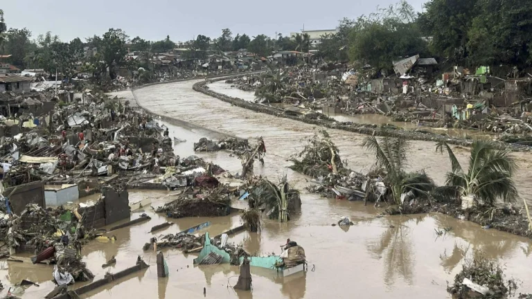
The Philippine government declared a state of calamity on November 6, 2025, after Typhoon Kalmaegi left 114 people dead, 127 missing, and displaced more than 560 000 residents while flooding parts of the Visayas, according to the National Disaster Risk Reduction and Management Council (NDRRMC).

At least 66 deaths have been confirmed, while 26 remain missing since Typhoon Kalmaegi (locally named Tino) made landfall over the Philippines on November 4, 2025. Nearly 390 000 people have been evacuated as recovery operations continue across the country.
Up to five fatalities have been reported since Typhoon Kalmaegi’s landfall over the Southern Leyte province in the Philippines on November 4, 2025. Landfall in Vietnam is expected on Thursday, November 6.
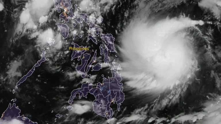
Severe Tropical Storm Kalmaegi (locally named Tino) is rapidly intensifying over the Philippine Sea and is expected to reach typhoon strength prior to landfall in the central Philippines by November 3–4, 2025.

he NOAA Hurricane Hunters shared a video experienced above normal turbulence levels while going inside the eye of Hurricane Melissa forcing them to return due to safety concern on Tuesday, October 28, 2025.
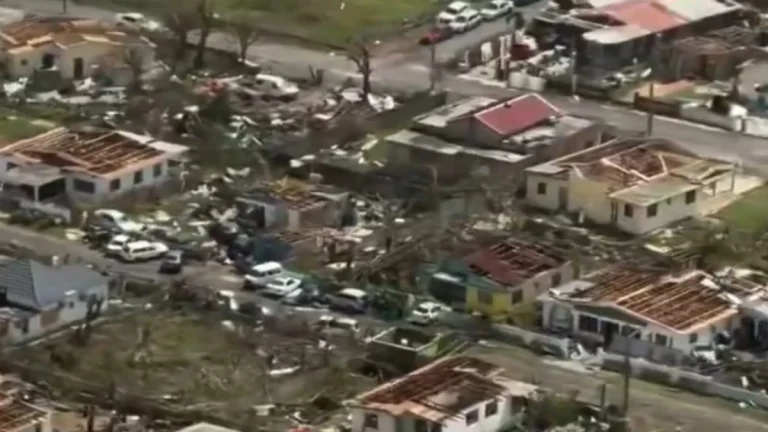
Hurricane Melissa made landfall near Black River, St Elizabeth Parish, Jamaica, at approximately 10:15 LT (15:15 UTC) on October 28, as a Category 5 hurricane with maximum sustained winds of 295 km/h (185 mph) and a minimum central pressure of 915 hPa. This was the strongest hurricane to strike Jamaica on record, causing catastrophic damage…

The historic landfall of Hurricane Melissa over Jamaica on October 28, 2025, has left behind a trail of destruction, prompting authorities to declare the island a disaster area on October 29. Over half a million people were left without power as Melissa ripped through the island. While some fatalities have been reported in Jamaica, official confirmation is yet to be made.
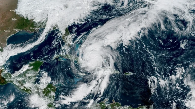
Hurricane Melissa is forecast to produce a dangerous storm surge and life-threatening coastal flooding across the southeastern and central Bahamas on Wednesday, October 29, 2025. The system is expected to pass near or just west of Bermuda late Thursday and Thursday night, bringing hurricane-force winds and heavy rainfall to the island.