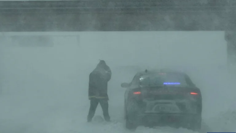
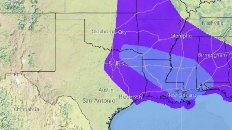
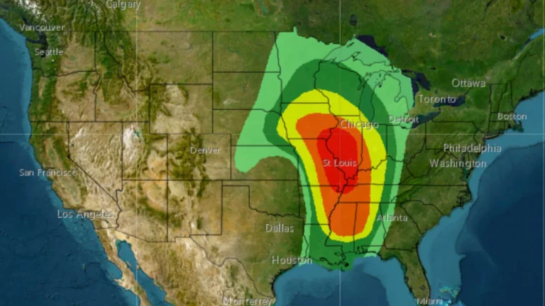
• Widespread freezing rain and dangerous travel forecast from Midwest to Mid-Atlantic, U.S.

    A mix of freezing rain and sleet will develop across parts of the Midwest and northern Mid-Atlantic from Wednesday, February 5 through Thursday, February 6, 2025, as Arctic air lingers ahead of an approaching storm system. The greatest ice accumulation risks are expected in western Maryland, the West Virginia Panhandle, and Pennsylvania, where ice buildup may cause power outages and hazardous road conditions. Elsewhere, lighter freezing rain could still lead to travel disruptions across the Great Lakes and Ohio Valley.

  • Ollera Creek Bridge collapse cuts key transport route in Queensland’s worst floods in 60 years, Australia

    The Ollera Creek Bridge, a critical section of the Bruce Highway, was destroyed over the weekend, severing a key transport link in Queensland amid the state’s worst flooding in 60 years. The floods have claimed the life of at least one person after a rescue boat capsized and have inundated thousands of homes and numerous roads across the region.

  • Major flooding underway in northern Queensland after extreme rainfall, Australia

    A major flood event is underway in northern Queensland, Australia, on Sunday, February 2, 2025, after parts of the region received between 500 and 1 000 mm (19.7 – 39.4 inches) of rain in the 48 hours leading up to 09:00 LT today. At least one person has drowned in floodwaters after an SES boat capsized. The region is forecast to receive additional heavy rainfall, with some areas expected to see up to 500 mm (19.7 inches) of additional rain over the next 24 hours.

  • Major atmospheric river to impact California coast this weekend

    Forecast confidence in a high-impact atmospheric river (AR) event has steadily increased since January 27, 2025, and CW3E is now warning about a major AR event expected to begin this Friday, January 31 along the U.S. West Coast, and potentially continue into early next week. The most recent forecast from the NCEP Global Ensemble Forecast System (GEFS) is showing >50% probability of an AR 4 or greater over along the California coast between Santa Cruz and Mendocino Counties.

  • Increased volcanic activity detected at Mount Teide, no imminent eruption risk, Tenerife

    The Scientific Committee for the Evaluation and Monitoring of Volcanic Phenomena (CCES) has confirmed that the Teide volcano in Tenerife, Spain is exhibiting anomalous geophysical activity, characterized by increased seismicity, geodetic deformation, and gas emissions. While there are no indications of an imminent eruption, experts acknowledge an elevated likelihood of volcanic activity in the medium to long term.

  • Red alerts issued as extremely dangerous Storm Éowyn approaches Ireland and UK

    Met Éireann, Ireland’s national meteorological service, has issued Red Level wind warnings for multiple counties as Storm Éowyn approaches the country on January 23, 2025. Éowyn is forecast to produce destructive gusts exceeding 130 km/h (81 mph), potentially causing widespread power outages, structural damage, dangerous travel conditions, and coastal flooding. Authorities have urged the public to shelter in place under Red warnings and avoid non-essential travel under Orange warnings. Schools nationwide will close, and disruptions to public transport and essential services are anticipated.

  • Rapidly spreading Hughes Fire puts 54 000 under evacuation orders or warnings as investigators probe possible human cause, California

    The Hughes Fire erupted on January 22, 2025, near Castaic Lake in northern Los Angeles County, tearing through more than 4 047 ha (10 000 acres) in just hours and triggering evacuation orders or warnings for over 54 000 residents. With no lightning strikes reported, investigators are expected to focus on potential human-related causes. Adding to concerns, unconfirmed reports suggest two individuals were spotted near the fire’s point of origin, though authorities have not yet addressed whether arson is suspected.