Flooding triggered by intense rainfall leaves one dead in Caracas, Venezuela
Heavy rainfall on the night of August 17–18, 2025, caused flash flooding in Caracas, Venezuela, leaving one person dead on the old road to El Junquito.


Heavy rainfall on the night of August 17–18, 2025, caused flash flooding in Caracas, Venezuela, leaving one person dead on the old road to El Junquito.

A disturbance in the Atlantic Ocean’s Main Development Region has a medium chance of developing into a tropical cyclone within the next seven days. If the system develops into a tropical storm, it will be named Fernand, the next designation on the 2025 Atlantic hurricane list.
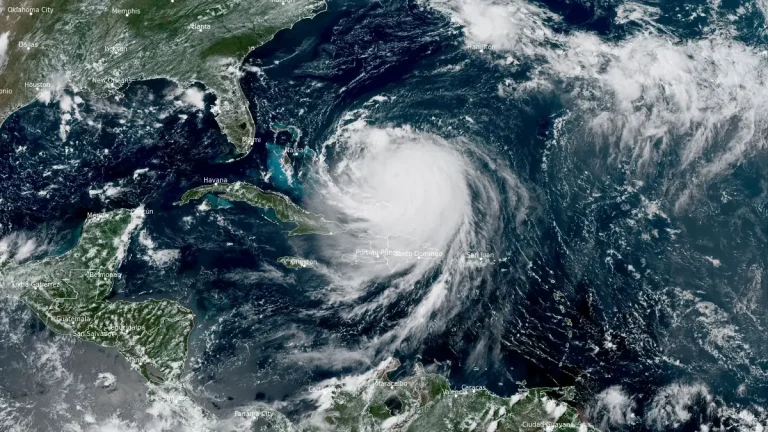
Category 4 Hurricane Erin was located 220 km (140 miles) north-northeast of Grand Turk Islands at 18:00 UTC (14:00 EDT) on August 18, 2025, with maximum sustained winds of 220 km/h (140 mph), maintaining Category 4 strength while moving northwest at 20 km/h (13 mph).

Hurricane Erin formed at 15:00 UTC on August 15, 2025, becoming the first hurricane of the 2025 Atlantic season. Current forecast calls for continued intensification and status of major hurricane over the weekend.

Heavy monsoon rains triggered devastating floods and landslides across Pakistan on August 15, 2025, killing more than 160 people and destroying critical infrastructure. Additional casualties were reported in Indian-administered Kashmir, where at least 60 people died following a cloudburst and associated flooding.

A massive cloudburst struck Chosoti village in Jammu and Kashmir’s Kishtwar district at around 12:00 local time (LT) on August 14, 2025, killing at least 60 people, injuring more than 300, and leaving over 250 others missing.

Tropical Storm Erin is forecast to strengthen into the first hurricane of the 2025 Atlantic season by August 15, 2025, and could reach major hurricane strength early next week as it moves near or just north of the northern Leeward Islands. The system is prompting early emergency preparations in the U.S. Virgin Islands despite no projected landfall, with forecasters warning of dangerous surf and rip currents across the Caribbean and potentially along the U.S. East Coast.
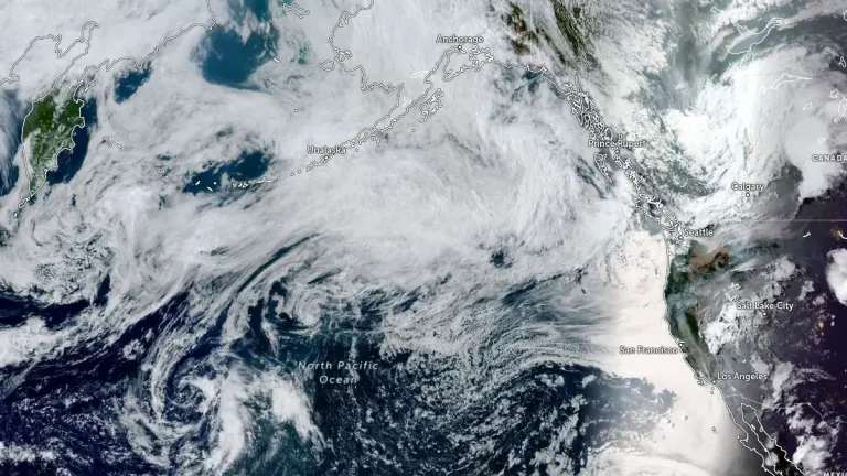
An atmospheric river (AR) with moderate-to-strong integrated vapor transport (IVT) exceeding 500 kg m⁻¹ s⁻¹ is forecast to make landfall over the Pacific Northwest and southern British Columbia on the evening of August 14, 2025, bringing sustained AR conditions for about 24 hours and significant precipitation through August 16.
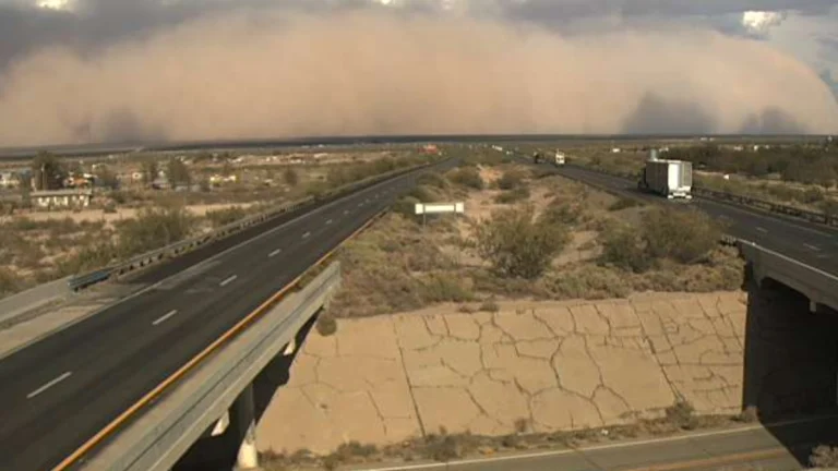
A severe dust storm produced near-zero to zero visibility along Interstate 10 between Lordsburg and Deming, New Mexico, at about 17:30 local time (LT) on August 12, 2025, prompting a full closure of the corridor between mile markers 20 and 81, roughly 98 km (61 miles). Conditions improved in the area by 18:30 LT.

The first significant rainfall event in weeks is forecast for coastal British Columbia, Canada, with an atmospheric river expected to bring 20–40 mm (0.8–1.6 inches) to the Lower Mainland and over 50 mm (2 inches) to higher elevations from August 15 to 17, 2025. The rainfall is expected to bring some relief to the region following prolonged wildfire activity that has scorched over 7 000 000 ha (1.8 million acres) across Canada making it the country’s second-worst wildfire season on record.
