Massive tornado damages buildings near Watertown, South Dakota
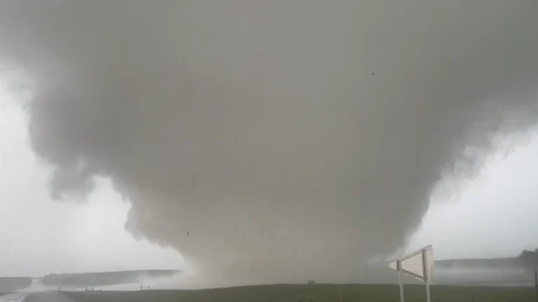
A powerful tornado touched down west of Watertown, South Dakota on July 27, 2025, destroying multiple structures and creating dramatic visuals.


I am an Assistant Editor and Severe Weather & Science Journalist at The Watchers, specializing in real-time severe weather coverage, geophysical event reporting, and research-driven scientific analysis. You can reach me at rishav(at)watchers(.)news.
A powerful tornado touched down west of Watertown, South Dakota on July 27, 2025, destroying multiple structures and creating dramatic visuals.
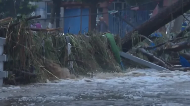
Record-breaking rainfall struck Fuping County, Hebei Province, China, on July 25–26, 2025, killing at least two people and leaving two others missing. Xizhuang station recorded 532 mm (20.94 inches) of rain in eight hours, with peak intensities reaching 145 mm (5.71 inches) per hour. Over 46 200 residents were affected, and more than 4 600 were evacuated.

Severe thunderstorms caused flash floods across the Chicago metropolitan area on Friday, July 25, 2025, with over 150 mm (6 inches) of rainfall reported in Bridgeview within just two hours.
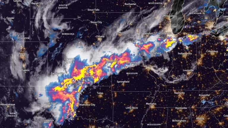
Record rainfall caused flash flooding in Kansas City, Missouri, on Thursday, July 24, 2025, submerging streets and prompting multiple water rescues.

Record-breaking rainfall hit Yi County, Baoding City, northern China, on July 25, 2025, delivering nearly a year’s worth of precipitation in just 24 hours and forcing the evacuation of over 19 000.

Lewotobi Laki-laki volcano in East Flores, Indonesia experienced a sharp rise in seismic activity between 12:00 and 18:00 LT (05:00–11:00 UTC) on July 25, 2025, including 34 volcanic earthquakes of multiple types. The Alert Level remains at IV (highest).
Typhoon Co-may (Emong) made its second landfall in Candon City, Ilocos Sur at 05:10 local time on July 25, 2025, weakening into a severe tropical storm as it crossed the Cordillera Administrative Region. At least 25 people have died and 8 remain missing in the Philippines following severe flooding and landslides triggered by southwest monsoon rains enhanced by tropical cyclones Wipha, Co-may and Francisco over the past 10 days.
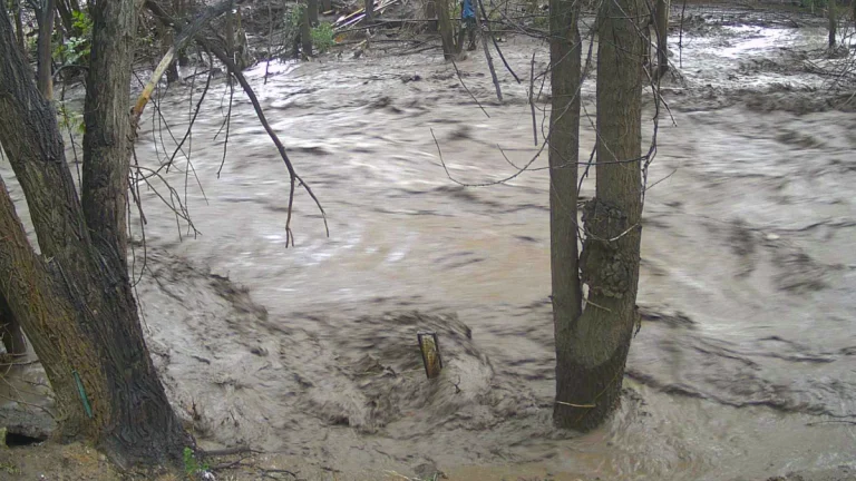
Flash floods triggered by persistent monsoonal rains prompted multiple water rescues near Ruidoso, New Mexico, on July 24, 2025. The Rio Ruidoso River overflowed its banks at multiple locations after reaching flood stage. Flooding was reported along several routes, including parts of I-40, prompting multiple road closures.

A powerful tornado ripped through City Beach in Western Australia as a severe storm moved through Perth, bringing hail, damaging winds, and flooding on Wednesday night, July 23, 2025. The tornado developed from a rapidly intensifying supercell along the coast, catching authorities off guard and leaving behind a trail of destruction.
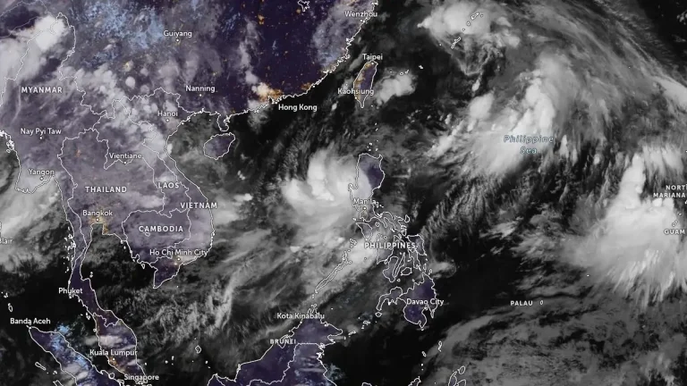
Typhoon Co-may made landfall over Agno in Pangasinan at 22:40 local time (LT) on July 24, 2025, with maximum sustained winds up to 120 km/h (75 mph) and gusts reaching 165 km/h (103 mph). It is forecast to make a second landfall over La Union or Ilocos Sur on July 25. This is the strongest storm to hit this region in 16 years.