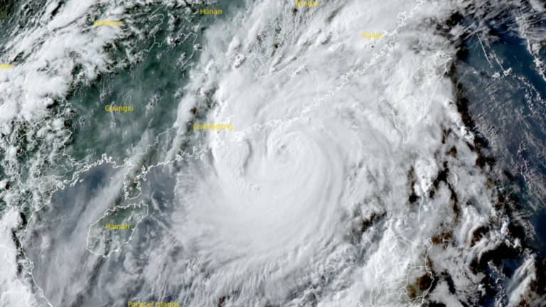
• Over 20 000 evacuated as Typhoon Noul approaches Guangdong, up to 600 mm (24 inches) of rain forecast, China

    Typhoon Noul is forecast to make landfall over eastern Guangdong by July 26, 2026, bringing a significant threat of flooding across southern China. More than 20 000 people have been evacuated Guangdon with rainfall totals of 500 to 600 mm (20 to 24 inches) forecast as the storm approaches. Authorities have raised Guangdong’s emergency response for flood and typhoon control to Level III on July 25 as Typhoon Noul approached the province, while activating a Level IV flood emergency response for Jiangxi and Hunan.


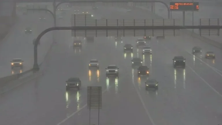
  • Two dead in Upshur County due to catastrophic flooding in West Virginia

    Two people have died after catastrophic flash flooding swept across north-central West Virginia authorities confirmed on July 24, 2026. The floods were triggered by torrential thunderstorms that dumped more than 102 mm (4 inches) of rain in under 40 minutes in parts of the state with totals reaching over 178 mm (7 inches) in some areas through July 21.

  • Extreme Heat Watches issued for Utah, Montana, and northern Wyoming, temperatures up to 43°C (110°F) forecast through July 27

    Extreme Heat Watches have been issued for large portions of Utah, Montana, and north-central Wyoming as widespread dangerous heat is forecast from Friday, July 24, through Sunday, July 26, with some areas remaining under hazardous conditions into early next week. Afternoon temperatures are forecast to reach 35 to 43°C (95 to 110°F), while unusually warm nights across northern Utah are expected to limit overnight cooling and increase cumulative heat stress.

  • Extreme Heat Warnings issued for parts of Arizona, California and Nevada, temperatures above 49°C (120°F) forecast

    Extreme Heat Warnings have been issued across large parts of Arizona, California, and Nevada as a prolonged heat event is forecast to persist through at least Monday, July 27, 2026. Afternoon temperatures are expected to reach 38 to above 49°C (100 to more than 120°F), while exceptionally warm overnight lows are forecast to provide little relief, significantly increasing the risk of heat-related illness.

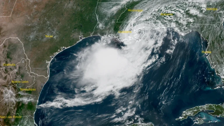
  • Tropical Storm Bertha makes landfall in St Bernard Parish, Louisiana, heads toward upper Texas coast

    Tropical Storm Bertha made landfall at approximately in St. Bernard Parish, Louisiana at approximately 13:50 CDT (18:50 UTC)on July 22, 2026, with maximum sustained winds of 72 km/h (45 mph). Storm surge of up to 1 m (3 feet), rainfall totals of 25 to 100 mm (1 to 4 inches) with isolated amounts reaching 150 mm (6 inches), and isolated flash flooding remain possible across portions of the central and western Gulf Coast through July 24.

  • State of Emergency declared for West Virginia after historic flooding

    Historic flooding in Upshur County and widespread impacts from severe thunderstorms prompted West Virginia Governor Patrick Morrisey to declare a State of Emergency for all 55 counties on July 21, 2026. The Sand Run stream gauge near Buckhannon rose to record levels, reportedly reaching major flood stage for the first time on record. Meanwhile, torrential rainfall totals of up to 127 mm (5 inches) in less than six hours caused flash flooding, infrastructure damage, and multiple road closures.

  • Four tornadoes confirmed in central Pennsylvania, including EF2 in Huntingdon County

    Four tornadoes touched down across central Pennsylvania on July 18, 2026, as a line of severe thunderstorms crossed the region, according to National Weather Service damage surveys. The tornadoes included one EF2, two EF1s, and one EF0, producing damage in Huntingdon, Clearfield, Jefferson, and Clarion counties. Despite considerable damage to forests, farms and other structures, no injuries or fatalities were reported.