
Land uplift measurements indicate rising eruption risk in Svartsengi area, Iceland
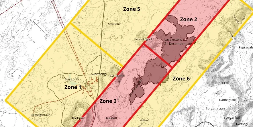
Image credit: IMO
The Icelandic Meteorological Office (IMO) warns of an increased risk of eruption in the Reykjanes area, following their analysis on January 9, 2024, which reveals magma accumulation beneath Svartsengi similar to levels prior to the December 18 eruption.
Recent seismic activity and land uplift measurements have heightened concerns about a potential volcanic eruption in the Reykjanes Peninsula. The latest report by IMO indicates a substantial accumulation of magma beneath Svartsengi, reaching levels comparable to those that triggered the eruption on December 18, 2023.
Earthquake activity, primarily concentrated between Hagafell and Stóra Skógfell near the center of the intrusion, continues to mirror patterns observed in recent days. Additionally, there is ongoing seismic activity in Fagradalsfjall, persisting since December 18.
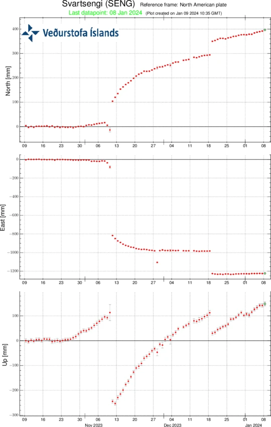
A significant indicator of the looming threat is the ongoing land uplift in the Svartsengi area.
Data from the GPS station SENG shows a steady trend of elevation increase since the December 18 eruption. The current rate of uplift is approximately 5 mm (0.2 inches) per day, resulting in the area now being around 5 cm (2 inches) higher than before the December 18 eruption last year.
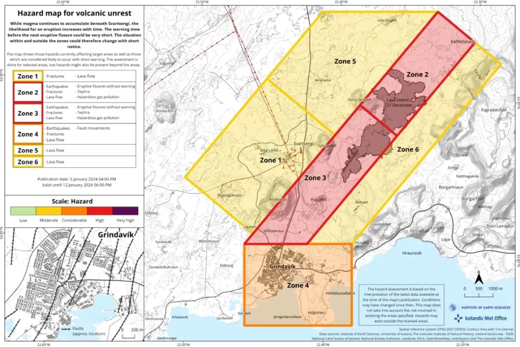
On January 5, IMO released an updated hazard map (below), with plans for reassessment on January 12. This map provides a hazard-based appraisal of the Grindavík – Svartsengi region, incorporating the latest monitoring data, seismic activity, ground deformation, and geodetic modeling results. The assessment also evaluates the likelihood of volcanic hazards in each of the six zones depicted on the map.
References:
1 Increased Risk of an Eruption in the Coming Days – IMO – January 9, 2024
The Watchers team and our contributors bring the latest on extreme weather, earthquakes, volcanic eruptions, space weather, and all things science. We're all about making sense of the natural world and keeping you informed on what’s happening. Got a tip or a question? Hit us up using the form at newstips!
Commenting rules and guidelines
We value the thoughts and opinions of our readers and welcome healthy discussions on our website. In order to maintain a respectful and positive community, we ask that all commenters follow these rules.