
Winter storm to bring heavy snow to High Plains and Great Lakes, impactful freezing rain possible
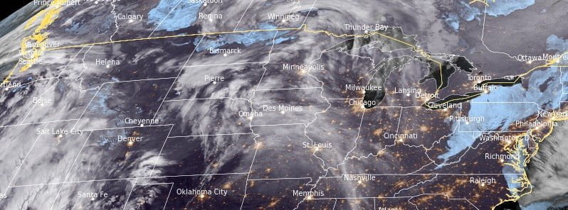
Image credit: NOAA/GOES-East, RAMMB/CIRA, The Watchers. Acquired at 06:00 UTC on January 17, 2023.
A winter storm is forecasted to form on Tuesday evening, January 17, 2023, in the eastern regions of Colorado before traversing northeastward through Thursday, January 19. This system is anticipated to bring copious amounts of snowfall to the High Plains region and western Great Lakes area, with the possibility of substantial freezing rain. Expect significant disruptions to travel in affected areas.
- A winter storm is forecasted to develop over eastern Colorado Tuesday night and then progress northeast into the Great Lakes by Thursday, bringing a mixture of heavy snow, sleet, and freezing rain across the region.
- Intense snowfall rates of 2.5 to 5 cm (1 – 2 inches) per hour are possible within the heaviest snow bands, from northeast Colorado and southern Nebraska to northern Iowa, potentially resulting in isolated snowfall totals above 25 cm (10 inches).
- The combination of heavy snowfall rates and gusty winds will likely create hazardous travel conditions due to reduced visibility caused by blowing and drifting snow.
- An icy wintry mix of freezing rain and sleet is also expected from far northeast Kansas through southeast Nebraska and southern Iowa, potentially leading to slippery roads/sidewalks and isolated power outages.
According to National Weather Service, a multi-hazards storm system is expected to develop in the Plains as an area of low pressure deepens in the lee of the Rockies ahead of an approaching upper-level trough from the West.1
The low pressure system is forecasted to move northeastward into the Midwest through Wednesday morning, followed by a trailing cold front sweeping across the Plains and into the Mississippi Valley.
Heavy snowfall is expected to begin in portions of the Central High Plains Tuesday evening, north of the developing surface low. The snow will then spread northeastward through Wednesday, following an axis from northeastern Colorado/Wyoming through Nebraska, Iowa, and into Wisconsin. Accumulations of 10 to 20 cm (4 – 8 inches), locally higher, are forecast through Thursday morning. The snow is expected to taper off late Wednesday from west to east, continuing into Thursday for the Upper Midwest.
A wintry mix of sleet and freezing rain is also likely along the rain-snow transition. The locations most likely to see light accumulations of freezing rain are from northern Kansas and southeastern Nebraska, northeast through northern Missouri and southern Iowa. Deviations in the track of the system may affect the type and amount of precipitation seen.
The passage of the low pressure system will also bring colder temperatures, with highs around -6.7 °C (22 °F) spreading southward from the Northern Plains Tuesday into the Central Plains Wednesday.
It is worth noting that warm, humid air from the Gulf is expected to return northward ahead of the cold front, which will aid in the development of showers and thunderstorms on Wednesday from the Southern Plains to the Ohio Valley. The National Weather Service has issued a Slight Risk of Excessive Rainfall (level 2/4) for portions of the Lower Mississippi and Ohio Valleys, as localized heavier downpours and repetitive rounds of storms may lead to a few scattered instances of flash flooding.
Additionally, the Storm Prediction Center has issued a Slight Risk for severe weather (level 2/5) in an area roughly overlapping the same areas from the Lower Mississippi Valley into the Lower Ohio Valley.
Strong, mostly unidirectional wind shear over the region will promote the formation of organized lines of thunderstorms, with the potential for damaging winds and a few tornadoes.
References:
1 Short Range Forecast Discussion – NWS Weather Prediction Center College Park MD – 300 AM EST Tue Jan 17 2023
I'm a dedicated researcher, journalist, and editor at The Watchers. With over 20 years of experience in the media industry, I specialize in hard science news, focusing on extreme weather, seismic and volcanic activity, space weather, and astronomy, including near-Earth objects and planetary defense strategies. You can reach me at teo /at/ watchers.news.
Commenting rules and guidelines
We value the thoughts and opinions of our readers and welcome healthy discussions on our website. In order to maintain a respectful and positive community, we ask that all commenters follow these rules.