
Strong tremor and Crater Lake heating at Ruapehu, Aviation Color Code raised to Yellow, New Zealand
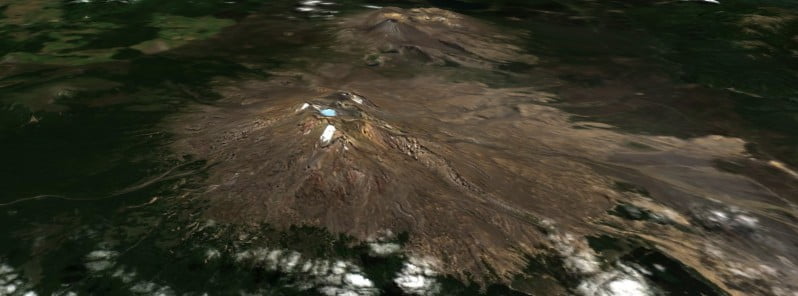
Featured image: Mt. Ruapehu on March 6, 2022. Credit: Copernicus EU/Sentinel-2, TW
A strong volcanic tremor and new heating cycle started at Mt. Ruapehu’s Crater Lake two weeks ago. On March 28, 2022, GeoNet raised the Aviation Color Code to Yellow. The Volcanic Alert Level remains at Level 2 since March 21.
Ruapehu’s Crater Lake (Te Wai ā-moe) entered a new heating cycle two weeks ago. This activity was accompanied by strong levels of volcanic tremor (volcanic earthquakes), GNS Duty Volcanologist Geoff Kilgour noted today.1
Over the past week, the lake has heated further to approximately 32 °C (90 °F), up from 31 °C (87.8 °F) last week. The slow heating has been hindered by heavy rainfall at the volcano and influx of cold water into the lake.
The strong tremor reported last week continues, Kilgour added.
Sustained elevated tremor, combined with the slow lake heating, continues to indicate that gas is fluxing through the system.
However, the slower-than-expected increase in lake temperature suggests a partial blockage may exist in the vent beneath the lake, preventing the hot gas from entering the lake. This could allow pressure to build up within the volcano.
The interpretation of this activity is consistent with elevated volcanic unrest and therefore the Volcanic Alert Level remains at Level 2 since March 21.2
The Aviation Color Code has been raised to Yellow today.
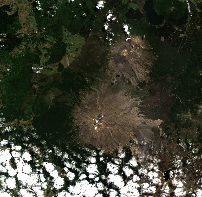
Mt. Ruapehu on March 6, 2022. Credit: Copernicus EU/Sentinel-2, TW
Mt. Ruapehu is an active volcano and has the potential to erupt with little or no warning when in a state of elevated volcanic unrest, Kilgour said.
The Volcanic Alert Level reflects the current level of elevated volcanic unrest. The Volcanic Alert Level should not be used to forecast future activity. However, at Volcanic Alert Level 2, eruptions are usually more likely than at Volcanic Alert Level 1.
Volcanic Alert Level 2 indicates the primary hazards are those expected during volcanic unrest; steam discharge, volcanic gas, earthquakes, landslides and hydrothermal activity. While Volcano Alert Level 2 is mostly associated with volcanic unrest hazards, eruptions can still occur with little or no warning.
Geological summary
Ruapehu, one of New Zealand’s most active volcanoes, is a complex stratovolcano constructed during at least four cone-building episodes dating back to about 200 000 years ago.
The 110 km3 (26.4 mi3) dominantly andesitic volcanic massif is elongated in a NNE-SSW direction and surrounded by another 100 km3 (24 mi3) ring plain of volcaniclastic debris, including the Murimoto debris-avalanche deposit on the NW flank.
A series of subplinian eruptions took place between about 22 600 and 10 000 years ago, but pyroclastic flows have been infrequent. A single historically active vent, Crater Lake, is located in the broad summit region, but at least five other vents on the summit and flank have been active during the Holocene.
Frequent mild-to-moderate explosive eruptions have occurred in historical time from the Crater Lake vent, and tephra characteristics suggest that the crater lake may have formed as early as 3 000 years ago. Lahars produced by phreatic eruptions from the summit crater lake are a hazard to a ski area on the upper flanks and to lower river valleys.3
References:
1 Mt Ruapehu’s crater lake heating is accompanied by strong volcanic tremor. Volcanic Alert Level raised to Level 2 – GeoNet
2 Strong tremor and Crater Lake heating continues at Mt Ruapehu. Volcanic Alert Level remains at Level 2 – GeoNet
3 Ruapehu – Geological summary – GVP
I'm a dedicated researcher, journalist, and editor at The Watchers. With over 20 years of experience in the media industry, I specialize in hard science news, focusing on extreme weather, seismic and volcanic activity, space weather, and astronomy, including near-Earth objects and planetary defense strategies. You can reach me at teo /at/ watchers.news.
Commenting rules and guidelines
We value the thoughts and opinions of our readers and welcome healthy discussions on our website. In order to maintain a respectful and positive community, we ask that all commenters follow these rules.