
Sierra snowpack jumps from 19 to 98 percent in just 7 days, U.S.
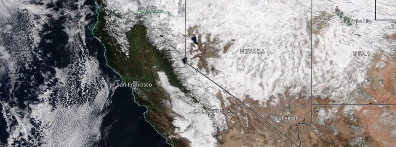
Image credit: NASA Terra/MODIS, TW. Acquired on December 17, 2021
Snowpack over the Sierra has increased dramatically in just 7 days after a series of storms affected the region last week. The sudden change gives California its wettest start to the Water Year (October 1 – September 30) in more than 40 years. A new series of Pacific storms will bring periods of heavy low elevation rain and mountain snow to much of the western U.S. through the Christmas weekend. Isolated urban and small stream flooding impacts will be possible along the immediate West Coast and into portions of the Central Valley in California this week.
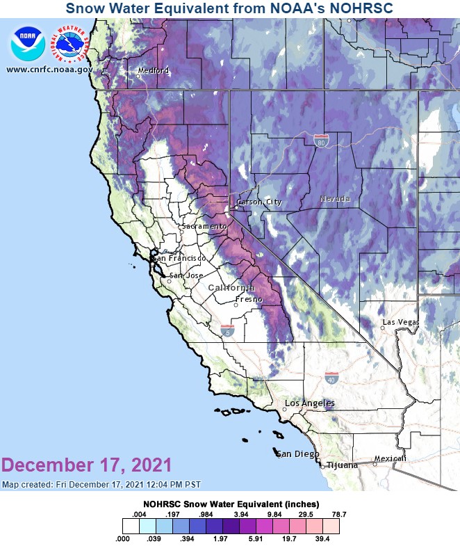
California statewide, the percentage of average snowpack jumped from 19% on December 10 to 98% on December 17.
This made the snow in the central Sierra at 102% of normal for this date. It was just 22% on December 10.1

While increases in the snowpack of this size are not common, they are also not unprecedented, said Julie Kalansky, deputy director of operations for the Center for Western Weather and Water Extremes (CW3E).
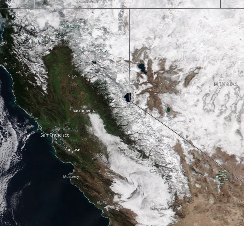
Image credit: NASA Terra/MODIS, TW. Acquired on December 17, 2021
Meanwhile, the next Sierra storm starts building on Tuesday and Wednesday, December 21 and 22, with travel impacts expected for the Christmas weekend.
"Atmospheric river (AR) activity is forecasted to bring stormy conditions from the Pacific Northwest to Baja California this week," CW3E noted.2
The current AR and its parent low will continue to bring rain to parts of the Pacific Northwest through Tuesday afternoon (LT), December 21.
The trough associated with the current AR is expected to cut off from the main flow and weaken. As it weakens, tropical moisture will be exported towards Southern California and Baja California as part of the second AR.
There is still considerable uncertainty in the timing, magnitude, and duration of AR conditions and precipitation.
The 12Z December 20 GEFS control member is forecasting AR 4 conditions for northern Baja California and AR 3 conditions in San Diego County.
Over the next seven days, the NWS Weather Prediction Center (WPC) is forecasting 130 – 260 mm (5 – 10 inches) of total precipitation (locally > 260 mm /10 inches) over the Sierra Nevada and 25 -75 mm (1 – 3 inches) of total precipitation over coastal Southern California, the Transverse Ranges, and the Peninsular Ranges.
Several feet of snow are possible in the Sierra Nevada.
References:
1 NWS California-Nevada RFC – Twitter
2 Atmospheric River Conditions are Forecast Over the US West Coast this Week with Heavy Precipitation in California – CW3E
I'm a dedicated researcher, journalist, and editor at The Watchers. With over 20 years of experience in the media industry, I specialize in hard science news, focusing on extreme weather, seismic and volcanic activity, space weather, and astronomy, including near-Earth objects and planetary defense strategies. You can reach me at teo /at/ watchers.news.
Commenting rules and guidelines
We value the thoughts and opinions of our readers and welcome healthy discussions on our website. In order to maintain a respectful and positive community, we ask that all commenters follow these rules.